Key:military
| Description |
|---|
| Facilities used by military forces. |
| Group: military |
| Used on these elements |
| Documented values: 21 |
| Useful combination |
| See also |
| Status: de facto |
| Tools for this tag |
|
Usage
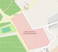
Tags with the military key are used for buildings and land used by the Army, Navy, Air Force and any other kind of military or paramilitary service in the host country (see military_service=*). There's also landuse=military for tagging land areas owned/used by the military for whatever purpose.
Legality
| Caution: mapping military installations is welcomed in OpenStreetMap, but may be prohibited by local law. Before mapping potentially sensitive sites such as these, please be aware of Section I b of the OSMF Terms of Use: "You are responsible for your own actions [...] OSMF generally cannot offer any protection, guarantee, immunity or indemnification." |
In some territories,[1][2][3] it is illegal to create maps of military facilities, or even mapping their location. With the act of surveying on-the-ground OSMers may be particularly at risk of attracting legal consequences, even in more liberal countries. Laws and sensitivity in general will vary depending on the type of facility. Some countries also have laws prohibiting the creation of such maps from aerial imagery, and even the use and distribution of maps containing this information. Clearly such activities can take place outside of the law's jurisdiction. A further dimension to the problem though, is that using OpenStreetMap can be illegal when other contributors have mapped these things. There's further discussion here at Talk:Key:military and elsewhere. In general you are advised to exercise caution and know your rights related to mapping military facilities.
Values
See below for details of common values for this key:
This table is a wiki template with a default description in English. Editable here.
