Key:ref:FR:gdo
Jump to navigation
Jump to search
| Description |
|---|
| French codification of power or gas distribution networks |
| Group: references |
| Used on these elements |
| Useful combination |
| Status: de facto |
| Tools for this tag |
|
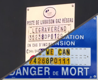
GDO is a French GIS made to document public power and gas distribution networks.
It allows precise identification of several elements of the network and those references may be public and added to OSM.
It is supported by Enedis (formerly ERDF) and GRDF, respectively current French distribution operator for electricity and gas.
