Week 1
(1–7 Jan.)
|

|
| English
|
Detail from a watercolour map of Seville, created by Andrew McGuire as a Christmas present for his wife. Hand-painted upon an OpenStreetMap base-map via Mapzen.
|

|
|
Week 2
(8–14 Jan2025-01-08–Error: Invalid time.)
|
|
| English
|
As part of the InAWARE project by HOT in Indonesia, 500 framed OpenStreetMap maps were delivered to village offices around Jakarta, to help officials identify infrastructure in their area. Previously many such offices used rough hand-drawn maps.
|
|
|
Week 3
(15–21 Jan2025-01-15–Error: Invalid time.)
|

|
| English
|
Car parks take up a lot of space within our cities. What The Street visualises this and other uses of city space for cars, trains, and cycles using OpenStreetMap data.
|
|
|
Week 4
(22–28 Jan2025-01-22–Error: Invalid time.)
|

|
| English
|
Christian Quest's latest creation is a 3D printed OpenStreetMap logo shaped cookie-cutter!
|
|
|
Week 5
(29 Jan – 4 Feb2025-01-29–Error: Invalid time.)
|

|
| English
|
No image was featured this week.
|
|
|
Week 6
(5–11 Feb2025-02-05–Error: Invalid time.)
|
|
| English
|
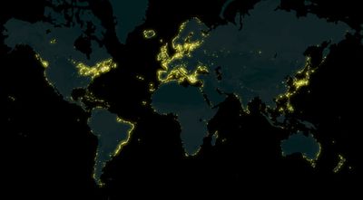
A map of lighthouses all over the world mapped on OpenStreetMap, made by Arun Ganesh (planemad). See also the interactive map on MapBox.
|
|
|
Week 7
(12–18 Feb2025-02-12–Error: Invalid time.)
|

|
|
Week 8
(19–25 Feb2025-02-19–Error: Invalid time.)
|

|
|
Week 9
(26 Feb – 4 Mar2025-02-26–Error: Invalid time.)
|
|
| English
|
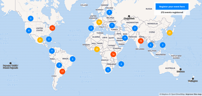
This year Open Data Day will be celebrated on March 3rd and there are already 406 events registered all around the world. Many of them will have activities related to OpenStreetMap. ") Check out the map and participate in an event near you! Check out the map and participate in an event near you!
|
|
|
Week 10
(5–11 Mar2025-03-05–Error: Invalid time.)
|
|
| English
|
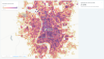
Colorful exploration of OpenStreetMap buildings data on the MIT Campus in Cambridge, Massachusetts, United States. Map produced by Curran Kelleher [1].
|
|
|
Week 11
(12–18 Mar2025-03-12–Error: Invalid time.)
|
|
| English
|
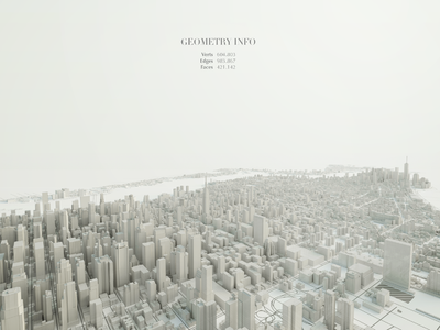
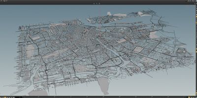
Beautiful 3D visualization of Manhattan's OpenStreetMap data. Made by Matteo Prati using the open source software Blender. Check out other images in his website.
|
|
|
Week 12
(19–25 Mar2025-03-19–Error: Invalid time.)
|
|
|
Week 13
(26 Mar – 1 Apr2025-03-26–Error: Invalid time.)
|

|
|
Week 14
(2–8 Apr2025-04-02–Error: Invalid time.)
|
|
| English
|
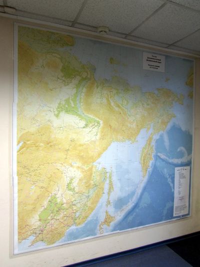
A huge printed map in an office in Russia. Made by Dmitry Afonin with QGIS using OSM data. More photos and more maps.
|
|
|
Week 15
(9–15 Apr2025-04-09–Error: Invalid time.)
|
|
|
Week 16
(16–22 Apr2025-04-16–Error: Invalid time.)
|
|
| English
|
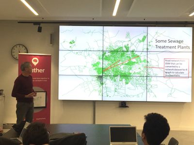
Calculating routing distances to sanitation facilities in Lusaka, Zambia. A project presented at Gather Data Dive.
|
|
|
Week 17
(23–29 Apr2025-04-23–Error: Invalid time.)
|
|
|
Week 18
(30 Apr – 6 May2025-04-30–Error: Invalid time.)
|
|
| English
|
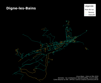
Thematic map of street names by gender in Digne-les-Bains (Alpes-de-Haute-Provence, France), made in the “Dessine ta ville” (Draw your city) workshop for the “Libre en fête 2018” event organized by Linux-Alpes (apitux.org).
|
|
|
Week 19
(7–13 May2025-05-07–Error: Invalid time.)
|

|
|
Week 20
(14–20 May2025-05-14–Error: Invalid time.)
|

|
|
Week 21
(21–27 May2025-05-21–Error: Invalid time.)
|
|
|
Week 22
(28 May – 3 Jun2025-05-28–Error: Invalid time.)
|

|
|
Week 23
(4–10 Jun2025-06-04–Error: Invalid time.)
|
|
|
Week 24
(11–17 Jun2025-06-11–Error: Invalid time.)
|
|
|
Week 25
(18–24 Jun2025-06-18–Error: Invalid time.)
|

|
|
Week 26
(25 Jun – 1 Jul2025-06-25–Error: Invalid time.)
|
|
|
Week 27
(2–8 Jul2025-07-02–Error: Invalid time.)
|
|
| English
|
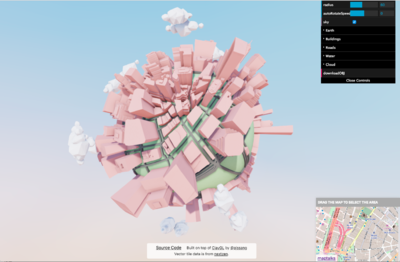
3D rendering of Amsterdam by Paleo Pixels, who developed converter scripts to load OpenStreetMap data into the “Houdini” 3D software.
|
|
|
Week 28
(9–15 Jul2025-07-09–Error: Invalid time.)
|

|
|
Week 29
(16–22 Jul2025-07-16–Error: Invalid time.)
|

|
| English
|
Arjan Schrauwen from Dutch graphics design firm Beeldkompaan has taken a chunk of New York OpenStreetMap buildings data to a new moonbase location.
|
|
|
Week 30
(23–29 Jul2025-07-23–Error: Invalid time.)
|
|
|
Week 31
(30 Jul – 5 Aug2025-07-30–Error: Invalid time.)
|

|
|
Week 32
(6–12 Aug2025-08-06–Error: Invalid time.)
|

|
| English
|
Miriam Gonzales and Céline Jacquin, from the Mexican OpenStreetMap community, were interviewed by the TV UNAM (the TV channel of the main Mexico university). They talked about OSM, GeoChicas and humanitarian mapping.
|
|
|
Week 33
(13–19 Aug2025-08-13–Error: Invalid time.)
|

|
| English
|
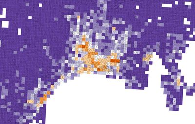
"Accumulation curves" showing the growth of shops data in the UK by SK53. This image shows a graph for each of the top shop types while his recent blog post compares and analyses growth shapes in various other ways.
|
|
|
Week 34
(20–26 Aug2025-08-20–Error: Invalid time.)
|
|
|
Week 35
(27 Aug – 2 Sep2025-08-27–Error: Invalid time.)
|
|
|
Week 36
(3–9 Sep2025-09-03–Error: Invalid time.)
|

|
|
Week 37
(10–16 Sep2025-09-10–Error: Invalid time.)
|

|
|
Week 38
(17–23 Sep2025-09-17–Error: Invalid time.)
|

|
|
Week 39
(24–30 Sep2025-09-24–Error: Invalid time.)
|
|
| English
|
The community engaged in disaster preparedness/response mapping for Typhoon Ompong in the Philippines, including this mapathon event hosted by the Red Cross.
|
|
|
Week 40
(1–7 Oct2025-10-01–Error: Invalid time.)
|
|
| English
|
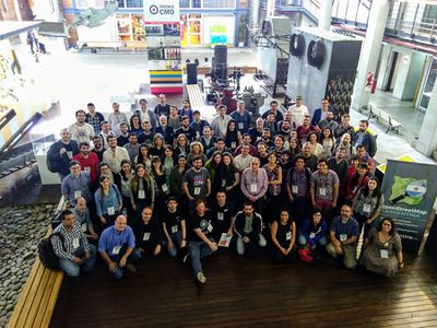
State of the Map Latam 2018 took place in Buenos Aires, Argentina. It was the 4th edition of that regional conference that gathers together the OpenStreetMap community of all Latin America
|
|
|
Week 41
(8–14 Oct2025-10-08–Error: Invalid time.)
|

|
|
Week 42
(15–21 Oct2025-10-15–Error: Invalid time.)
|

|
| English
|
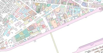
The gloriously detailed mapping of the Herrenhausen Gardens in Hannover, Germany, shown here within JOSM editor, with the Mapillary plugin showing the view on the ground.
|
|
|
Week 43
(22–28 Oct2025-10-22–Error: Invalid time.)
|
|
|
Week 44
(29 Oct – 4 Nov2025-10-29–Error: Invalid time.)
|
|
| English
|
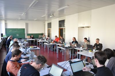
Teachers from Ireland, Portugal, Spain, Romania and Germany met in Saarburg, Germany for week-long training session in humanitarian mapping and a first hackathon, to kick off a two year Erasmus+ project
|
|
|
Week 45
(5–11 Nov2025-11-05–Error: Invalid time.)
|

|
| English
|
Mappers in Chiang Mai, Thailand, sometimes meet at the Shewe Cafe, which can serve you an OpenStreetMap cappuccino!
|
|
|
Week 46
(12–18 Nov2025-11-12–Error: Invalid time.)
|
|
|
Week 47
(19–25 Nov2025-11-19–Error: Invalid time.)
|
|
| English
|
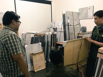
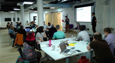
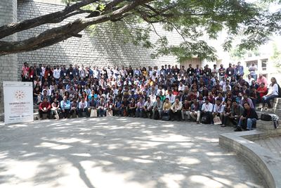
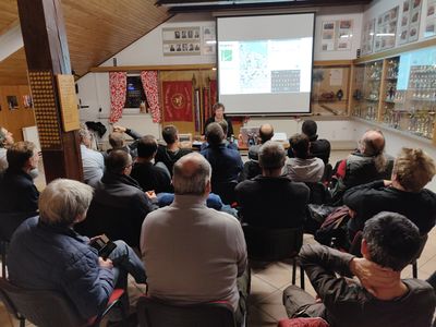
State of the Map Asia 2018 last weekend brought together mapping enthusiasts in Bangalore from countries across the globe, for two days of interesting sessions and workshops.
|
|
|
Week 48
(26 Nov – 2 Dec2025-11-26–Error: Invalid time.)
|
|
|
Week 49
(3–9 Dec2025-12-03–Error: Invalid time.)
|

|
|
Week 50
(10–16 Dec2025-12-10–Error: Invalid time.)
|

|
|
Week 51
(17–23 Dec2025-12-17–Error: Invalid time.)
|
|
| English
|
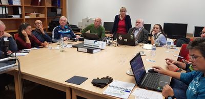
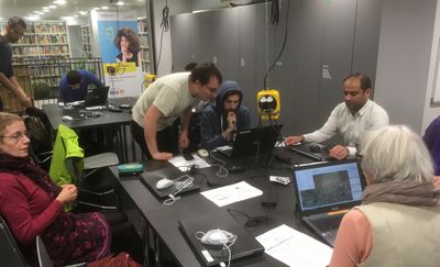
Last week, MAMAPA organized a mapathon at Ideenw3rk -- a workspace inside the beautifully-renovated city Public Library -- in Ludwigshafen, Germany. Working in tandem, immigrants and locals mapped features together, while simultaneously practicing their German.
|
|
|
Week 52
(24–30 Dec.)
|

|
| English
|
Ito World produced another spectacular Christmas animation, showing delivery routes over the OpenStreetMap road network for every address in the UK, for SNT logistics to deliver presents! (This is fictional. In fact Santa delivers presents by sleigh)
|
|
|


.jpg)


