MLIT ISJ/import2019 outline
Ichi Sansho Joho Import 2019 is an import of Ichi Sansho Joho (also called ISJ) dataset which is of type node covering (broad location in Japan). The import is currently 2019 September at the planning stage.
Goals
ISJ dataset is very reliable and accurate dataset of Japanese place name. It contains administrative place name only. Not for natural place name.
The goal of this import is to improve coverage of Japanese place name using ISJ.
And by doing this import, it could improve normalization of place name data in Japan.
Schedule
Total number of municipalities (data files) to be imported: 1909
- 2021/04/XX Target municipalities that do not require merging of imported data with existing data (Number of targets: 514)
- 2021/05/XX Target municipalities that require merging of imported data with existing data and have less than 30 data to be merged (Targeted number: 748)
- 2021/05/XX Target municipalities that require merging of imported data with existing data and have less than 100 data to be merged (Targeted number: 407)
- 2021/06/XX Consider whether to do for municipalities that need to merge imported data with existing data and have more than 100 data to be merged (target: 237)
TBD for detail.
Import Data
Background
Data source site: http://nlftp.mlit.go.jp/isj/index.html
Data license: http://nlftp.mlit.go.jp/isj/agreement.html
Type of license (if applicable): Original. It is similar to CC BY (attribution).
Link to permission (if required): OSMFJ got permission to use this dataset in OpenStreetMap (2012
OSM attribution (if required): http://wiki.openstreetmap.org/wiki/Contributors#ISJ
ODbL Compliance verified: yes
OSM Data Files
- Github: nyampire/import_ISJ_2019
Import Type
This is one time import.
Data Preparation
Data Reduction & Simplification
No reduction or Simplification is planned.
Tagging Plans
""大字・町丁目レベル位置参照情報" dataset has following data scheme.
> source: http://nlftp.mlit.go.jp/isj/data.html
| 項目 | 定義 | 記述例 | OSM Tagging |
|---|---|---|---|
| 都道府県コード | JIS都道府県コード | "13" | no use. Reference number of Prefecture |
| 都道府県名 | 当該範囲の都道府県名 | "東京都" | no use. Name of Prefecture |
| 市区町村コード | JIS市区町村コード | "13101" | no use. Reference number of Municipality |
| 市区町村名 | 当該範囲の市区町村名 (郡部は郡名,政令指定都市の区名も含む) |
"千代田区" | no use. Name of Municipality |
| 大字町丁目コード | 大字町丁目コード (JIS市区町村コード+独自7桁) |
"131010005002" | no use. This dataset original ID of the quarter/neighbourhood. |
| 大字町丁目名 | 当該範囲の大字・町丁目名 (町丁目の数字は漢数字) |
"霞が関二丁目" | name=* Name of quarter/neighbourhood. |
| 緯度 | 十進経緯度(単位:度、小数点以下第6位まで、半角) | "35.676155" | latitude |
| 経度 | 十進経緯度(単位:度、小数点以下第6位まで、半角) | "139.751075" | longitude |
| 原典資料 | 大字・町丁目位置参照情報作成における原典資料を表すコード 1:自治体資料、2:街区レベル位置参照情報、3:1/25000地形図、0:その他資料 |
"1" | no use. Source of this information. Affect on geometrical Accuracy. |
| カテゴリ | 大字/字/丁目の区別を表すコード 1:大字、2:字、3:丁目、0:不明(通称) |
"3" | 1: place=quarter (Major neighborhood) 2: place=neighbourhood (Minor neighborhood) 3: place=neighbourhood (Minor neighborhood) 4: place=locality (unknown or "so called" place name. most of them are place name in Kyoto area) |
place=quarter or neighborhood?
Japanese place name structure has definition about quarter/neighbourhood as following.
| 大字・町 | place = quarter | admin_level=9 |
| 字・小字・丁目 | place=neighbourhood | admin_level=10 |
- Japanese Place/admin_level structure: https://docs.google.com/spreadsheets/d/1eAE72mjCLoJVGZo5qRhCYK22UxVQ8bpbQSU9ZLHq40o/edit#gid=0
According to this structure, `丁目` (category 3) lines should be divided into 2 column (quarter & neighbuorhood).
But we do not divide `丁目` into 2 stratum in this import action.
Reason is followings.
Issues on separation
- There are several place name which is quite difficult to separate, such as "志布志町志布志一丁目". This could not be simply devided by "丁目" word.
- In Hokkaido region, citizens and municipality have different separation style such as "北1条西2丁目". (See also: talk-ja投稿)
Issues on import workflow
- To divide the `丁目` structure into quarter and neighbourhood, relation:boundary and role:subarea should be used to represent structure.
- To make a valid boundary relation, the relation have to have a boundary polygon data. (`place` node should be used as role:label)
- But currently, we do not have valid `丁目` level boundary open data as polygon format.
- So we could not use boundary relation to represent the place structure.
- We will divide place name, and merge it with valid polygon in future.
Changeset Tags
- source = ISJ 2019
- source:ref = https://wiki.openstreetmap.org/wiki/JA:MLIT_ISJ/import2019_outline
Data Transformation
Original data is distributed in CSV format. Meta data is as following.
- Encoding: Shift-JIS
- EPSG: 4612, 世界測地系(日本測地系2000)
Describe the transformations you'll need to conduct, the tools you're using, and any specific configurations or code that will be used in the transformation. TBD
Data Transformation Results
Samples are available at Github.
Data Merge Workflow
Team Approach
At this time, only user:nyampire will do import tasks.
Possible account is followings
Aside from the import tasks, user:okadatsuneo is working trace tasks.
His working account is following.
And his working list and import procedure are described in this page.
user:nyampire and user:okadatsuneo is having continuous contacts on the Slack channel.
References
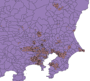
Surely, there are existing node of place=[quater, neighborhood or hamlet] in Japan.
To clarify the scope of work, user:nyampire has created a list of municipalities that may have potentially duplicate data to import.
In the following list, the number of place=[quarter, neighborhood or hamlet] is included in the municipality's area is clearly indicated.
Workflow & Conflation
Detailed procedure is available at
Revert Plan
user:nyampire will revert if any problems happen.
QA
Planning to use OpenRefine to detect errors and duplicates.
TBD
See also
The email to the Imports mailing list was sent on 2021-04-02 and can be found in the archives of the mailing list at [1].
