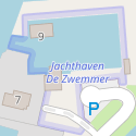
Tag:leisure=marina
| Description |
|---|
| A facility for mooring leisure yachts and motor boats. |
| Rendering in OSM Carto |

|
| Group: leisure |
| Used on these elements |
| Useful combination |
| See also |
| Status: de facto |
| Tools for this tag |
|
leisure=marina is used to identify an area of land and probably also water used for the mooring and servicing of pleasure boats and yachts, often after paying a fee or by some other arrangement with the owner. A larger facility suitable for ships, trawlers or sea-going vessels should be tagged using harbour=* rather than marina.
How to map
Use leisure=marina on an area ![]() drawn around the perimeter of the facilities associated with a marina. The area should encompass its land-based services including amenity=toilets, amenity=shower, amenity=restaurant, waterway=fuel, shop=boat and also any area of water that is private property associated with the marina. This may include that part of a river or part of a lake in the immediate vicinity of jetties. The extent of the marina should not include water available to general boat traffic.
drawn around the perimeter of the facilities associated with a marina. The area should encompass its land-based services including amenity=toilets, amenity=shower, amenity=restaurant, waterway=fuel, shop=boat and also any area of water that is private property associated with the marina. This may include that part of a river or part of a lake in the immediate vicinity of jetties. The extent of the marina should not include water available to general boat traffic.
In case the marina cannot be mapped as an area (e.g., due to a lack of high resolution aerial imagery, or not having a clear picture of what the extent of the marine is) the marina can be mapped as a node ![]() placed centrally within the marina.
placed centrally within the marina.
Use name=* for the name of the marina and capacity=* for the number of boats that can be stored. Also website=* for a link to the website for the marina.
Add mooring=yes or mooring=* to any sections of water's edge where boats can be moored and man_made=pier for any structures over or into the water. Use amenity=boat_storage for areas where boats are stored and waterway=boatyard for places where boats are constructed or repaired. Add amenity=boat_rental, amenity=boat_sharing, waterway=fuel and waterway=sanitary_dump_station for marine focused services. Tag leisure=slipway, man_made=crane etc. to indicate marina-related infrastructure elements.
Example
| Photo | Tags | OSM Carto |
|---|---|---|

|
leisure=marina |
Things to avoid
Caution. This tag was in the past used to tag only the water where the boats were moored. There is still some disagreement and confusion but OSM Carto marks a marina using a dotted blue line which is not filled in unless suitable tagging. The water area can be tagged with natural=water.
See also
- harbour=* - General harbour tag
- waterway=boatyard - A place for constructing, repairing and storing vessels out of the water
- industrial=port - Port area handling commercial traffic
- Harbour - A place where ships and other craft can seek shelter.
- office=harbour_master - The Harbourmaster's office
- craft=sailmaker - A workshop of a sailmaker who cleans, repairs and makes sails
- craft=upholsterer - A place where furniture, especially seats are provided with padding, springs, webbing, and fabric or leather covers
- vhf=* - VHF channel number to communicate with the marina

