New Jersey
| V・T・E |
| latitude: 40.4072, longitude: -74.0341 |
| Browse map of New Jersey 40°24′25.92″ N, 74°02′02.76″ W |
| Edit map |

|
|
| External links: |
| Use this template for your locality |
New Jersey is a state in United States, North America at latitude 40°24′25.92″ North, longitude 74°02′02.76″ West.

Things to do
Routes and Relations
Work is underway to create relations for the roadways, transit systems, bicycle paths and railroads (both freight and passenger) throughout the state. The /Railroads wiki has not yet begun, but it is in an early planning phase. (abandoned?)
Network values for New Jersey routes:
network=US:NJfor NJ state routesnetwork=US:NJ:NJTPfor the New Jersey Turnpikenetwork=US:NJ:GSPfor the Garden State Parkwaynetwork=US:NJ:ACEfor the Atlantic City Expressway
Places
Counties
- Atlantic County
- Bergen County
- Burlington County
- Camden County
- Cape May County
- Cumberland County
- Essex County
- Gloucester County
- Hudson County
- Hunterdon County
- Mercer County
- Middlesex County
- Monmouth County
- Morris County
- Ocean County
- Passaic County
- Salem County
- Somerset County
- Sussex County
- Union County
- Warren County
Roads
TIGER
The TIGER import is finished, however there's still significant amount of cleanup left to be done. Review roads, realigning them and updating attributes as needed. Many track roads are incorrectly tagged with highway=residential, especially in the Pinelands, rural areas, and military bases. Replace with highway=track, and it's beneficial to add the tracktype=* too.
Junction and connectivity problems have mostly been fixed over the years.
Classifications
Note that, unless stated below, tags should not be applied simply based on the administrative level of the road.
- Motorway Controlled access throughout; divided highway; no traffic lights or cross traffic, save for frontage roads. Should include all toll roads.
- Trunk Generally controlled access (interchanges, flyovers, and jughandles), sometimes using traffic circles (e.g. NJ 38, NJ 70, NJ 23, NJ 208). Can be applied to a long two-lane route for at least 30 miles as long as it does not parallel a road built to higher standards (e.g. NJ 49, NJ 31, US 40, US 322, US 206). Freeway-grade portions may be designated as motorways if they meet all requirements.
- Primary Well-traveled roads that run long distances through an urban area or between areas where a trunk road or motorway is not available. May parallel a motorway, but not a trunk road (e.g. US 9 south of Toms River, US 202 in Morris, Passaic, and Bergen Counties). Should include most 500-series county routes and select 600-series roads.
- Secondary State, county, and municipal routes that serve as arterials or carry long distances, or form links between major roads.
- Tertiary All other signed numbered roads and important municipal roads, but not any roads maintained by a homeowner's association, public institution, or business.
- Residential All other complete public access roads.
- Unclassified All public access road stubs and high-traffic roads maintained by a homeowner's association, public institution, or business.
Protected lands and state parks
The Protected Areas Database of the U.S. from the USGS provides protected area boundaries for the entire United States, but it can be downloaded as shapefiles by state. Click to download the NJ PAD-US data (warning, about 200 MB, but this is because the ZIP contains a few shapefiles.) The only one you need is "PADUS2_0Combined_DOD_Fee_Designation_Easement_NJ." The boundaries are often divided by roads. These should be removed as they just needlessly complicate the map. Also, consider removing very small exclaves and inner boundaries, especially if they are not verifiable on the ground.
State parks, forests, and recreation areas
Most should be tagged as a relation with these tags: (few exceptions)
type=boundaryboundary=protected_arealeisure=nature_reservename=*protect_class=(check IUCN level, most will be 5)protection_title=State Park / State Forest / State Preserve / Recreation Areaoperator=New Jersey Division of Parks and Forestrywikipedia=*wikidata=*website=*
| Name | Object | Status |
|---|---|---|
| Abram S. Hewitt State Forest | 8515545 |
|
| Allaire State Park | 8293737 |
Boundary and tagging |
| Allamuchy Mountain State Park | 144426 |
Boundary and tagging |
| Atsion Recreation Area | 40508514 |
Make relation, boundary and tagging |
| Barnegat Lighthouse State Park | 10410758 |
|
| Bass River State Forest | 11023115 |
|
| Belleplain State Forest | 28595409 |
Make relation; Boundary and tagging |
| Brendan T. Byrne State Forest | 11018315 |
|
| Bull's Island Recreation Area | 18049376 |
Boundary and tagging |
| Cape May Point State Park | 8294644 |
|
| Cheesequake State Park | 8295233 |
Boundary and tagging |
| Corson's Inlet State Park | 11727143 |
|
| Delaware and Raritan Canal State Park | 18280332 |
|
| Double Trouble State Park | 11017653 |
|
| Farny State Park | 922861640 |
Make into one relation? |
| Fort Mott State Park | 40387232 |
Fix relation, maybe replace park tag? |
| Hacklebarney State Park | 8296053 |
Fix relation, boundary and tagging |
| High Point State Park | 144422 |
|
| Hopatcong State Park | 41272554 |
Fix relation, boundary and tagging |
| Island Beach State Park | 8294699 |
|
| Jenny Jump State Forest | 8526989 |
|
| Kittatinny Valley State Park | 11015294 |
|
| Liberty State Park | 8262630 |
|
| Long Pond Ironworks State Park | 8472098 |
|
| Monmouth Battlefield State Park | 8479993 |
Fix boundary |
| North Brigantine Natural Area | 868369392 |
Make relation, boundary and tagging |
| Norvin Green State Forest | 11012082 |
|
| Parvin State Park | 8462857 |
|
| Penn State Forest | 6656823 |
|
| Pigeon Swamp State Park | 357736839 |
Make relation; boundary and tagging |
| Princeton Battlefield State Park | 7930158 |
|
| Ramapo Mountain State Forest | 10928925 |
|
| Rancocas State Park | 142402 |
|
| Ringwood State Park | 10928924 |
|
| Round Valley Recreation Area | 12411506 |
Fix boundary and tagging |
| Six Mile Run Reservoir Site | 12427734 |
Fix boundary and tagging |
| Spruce Run Recreation Area | 12420998 |
Fix boundary and tagging |
| Stephens State Park | 8480024 |
Fix relation, boundary and tagging |
| Stokes State Forest | 8512441 |
|
| Stow Creek State Park | 17343939 |
|
| Swartswood State Park | 8479981 |
Fix boundary and tagging |
| Tall Pines State Preserve | 11046166 |
|
| Voorhees State Park | 8479989 |
Fix boundary and tagging |
| Warren Grove Recreation Area | 9166608 |
Fix tagging |
| Washington Crossing State Park | 8480008 |
Fix relation, boundary and tagging |
| Washington Rock State Park | 607566426 |
|
| Wawayanda State Park | 8481989 |
|
| Wharton State Forest | 11020646 |
|
| Worthington State Forest | 11014693 |
Wildlife Management Areas
There are 122 Wildlife Management Areas in New Jersey. Currently, only a handful are mapped. Use the same tagging, except protect_class=4 and protection_title=Wildlife Management Area
List of New Jersey wildlife management areas on Wikipedia
Division of Fish and Wildlife website with all WMAs and maps
Power Network
- Power lines in New Jersey
-
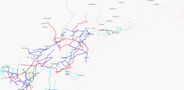 Lines with voltage on Mar 9th, 2011

Data Sources
Potential Data Sources provides a list of many layers, some of which could be imported into OSM.
Data sources for the State of New Jersey can be searched via NJGIN. Check the metadata to determine whether or not a data source is licensed appropriately for use in OpenStreetMap.
New Jersey Aerial Photography

The State of New Jersey has statewide aerial photography available through a Web Map Service. There are no restrictions on its use. The most recent data available are from 2015. Even though this data covers the entire state with little temporal variation, aerial photography provided elsewhere is more up-to-date, so it should be used with caution.