Pl:Jeździectwo
 Jazda konna wzdłuż brzegu. |
| Opis |
| Oznaczaniu dróg, punktów, obszarów i relacji związanych z jazdą konną. |
| Kategoria: Jeździectwo |
| Tagi |
Jeśli rozumiesz angielski, proszę pomóż ukończyć to polskie tłumaczenie. Przeczytaj instrukcje dotyczące tłumaczenia tej wiki.
Wydaje się, że nikt nad tym tłumaczeniem obecnie nie pracuje, więc możesz podjąć się tego zadania.
Artykuł poświęcony jest obiektom związanym z jazdą konną.
Procedury
Poniższa tabela zawiera listę procedur wraz z ich poprawnym tagowaniem i przykładowym zdjęciem.
Klucze napisane kursywą są proponowane i nie zostały jeszcze zatwierdzone. Szczegółowy opis każdej procedury znajduje się w powiązanym artykule.
| Procedura | Tagowanie | Element | Opis | Zdjęcie |
|---|---|---|---|---|
| Ograniczenie dostępu | horse=* | Oznaczenia uprawnień dostępu dla koni (osób jeżdżących konno) na drogach, trasach, ścieżkach. Jeśli jazda jest dozwolona tagujemy (horse=yes) lub jeśli zabronieniona (horse=no) w określonym obszarze. |

| |
| Jazda konna | highway=bridleway | Droga przeznaczona do jazdy konnej. Piesi są zazwyczaj również dopuszczeni, jazda rowerem może być dozwolona w zależności od lokalnych przepisów/ prawa. Przejazd dla innych pojazdów jest zazwyczaj zabroniony. | 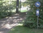
| |
| Karmienie zwierząt | amenity=feeding_place feeding:for=horse feeding:type=automated feeding:fodder=* |
Zautomatyzowane stanowisko karmienia zapewniające paszę. | 
| |
| Field shelter | amenity=shelter shelter_type=field_shelter access=private (if necessary) |
A shelter to provide protection against bad weather conditions. As those shelters are usually not freely accessible the tag access=private might be appropriate. | 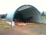
| |
| Ford | ford=yes | A shallow place with good footing where a river or stream may be crossed by wading or in a vehicle. | 
| |
| Guidepost Signpost |
tourism=information information=guidepost horse=yes |
A guidepost / signpost with information for horse riders. | 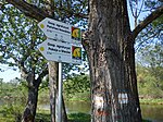
| |
| Horse boarding | amenity=animal_boarding animal_boarding=horse |
A boarding facility for horses. | 
| |
| Horse stile | barrier=horse_stile | A horse stile allows pedestrians and horses to cross a gap through a fence, but prevents or makes it very difficult for motorcycles, riderless horses and other live stock to cross. | 
| |
| Horse walker | animal=horse_walker | A horse walker is used for exercising horses or to cool them down after training (so called hot walker). | 
| |
| Manger Cratch |
amenity=feeding_place feeding:for=horse feeding:type=manger feeding:fodder=hay |
A manger to provide hay as fodder. | 
| |
| Manure | man_made=bunker_silo content=manure |
Bunker silos are open-sided structures which can be used with tractor to empty them. They are used to store |

| |
| Map | tourism=information information=map horse=yes |
A board with a map that shows features related to horse riding. | 
| |
| Open stable | landuse=animal_keeping animal_keeping=horse animal_keeping:type=open_stable |
A fenced area where horses are kept, but can move freely and food and water is provided. The horses may stay in the open stable the whole time. The fence can be tagged using barrier=fence and fence_type=*. | 
| |
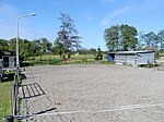
| Paddock | landuse=animal_keeping animal_keeping=horse animal_keeping:type=paddock |
A paddock is a fenced area to keep horses but does not allow for grazing. The surface is either very low cut grass or a layer of sand or similar material. In order to keep the surface suitable usually a drainage is necessary. The fence can be tagged using barrier=fence and fence_type=*. The main difference to a pasture, which is also called paddock in some regions, is that a paddock does not allow grazing and possesses a drainage. |
| |
| Paddock box | landuse=animal_keeping animal_keeping=horse animal_keeping:type=paddock used for the open-air area see Stable for the building |
A paddock box is a stall (box) for a horse with a very small adjacent outdoor enclosure which grants access to the open air but does not allow grazing. A paddock box is tagged just like a stable with an adjacent paddock area. | 
| |
| Pasture (Paddock) |
landuse=meadow meadow=pasture (undocumented) and optional landcover=grass |
Pasture - sometimes also called paddock - is a fenced area mainly used for grazing. The fence can be tagged using barrier=fence and fence_type=*. If the area is not suitable for grazing, see Paddock. |

| |
| Racecourse |
leisure=track |
A |
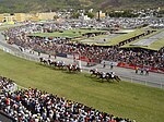
| |
| Riding arena | leisure=pitch sport=equestrian building=* additional if within a building |
A |
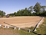
| |
| Riding hall | building=riding_hall sport=equestrian additional if appropriate |
A building that was built as a |

| |
| Riding stable | leisure=horse_riding | An |

| |
| Stable | building=stable if the whole building is used as a stable building:use=stable if only a part of the building is used as a stable |
A stable is a building in which horses are kept. It most commonly means a building that is divided into separate stalls for individual animals. If the whole building is used as a stable, use the tag building=stable. Otherwise, if only part of the building is used, map this part separately and only apply the tag building:use=stable. | 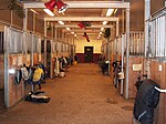
| |
| Trail riding station | tourism=trail_riding_station if only used as trail riding station tourism=* |
A station that offers temporary accomodation for guest horses and usually also for riders. | 
| |
| Veterinary for horses | amenity=veterinary veterinary=* veterinary:treats:horse=yes |
A place where a veterinary treats horses. The size of the facility can be specified as veterinary=practice, veterinary=clinic or veterinary=hospital. | 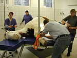
| |
| Watering place | amenity=watering_place | A place where water is contained and animals can drink. | 
|
Trasy jeździeckie
Oficjalnie oznaczone trasy jazdy konnej można mapować za pomocą relacja z type=route lub tagu route=horse.
horse_scale opisujące trudność drogi
horse_scale to system opisujący trudność trasy do jazdy konnej (podobny do sac_scale dla turystów lub mtbscale dla rowerów).
Znacznik horse_scale można zastosować do każdej części drogi - a w szczególności do mostów. Jeśli otagujemy drogę, powinniśmy podać pełną wartość tej części z najwyższą horse_scale, ponieważ najtrudniejsza część ogranicza użyteczność drogi.
Tag horse=no definiuje, że prawnie zabrania się jeździć po tej drodze. Czasami horse=no jest błędnie używany, aby wskazać, że droga jest nieodpowiednia lub niebezpieczna. Należałoby go zastąpić znacznikiem horse_scale.
| Tag | Opis |
|---|---|
| horse_scale=common | riding is easy, way is smooth and wide. The default, used to indicate that the way is checked regarding horse issues. |
| horse_scale=demanding | Caution required. Some parts of the way are demanding. Uneven surface. Caution and a skillful horse are required. |
| horse_scale=difficult | Narrow and possibly steep drops to the sides. May have barriers like trees or narrow constrictions. Difficult to pass for big horses. Can usually be passed riding. |
| horse_scale=critical | Very narrow and demanding. Only for trained and experienced horses and riders. Usually passed walking and leading the horse. Bridges should be checked for capacity and condition. |
| horse_scale=dangerous | Difficult, winding and dangerous. Only possible for very experienced horses and riders in good weather, usually leading the horses. Obstacles impassable for average horses. |
| horse_scale=impossible | Completely impassable for horses, deadly peril. Obstacles like ladders or climbing spots with fixed ropes. Too narrow or low for horses. Unstable or narrow bridges, danger of collapse or drop. |
Najlepsza dokumentacja tego tagu jest w języku niemieckim (https://wiki.openstreetmap.org/wiki/Reiten).
Historycznie wartości horse=critical (krytyczna) i horse=unsuitable (nieodpowiednie) były czasem używane do określenia drogi, w jaki sposób jest ona, dla jeźdźców, problematyczna lub niemożliwa. Są one przestarzałe i nie powinny być dłużej używane.
Inne przydatne znaczniki
Następujące znaczniki nie są bezpośrednio związane z jazdą konną, ale zwykle są przydatne podczas mapowania powiązanych tagów:
- surface=*
- smoothness=*
- incline=*
- barrier=*
- width=*
- trail_visibility=*
