Key:meadow
Jump to navigation
Jump to search
| Description |
|---|
| Used to indicate the kind of meadow. |
| Group: landuse |
| Used on these elements |
| Documented values: 3 |
| Requires |
| Useful combination |
| See also |
| Status: de facto |
| Tools for this tag |
|
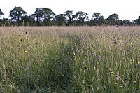
The key meadow=* has been used with the tag landuse=meadow to indicate the kind of meadow.
Meadows in certain climates would become scrub or woodland if left alone. Meadows can be quickly colonised by woody plants that will shade out meadow species.
Tagging
Draw a way around the area of the meadow, and tag landuse=meadow + meadow=*.
Values
- meadow=agricultural a hay meadow or a pasture, maintained by cutting, mowing or grazing. This value is the default status, but is also the most commonly used. See also the more specific tag meadow=pasture below.
- meadow=transitional an area of grass which is transitioning to heath, scrub or woodland.
- meadow=perpetual a "meadow" which is retained by natural environmental factors. However, it is more common to use natural=grassland in this case.
- meadow=paddock an area of grass where horses or other animals are kept
- meadow=pasture a pasture for grazing livestock, usually fenced, not used for cutting hay.
- meadow=meadow_orchard an area which is both an orchard (with trees grown for fruit or nuts)and a meadow. Also see orchard=meadow_orchard + landuse=orchard
See also
- crop=* - the crop produced by cultivated land
- produce=* - the produce of an agricultural area
- landuse=farmland - An area of farmland used for tillage (cropland), sometimes also used for pasture or meadow.
- landuse=grass - An area of mown and managed grass, e.g. a lawn in a park, the middle of a roundabout, part of a golf course, the side of the road etc. Maybe consider surface=grass or landcover=grass.
- natural=grassland - An area of non-cultivated grassland.
- Vegetation - summary of tags related to areas of vegetation of different types
