Tag:archaeological_site=roman_circus
Jump to navigation
Jump to search
| Description |
|---|
| To specify an archaeological site as a Roman circus. |
| Group: historic |
| Used on these elements |
| Requires |
| Useful combination |
|
| See also |
| Status: in use |
| Tools for this tag |
|
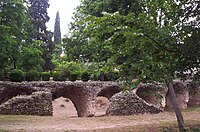
The tag archaeological_site=roman_circus specifies an archaeological site as a ![]() Roman circus, a large open-air venue used for public events in the ancient Roman Empire.
Roman circus, a large open-air venue used for public events in the ancient Roman Empire.
How to map
Set a node ![]() or draw as an area
or draw as an area ![]() along the outline.
along the outline.
Tag it with
Tags used in combination
- wikipedia=* - a link to Wikipedia's article
- wikidata=* - an ID of the specific Wikidata item
- historic:civilization=ancient_roman (or more precise subtags) - the civilization (culture) that originally created the feature
- tourism=attraction - if it is a tourist attraction.
- heritage=* - if it is registered by an official heritage organisation.
- ruins=yes - when it is in ruins.
- building=circus - if the site is still building.
