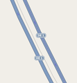
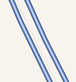
Tag:barrier=guard_rail
| Description |
|---|
| A rail, typically metal, designed to keep vehicles within their roadway, and prevent collisions or runaways. Right side is the smooth side facing the roadway. When drawing the line in iD, the arrow side points towards the road. |
| Rendering in OSM Carto |

|
| Group: barriers |
| Used on these elements |
| Implies |
| See also |
| Status: approved |
| Tools for this tag |
|
barrier=guard_rail is used to identify a continuous barrier raised off the ground by vertical struts to between mid-thigh to mid-chest level (also known as crash barriers or traffic barriers). Note that this tag is not intended for barriers meant to hold people outside of an area, which are also sometimes called "guard rail".
British English usually refers to these as crash barriers, so the tag is slightly anomalous in preferring American English.
How to map
As with other barriers, create a line along the length of the barrier and nodes at points of intersection. Leave gaps in the line where there is no barrier present.
Guard rails along roadways typically have an inner and outer surface; the inner surface is smooth and faces the roadway, while the outer surface is typically where vertical struts are connected (see example picture in info-box). If there is a clear inner/outer demarcation to the guard rail, construct the line so that the right side is inner, i.e. street-facing and left side is outer.
Rendering
Below images are views of how barrier=guard_rail is rendered in Potlatch as of December 2012, specifically in the standard (first) and MapQuest (middle) views. Neither the Cycle Map nor Transport Map views render this tag value. The last is an example of aerial imagery showing a section of guardrail in the general area of the map shown in the top two Potlatch images.
Use in a maritime environment
See also
There are other barrier types which serve a similar function: Alternative implementations for vehicular safety barriers are
- barrier=jersey_barrier (a barrier of concrete blocks instead of metal railing)
- barrier=cable_barrier (steel wire mounted on posts).
For barriers for example at the edge of cliffs and bridges to prevent people from falling down, see fence_type=railing. There are also some instances of barrier=railing in the database as of September 2014
Some other barrier types should not be confused with barrier=guard_rail: A handrail (handrail=* as part of steps, or barrier=handrail on its own) is designed to be grasped by the hand to provide stability or support. Other barriers concern more preventing vehicles into an area rather than vehicle or personal safety, for instance:


