Tag:dual_carriageway=yes
| Description |
|---|
| Specifies that a highway is a dual-carriageway road (divided highway) |
| Group: highways |
| Used on these elements |
| Requires |
|
| Useful combination |
| See also |
| Status: in use |
| Tools for this tag |
|
The tag dual_carriageway=yes has been used to specify that a highway is a dual carriageway or divided highway: a road with a dividing strip or barrier between the traffic in opposite directions. The carriageways in each direction may be divided by an open strip, central reservation or median of grass or bare ground, or by a barrier such as a low wall, fence or hedge. Usually there are two or more lanes in each direction. Note that this tag is not used for motorways.
How to map
Add the tag dual_carriageway=yes to a way which is tagged as a highway=primary, highway=secondary or other highway=* feature.
This tag is not used for highway=motorway, because all motorways are dual carriageways. In some regions, highway=trunk are always dual carriageway, but in others this tag is used.
(See instead dual_carriageway=no to tag a highway=trunk which is not a dual carriageway in regions where this would be expected)
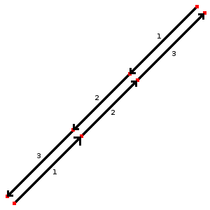
Usually dual carriageway highways, where each direction of travel is divided by a physical separation or barrier, are mapped with a separate way for each direction of travel, and the tag oneway=yes is added. Position the nodes in alignment (as shown in the example).
Also consider adding motorroad=* if foot and bicycle access is restricted, or add access=* restrictions specifically.
Rationale
There is no known, reliable and automatic method that would allow distinguishing whether oneway=yes is oneway road or a part of bidirectional roads mapped as two ways. For example there are dual carriageway highway=residential[1].
Practical use includes determining the default speed limit where there are no signs or other tagging[2], distinguishing roads where bicycle contraflow is missing from ones where it is not needed[3] and special rendering for such roads in maps of a high detail[4].
For road network analyses (e.g. calculations of road network lengths), this tag can be used to avoid errors due to the "double" presence of roads in both directions.
Also, along dual carriageways, parking is usually not allowed/there is no parking lane on the side facing the centre – however, you can make this explicitly clear by tagging parking:left=no.
Note that in some regions it can be assumed that all oneway=yes major roads (highway=trunk, highway=primary, highway=secondary, highway=tertiary) are dual carriageways.
Bad mapping
If road that is not split by physical barrier is mapped as multiple carriageways (or with each lane mapped separately and so on) then it is bad mapping. Unless local circumstances require it to be mapped as two ways, it should preferably be fixed and mapped as a single highway=* line. Adding dual_carriageway=yes is unhelpful as it only obscures the problem of bad mapping.
Other tagging
(can indicate different values; may be confusing for carriage=* and other *way=*.)
(may imply multiple-carriageway)

See also
- highway=motorway - a motorway or freeway. While almost all motorways are dual carriageway, divided highways, this tag is not used in that case, since it is implied by the tag highway=motorway.
- expressway=yes/no - commonly used in the United States to specify whether a dual carriageway "divided highway" has high-speed design features and limited access to adjacent properties or partial grade separation.
- motorroad=yes/no - specifies whether or not highways have motorway-like access restrictions. Commonly used in parts of Europe and Japan to specify a road designed for motor vehicle use only.
External links
- https://github.com/gravitystorm/openstreetmap-carto/issues/4780 - identifying dual carriageways would be useful for advanced tweaks in display of oneway=*
Possible tagging mistakes
References
- ↑ Retoryka in Kraków, Poland
- ↑ See Default speed limits - though in vast majority of cases you can also do well by assuming that oneway=yes of high road classes as dual carriageways
- ↑ That is why dual carriageways in Kraków were mapped with this tag by User:Mateusz Konieczny
- ↑ That is why this tag was used in Seattle

