Tag:industrial=petroleum_terminal
Jump to navigation
Jump to search
| Description |
|---|
| A petroleum terminal |
| Group: industrial |
| Used on these elements |
| Requires |
| Useful combination |
|
| Status: in use |
| Tools for this tag |
|
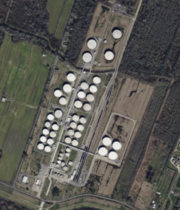
A petroleum terminal (also called a tank farm or oil depot) is an industrial facility for the storage of oil, petroleum and petrochemical products, and from which these products are transported to end users or other storage facilities. An oil terminal typically has a variety of above or below ground tankage; facilities for inter-tank transfer; pumping facilities; loading gantries for filling road tankers or barges; ship loading/unloading equipment at marine terminals; and pipeline connections.
How to map
Draw an area ![]() around the grounds of the petroleum terminal or place a node
around the grounds of the petroleum terminal or place a node ![]() at the centre of the grounds.
at the centre of the grounds.
Add
Example
| Photo | Tagging | OSM Carto | Note |
|---|---|---|---|

|
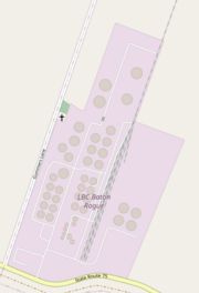
industrial=petroleum_terminal name=LBC Baton Rogue operator=LBC Baton Rogue, LLC capacity=3170000 barrels website=https://www.lbctt.com/location/lbc-baton-rouge/ |

|
A large tank farm tagging example |
