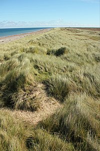
Tag:landcover=dunes
Jump to navigation
Jump to search
| Description |
|---|
| Land covered by dune(s). See natural=sand, natural=dune, landform=dune_system instead |
| Group: natural |
| Used on these elements |
| Status: deprecated |
| Tools for this tag |
|
See also the tags natural=dune, landform=dune_system and natural=sand which are more commonly used for the dune landform and for areas of sand (natural=sand) other than beaches (natural=beach).
Dunes occur in different shapes and sizes, formed by interaction with the flow of air or water. Dunes are characterized by blowing sand that abrades vegetation. Dunes can be natural, but also man made(artificial)[1][2][3].
