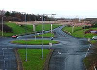
Tag:landcover=grass
| Description |
|---|
| An area covered with grass. |
| Group: natural |
| Used on these elements |
| Useful combination |
| See also |
| Status: in use |
| Tools for this tag |
|
Land physically covered by grass, independent from its usage.
The tag does not describe the human use to which the area is put, nor if it is managed or not, as long as the area is covered by plants considered to be grasses.
This tag is controversial. The tag landuse=grass is a much more common tag used in a similar way: As of mid-2019, landuse=grass is used over 100 times more frequently than landcover=grass which is also held to be controversial by some. In early 2021 landuse=grass was used over 139 times more often than landcover=grass[1].
Other primary tags used to describe areas with grass growing on them with partly more specific meaning are natural=grassland for grasslands, and landuse=meadow for pastures and meadows.
As an add-on (subsidiary property) tag for other features (e.g. a road indicating a grass surface) use surface=grass.
Other areas of low vegetation, but woody rather than herbaceous, are described with natural=heath and natural=scrub.
How to map
Additional tags
To further describe the grass the following may be used;
To describe additional attributes of this land cover the following are examples that may be used:
Possible tagging errors
- artificial turf. This should be a separate tag as it has different characteristics compared to vegetation.
Support in editors and data consumers
Support for landcover=grass was declined in OSM Carto[2], JOSM[3] and iD[4].
See also
- landuse=grass - alternative tag, but more common, for areas covered by grass
- surface=grass - tag used as an add-on (subsidiary property) tag for other features
- landuse=meadow - grass and other non-woody plants, used for hay or grazing
- natural=grassland - for grasses (Poaceae) and other herbaceous (non-woody) plants.
- landuse=farmland produce=turf - tags used where grass (turf) is harvested for transplant elsewhere.
References
- ↑ 4 185 348 vs 29 918
- ↑ https://github.com/gravitystorm/openstreetmap-carto/issues/2548 - together with landcover=trees, due to duplicating far more popular tagging schemes
- ↑ https://josm.openstreetmap.de/browser/josm/trunk/data/validator/ignoretags.cfg?rev=11949 - adding landcover=grass and landcover=trees to known popular tags that were decided to not be included in presets
- ↑ https://github.com/openstreetmap/iD/issues/4272 - declining support of landcover=trees, but it is rejection of landcover scheme in general (due to duplicating far more popular tagging schemes)
