Tag:landuse=reservoir_watershed
| Description |
|---|
| A restricted area around a public water supply in order to ensure clean water. |
| Group: landuse |
| Used on these elements |
| Useful combination |
| See also |
| Status: in use |
| Tools for this tag |
|
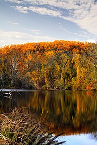
A reservoir watershed is land in and around the watershed of a public water supply, which is designated as a buffer zone in order to protect a reservoir and/or groundwater from pollutants and/or contamination. Reservoir watersheds usually have special management policies to ensure clean water. In some cases, all public access is prohibited, and in other cases, human recreation is allowed but with restrictions.
This should not be confused with boundary=water_protection_area, which is a (usually larger) encompassing area in which special laws apply for the protection of a public water supply. Rather, landuse=reservoir_watershed indicates the lands directly buffering the public water supply, and used primarily for that purpose.
The protections afforded are codified in law, sometimes signed-on-the-ground with legal citations, especially at boundary edges.
This tag was invented in the US State of Massachusetts from the MassGIS import, and as of early 2021 is mostly used in the northeast USA.
Tagging
| Tag | Description |
|---|---|
| boundary=protected_area | These areas are usually |
| landuse=reservoir_watershed | Indicates that the primary land use is for protection of the public water supply. |
| protect_class=1a,1b, or 2-6 | Apply this tag if the area is managed in accordance with IUCN protected area category descriptions. Otherwise, this tag can be omitted. |
| protection_title=* | A protection title should be added based on local naming conventions, e.g., "Watershed Protection Area", "Watershed Recreation Unit", etc. |
| related_law=* | The name, number, or title of the law that designates this area for watershed protection. |
| leisure=nature_reserve | If public access is allowed, it is appropriate to tag these areas as nature reserves as an area in which the public is invited to enjoy the flora and fauna. |
| access=* | Watershed protection areas tend to have specific restrictions on what the public is allowed to do. The appropriate value of access=* should be added. |
| fishing=* | Indicate whether fishing is permitted, e.g. fishing=no, fishing=permit, fishing=yes, etc... |
Examples
The City of Baltimore, Maryland, USA maintains several public water supply reservoirs and maintains buffer lands around them in order to protect the public drinking water supply.

|
Loch Raven Reservoir Cooperative Wildlife Management Area |
|---|---|
| |

|
Loch Raven Reservoir |
Other reservoir watershed examples
See also
- See also boundary=protected_area and boundary=water_protection_area. The latter tag is not yet widespread, contains questioned, contended or controversial information and no Proposal process has taken place. However, such geographical areas (sometimes denoted by signs on highways at ridgetops) do exist, where "reduced salt used on roadways in this basin" is a real reason, for example. Other so-called "watersheds" may prohibit trucks carrying certain chemicals which would catastrophically foul water supplies if there were an unfortunate accident. (Similar to "no transport of explosives through tunnel").
 Wasserschutzgebiet (water protection zones in Germany)


