Tag:railway=platform_edge
| Description |
|---|
| Edge of a platform where trains stop and passengers can enter or exit a train. |
| Group: railways |
| Used on these elements |
| Useful combination |
|
| See also |
| Status: in use |
| Tools for this tag |
|
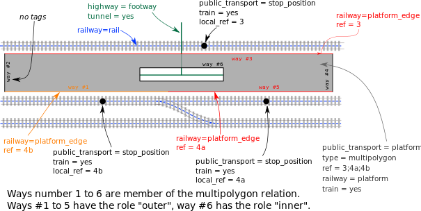
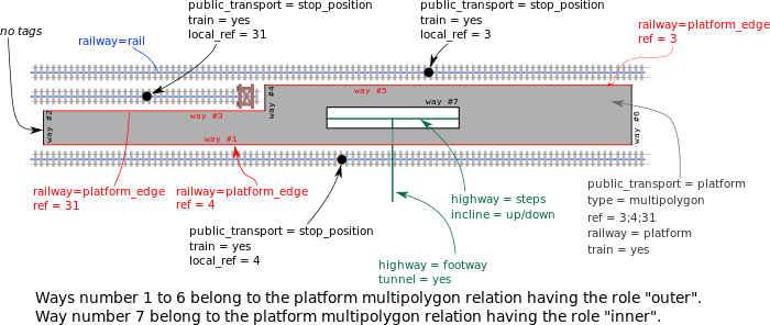
railway=platform_edge is part of a detailed way to map train platforms.
It is tagged on the edges of a train/tram/subway platform which are parallel to the track and where passengers can enter/exit a vehicle.
Why Do We Need This Tag?
Currently platforms are modeled as unclosed ways or areas (closed ways and multipolygons). If it is an island platform, it is currently tagged with the numbers of all tracks which use this platform. That's why there is a problem both for computer programs and humans which track is on which side. In some cases an island platform has more than two tracks using it (sounds strange if you rarely travel by train).
How to Map
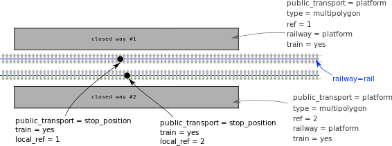
The platform is mapped as an area (typically a multipolygon) with the following tags:
- railway=platform
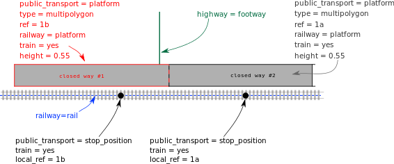
- ref=* – all platform edge numbers separated by semicolons (e.g. ref=5;6), unless platforms have their own numbering scheme independent of platform edge numbering scheme (e.g. in Poland), then platform number (e.g. ref=2).
Optional tags of the platform area:
- surface=*
- tactile_paving=*
- wheelchair=* (wheelchair accessibility of the platform, doesn't mean that the platform height matches the doors of the train)
Parts of the platform outline which
- are either not parallel to a railway track or
- are not used by passengers to enter/exit a train (e.g. because doors are not opened on that side or there is a fence)
must not be mapped as platform edges.
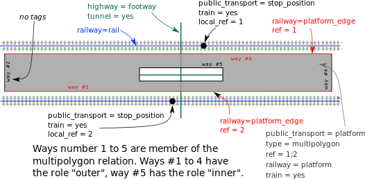
All ways parallel to a railway track which are used to enter/exit trains get railway=platform_edge + ref=*. These platform edges can have following optional tags:
- tactile_paving=*
- height=<height in metre> height above the rails
Such ways must share nodes with the platform outline or be a member of the platform multipolygon.


