Taho
| Bulk-downloading tiles from public tile servers puts a high load on them and is usually discouraged or forbidden by their usage policies. These policies are enforced by (automatic) bans. Consider using vector offline maps and their appropriate rendering applications instead. |
TAHO is a download tool for osm-Tiles and vector maps for offline map tools.
There are two versions of TAHO:
- taho.pl: a perl script which should work under almost every OS
- taho.exe: A Windows-program
Both can download maps in different sizes (1024*1024 to 8192*8192) for an area of any size. For each map calibration files in the following formats can be produced:
- *.bat for Pathaway
- *.cal for TTQV
- *.jpr for Fugawi
- *.kal for http://www.glopus.de/ Glopus
- *.map for Oziexplorer or PTGMAP
- *.inf for UI-View is at the moment only supported by taho.exe. More information about Taho for UI-View: OSM_Map_On_UI-View
- *.gmi for GPSTuner is at the moment only supported by taho.exe.
- without calibration File: for TurboGPS
The results of both Versions are the same, but the Windows Program is much easier to use. Both are opensource Programms under the GPL.
program information
Taho.pl
This is the original taho-Version. This perl tool use tiles@home tiles, Mapnik tiles ore some other and generates an pixel map of 1024*1024 to 8192*8192 Pixels with calibration. You can use the program by give the tilenames or the coordinates. The result is one or more PNG-images and some calibration files (s.above). Here the help of the script:
usage: D:\PROGRAMME\josm\taho.pl [-tilename=Z,x,y] [-coord=Z,lat,lon] [-coord2=l
at2,lon2] [-tilesource=source] [-proxy=proxyname] [-size=size] [-neighbormaps=ne
ighbormaps] [-ext=ext] [-cache=cache] [-turbogps=yes] [-output=outputDir]
This script downloads the tiles from the openstreetmap server and glue them toge
ther,
after that, it generates calibration files for Ozi, TTQV, Pathaway, Fugawi and G
lopus.

Z: Zoom 1..11

x,y: slippy map tilenames

lat,lon: :-)

source:
      - https://tah.openstreetmap.org/Tiles/tile
      - https://dev.openstreetmap.org/~ojw/Tiles/maplint.php
      - https://tile.openstreetmap.org

proxyname:
proxy and port number

size:
this parameter gives the count of glowed tiles. The parameter itself is the expo
nent to the basis of 2. eg size=2 mean a map of4x4 tiles, size of 5 means a map
of 32x32 tiles. The default is 2.

neighbormaps:
is the recursion count, it count the also generated maps in x and y direction. e
g. neighbortiles=2 is in sum 5x5 maps (5=1+2x2), neighbortiles=4 is in sum 9x9 m
aps (9=1+2x4)). The default is 0. This parameter can cause extrem traffic. PLEAS
E USE THIS PARAMETER WITH CARE. Do not use araund 180 deg longitude!

lat2,lon2:
alternative to neighbormaps. The whole area between lat,lat2, lon, lon2 will be
downloaded. This parameter can cause extrem traffic. PLEASE USE THIS PARAMETER W
ITH CARE. Do not use araund 180 deg longitude!

cache:
this parameter control the usage of the local cache, the default is 1

ext:
jpg or png, default is png

turbogps=yes:
altenative output name with calibration in the filename

 ------------------------------------------------------------------------------
 GNU General Public license, version 2 or later
 ------------------------------------------------------------------------------

example 1, part of germany : D:\PROGRAMME\josm\taho.pl -tilename="7,67,42" -tile
source="https://tile.openstreetmap.org"
example 2, Erlangen        : D:\PROGRAMME\josm\taho.pl -coord="11,49.58,11.00" -
proxy="http://proxy:3128"
example 3, Erlangen. Glopus: D:\PROGRAMME\josm\taho.pl -coord="13,49.58,11.00" -
size=3 -neighbormaps=2
example 4, Pathaway        : D:\PROGRAMME\josm\taho.pl -coord="14,49.58,11.00" -
size=2 -neighbormaps=3
example 5, Munich          : D:\PROGRAMME\josm\taho.pl -coord="11,48.15,11.58" -
tilesource="https://dev.openstreetmap.org/~ojw/Tiles/tile.php"
example 6, Sao Paulo       : D:\PROGRAMME\josm\taho.pl -coord="11,-23.6681,-46.7
520" -tilesource="https://dev.openstreetmap.org/~ojw/Tiles/tile.php"
example 7, Aachen          : D:\PROGRAMME\josm\taho.pl -coord="13,50.8,6.02" -co
ord2="50.73,6.17" -output="AC/"
example 8, Cyclemap        : D:\PROGRAMME\josm\taho.pl -coord="11,49.58,11.00" -
tilesource="http://c.andy.sandbox.cloudmade.com/tiles/cycle"

for more help please refer to https://wiki.openstreetmap.org/index.php/Oziexplore
r
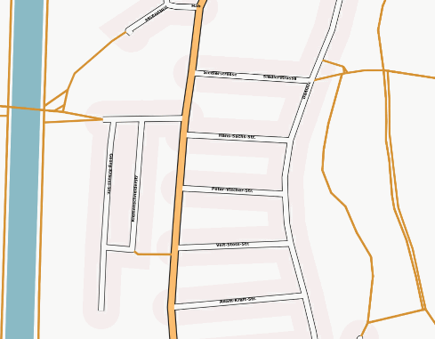
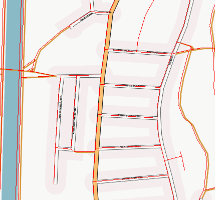
The map looks like this:
Now you can load the mif file and check the calibration of the pixel map.
Hints for Windows user to install perl, GD.pm and taho.exe:
- download and install perl from http://www.activestate.com/Products/ActivePerl/.
- After installation start the perl package manager (start->programs->activeperl->perl package manager).
- Open "edit->preferences".
- Add a new package location "name:uwinnipeg.ca location:http://theoryx5.uwinnipeg.ca/ppms/".
- After that go click on the "show all package icons".
- Mark and install the GD package.
Hints for Linux user to install perl and GD.pm :
You may need libgd-gd2-perl.
- On Debian: aptitude install libgd-gd2-perl
Taho.exe
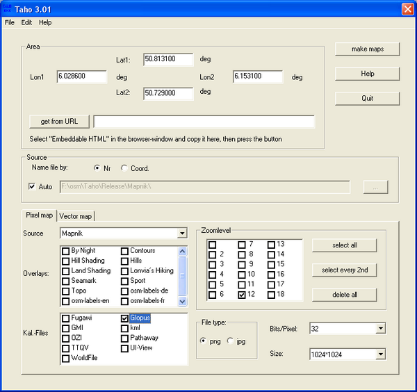
This is a Windows-Program. To select a area it uses the OSM-Export-Site, but ypu can also enter the coordinates by hand. From taho.exe Version 2 you do not need taho.pl and perl any more.
For more information about the programm see [1]
A detailed procedure for exporting maps to UI-View is available here
Tiles sources
Here some tiles sources:
- Mapnik https://a.tile.openstreetmap.org
- Osmarender https://a.tah.openstreetmap.org/Tiles/tile
- Cycle http://a.andy.sandbox.cloudmade.com/tiles/cycle
- Openstreetbrowser http://www.openstreetbrowser.org/tiles/base
- Öpnvkarte http://tile.xn--pnvkarte-m4a.de/tilegen
For a more complete list in german see Tile_servers
at all URLs starting with "http://a." the 'a' can be exchanged for 'b' or 'c'
The same list in the taho-Format [2](this link is used by taho.exe to update the url-List. So please do not remove)
Availability
The scripts and taho.exe are available here: [3]
If you find any bug, please contact one of us through the discussion page or send us an email to
- waschbaer42@gmx.de for taho.pl.
- --DimitriJunker 12:10, 19 November 2009 (UTC) for both versions


