TurboGPS
The given reason is: Proprietary application which cannot be downloaded any more. It did not have any substantial historic impact. --Nakaner (talk) 10:38, 4 February 2025 (UTC).
| Turbo GPS | ||||||||||||||||||||||||||||||||||||||||||||||||||||||||||||||||||||||||||||||||||||||||||||||||||||||||
|---|---|---|---|---|---|---|---|---|---|---|---|---|---|---|---|---|---|---|---|---|---|---|---|---|---|---|---|---|---|---|---|---|---|---|---|---|---|---|---|---|---|---|---|---|---|---|---|---|---|---|---|---|---|---|---|---|---|---|---|---|---|---|---|---|---|---|---|---|---|---|---|---|---|---|---|---|---|---|---|---|---|---|---|---|---|---|---|---|---|---|---|---|---|---|---|---|---|---|---|---|---|---|---|---|
| Author: | Michael Chourdakis | |||||||||||||||||||||||||||||||||||||||||||||||||||||||||||||||||||||||||||||||||||||||||||||||||||||||
| License: | Proprietary | |||||||||||||||||||||||||||||||||||||||||||||||||||||||||||||||||||||||||||||||||||||||||||||||||||||||
| Platforms: | Windows, Windows Mobile, and Android | |||||||||||||||||||||||||||||||||||||||||||||||||||||||||||||||||||||||||||||||||||||||||||||||||||||||
| Status: | Broken | |||||||||||||||||||||||||||||||||||||||||||||||||||||||||||||||||||||||||||||||||||||||||||||||||||||||
| Version: | 2.73 (2012-09-07) | |||||||||||||||||||||||||||||||||||||||||||||||||||||||||||||||||||||||||||||||||||||||||||||||||||||||
| Languages: | German, English, and ...
| |||||||||||||||||||||||||||||||||||||||||||||||||||||||||||||||||||||||||||||||||||||||||||||||||||||||
| Website: | http://www.turboirc.com/tgps/ | |||||||||||||||||||||||||||||||||||||||||||||||||||||||||||||||||||||||||||||||||||||||||||||||||||||||
|
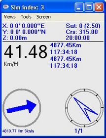
TurboGPS is a fast all in one GPS tool. Moving maps custom or online, tracks, way points. |
||||||||||||||||||||||||||||||||||||||||||||||||||||||||||||||||||||||||||||||||||||||||||||||||||||||||
| ||||||||||||||||||||||||||||||||||||||||||||||||||||||||||||||||||||||||||||||||||||||||||||||||||||||||
TurboGPS (turboirc.com/tgps) is a fast all in one GPS tool. Moving maps custom or online, tracks, way points, there is a PC and Windows Mobile Version.
Features
- Moving Map
- Map Format: JPG / Download tool for OpenStreetMap and Google Maps
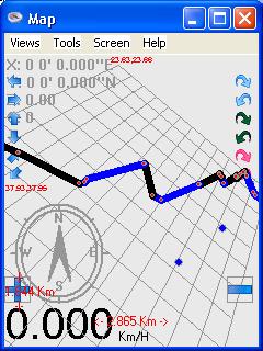
- Record Tracks and Export in GPX Format
- Way points add/import/export function
- Calibrating Raster Images
- Day, Night and custom View
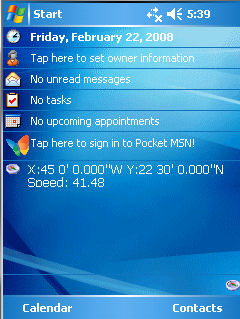
- Today plugin
- ...and much more check the homepage
Android Version
The Android version of Turbo GPS now supports OpenStreetMap directly without the need of the taho script. The following information is for the WM/PPC version.
In the Android version, use menu->maps->OSM Maps and Turbo GPS will automatically cache to SD card the tiles you will browse to.
Licence & Support
Freeware. Here you can support the project.
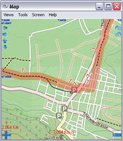
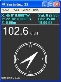
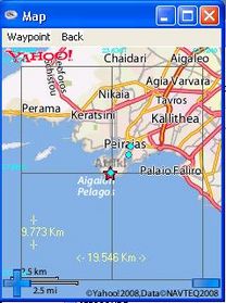
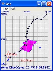
Screenshots
Wish List
Please go to the Discussion page.
Get the OSM map
- The taho.pl script has a option to generate directly calibrated maps to use in TurboGPS.
Example: taho.pl -coord="10,47.54,7.58" -coord2="47.48,7.66" -turbogps=yes
For Windows users the faster way would be to use the taho.exe. In the screen you have to choose the filename with the Coordinates.
Both tools you can finde here: Taho
This generated in the /map directory files like this:
7.55859375_47.4874452560027_7.6025390625_47.4577407945593_1024_1024.png
To get these filename you have to select "Koord." not "Nr." as in the picture above!!!
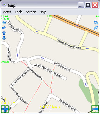
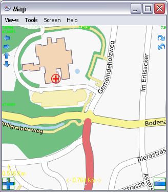
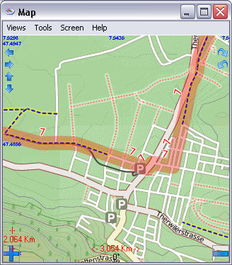
Maps in the Turbo GPS Application even the Cyclemap
Get the tracks
Menu: <Tools><Track Record><Start recording>
Options appear. Try speed 1 Km/h and Turn 10 Degree
At the end: <Tool><Track Record><End recording>
Do not normalise as this seams to corrupt file.
Before Exporting optionally <View> <Tracks> <Edit> <Rename>
To export: <View><Tracks> select the Track and export in GXP Format. press <NO> to save as Track.
Save on external card, if possible.
