Template:DE:Map Features:boundary
(Redirected from Template:De:Map Features:boundary)
Jump to navigation
Jump to search
Grenzen
| Schlüssel | Wert | Element | Kommentar | Darstellung | Foto | |
|---|---|---|---|---|---|---|
Grenzarten | ||||||
| boundary | aboriginal_lands | Grenze von Gebieten bzw. Reservate von Aborigines/Einheimischen/Ureinwohnern. | ||||
| boundary | administrative | Verwaltungsgrenze: Staatsgrenze, Bundesland, Landkreis, Stadt, Gemeinde, Ortsteil. Die Zugehörigkeit der Grenzlinie ist mit admin_level=* anzugeben. | ||||
| boundary | border_zone | Eine Grenzzone ist ein Gebiet in Grenznähe, in dem besondere Verkehrsbeschränkungen gelten. In der Regel ist für den Besuch eine Genehmigung erforderlich. | ||||
| boundary | census | A census-designated boundary delineating a statistical area, not necessarily observable on the ground. | ||||
| boundary | forest | A delimited forest is a land which is predominantly wooded and which is, for this reason, given defined boundaries. It may cover different tree stands, non-wooded areas, highways… but all the area within the boundaries are considered and managed as a single forest. | ||||
| boundary | forest_compartment | A forest compartment is a numbered sub-division within a delimited forest, physically materialized with visible, typically cleared, boundaries. | ||||
| boundary | hazard | Ein ausgewiesener Gefahrenbereich mit einer potenziellen Quelle für Schäden an Gesundheit, Leben, Eigentum oder einem anderen wertvollen Interesse. | ||||
| boundary | health | Health division boundaries. Some mappers use health_level=* instead of admin_level=* to specify level in the health system hierarchy. | ||||
| boundary | historic | A historic administrative boundary (use judiciously). | ||||
| boundary | limited_traffic_zone | Describes an officially designated area that requires authorization for the entry of certain vehicles. | ||||
| boundary | local_authority | Describes the territory of a local authority. | ||||
| boundary | low_emission_zone | A geographically defined area which seeks to restrict or deter access by certain polluting vehicles with the aim of improving the air quality. | ||||
| boundary | maritime | Seegrenzen (3 / 12 Meilen Zone) - Seegrenzen gemäß dem UN-Seerechtsübereinkommen, die keine Verwaltungsgrenzen sind: die Basislinie, die angrenzende Zone und die AWZ | ||||
| boundary | marker | Ein physischer Marker, der eine Grenze identifiziert | ||||
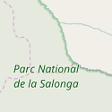
| boundary | national_park | Nationalpark | ||||
| boundary | place | boundary=place is commonly used to map the boundaries of a place=*, when these boundaries can be defined but these are not administrative boundaries. | ||||
| boundary | political | Wahlkreis (Grenzen der Wahlbezirke) | ||||
| boundary | postal_code | Postleitzahlengrenzen | ||||
| boundary | protected_area | Grenzen von Schutzgebieten verschiedener Kategorie | ||||
| boundary | religious_administration | A religious administration boundary, eg. of a catholic diocese or parish. Use religion=* and denomination=* to specify the church to which the boundary applies. Some mappers use religious_level=* instead of admin_level=* to specify level in the church hierarchy. | ||||
| boundary | special_economic_zone | Zur Auszeichnung einer Sonderwirtschaftszone, in der besondere rechtliche Regelungen gelten. | ||||
| boundary | statistical | An official boundary recognised by government for statistical purposes. | ||||
| boundary | disputed | An area of landed claimed by two or more parties (use with caution). See also Disputed territories. | ||||
| boundary | timezone | Boundaries of time zone | ||||
| boundary | benutzerdefiniert | Siehe Taginfo für weitere häufig genutzte Werte. | ||||
Attribute | ||||||
| admin_level | (number) | Beschreibt den Rang einer Verwaltungsebene auf deren Grenze | ||||
| health_level | (number) | Used by some mappers instead of admin_level=* in conjunction with boundary=health and is usually in the range 1 to 10. | ||||
| postal_code_level | (number) | Used by some mappers instead of admin_level=* in conjunction with boundary=postal_code and is usually in the range 1 to 10. | ||||
| religious_level | (number) | Used by some mappers instead of admin_level=* in conjunction with boundary=religious_administration and is usually in the range 1 to 10. | ||||
| border_type | * | Gibt die Art einer Grenzen an, z. B. Seegrenze oder importierte Grenze. | ||||
| start_date | (date) | historisches Eröffnungsdatum | ||||
This table is a wiki template with a default description in English. Editable here.


