Template:Sv:Map Features:boundary
Jump to navigation
Jump to search
Gräns
Used to describe administrative and other boundaries. See Boundaries for more details.
| Nyckel | Värde | Element | Kommentar | Rendering example | Foto | |
|---|---|---|---|---|---|---|
Boundary types | ||||||
| boundary | aboriginal_lands | A boundary representing official reservation boundaries of recognized aboriginal / indigenous / native peoples. | ||||
| boundary | administrative | Exempelvis gräns mellan länder, delstater, regioner, kommuner, församlingar m m. Använd i kombination med admin_level=* | ||||
| boundary | border_zone | A border zone is an area near the border where special restrictions on movement apply. Usually a permit is required for visiting. | ||||
| boundary | census | A census-designated boundary delineating a statistical area, not necessarily observable on the ground. | ||||
| boundary | forest | A delimited forest is a land which is predominantly wooded and which is, for this reason, given defined boundaries. It may cover different tree stands, non-wooded areas, highways… but all the area within the boundaries are considered and managed as a single forest. | ||||
| boundary | forest_compartment | A forest compartment is a numbered sub-division within a delimited forest, physically materialized with visible, typically cleared, boundaries. | ||||
| boundary | hazard | A designated hazardous area, with a potential source of damage to health, life, property, or any other interest of value. | ||||
| boundary | health | Health division boundaries. Some mappers use health_level=* instead of admin_level=* to specify level in the health system hierarchy. | ||||
| boundary | historic | A historic administrative boundary (use judiciously). | ||||
| boundary | limited_traffic_zone | Describes an officially designated area that requires authorization for the entry of certain vehicles. | ||||
| boundary | local_authority | Describes the territory of a local authority. | ||||
| boundary | low_emission_zone | A geographically defined area which seeks to restrict or deter access by certain polluting vehicles with the aim of improving the air quality. | ||||
| boundary | maritime | Sjögränser | ||||
| boundary | marker | A boundary marker, border marker, boundary stone, or border stone is a robust physical marker that identifies the start of a land boundary or the change in a boundary, especially a change in direction of a boundary. See also historic=boundary_stone | ||||
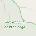
| boundary | national_park | Nationalpark. | ||||
| boundary | place | boundary=place is commonly used to map the boundaries of a place=*, when these boundaries can be defined but these are not administrative boundaries. | ||||
| boundary | political | Valkretsar, valdistrikt | ||||
| boundary | postal_code | Postal code boundaries. Some mappers use postal_code_level=* instead of admin_level=* to specify level in the postal hierarchy. | ||||
| boundary | protected_area | Skyddat område såsom nationalparker, naturskyddsområden, vattenskyddsområde eller annat. | ||||
| boundary | religious_administration | A religious administration boundary, eg. of a catholic diocese or parish. Use religion=* and denomination=* to specify the church to which the boundary applies. Some mappers use religious_level=* instead of admin_level=* to specify level in the church hierarchy. | ||||
| boundary | special_economic_zone | A government-defined area in which business and trade laws are different. | ||||
| boundary | statistical | An official boundary recognised by government for statistical purposes. | ||||
| boundary | disputed | An area of landed claimed by two or more parties (use with caution). See also Disputed territories. | ||||
| boundary | timezone | Boundaries of time zone | ||||
| boundary | Valfritt värde | Vanliga värden enligt Taginfo | ||||
Attributes | ||||||
| admin_level | (number) | Används tillsammans med boundary=administrative och är vanligen i spannet 1 till 10, förutom för Tyskland där även 11 används - läs mer under boundary=*. | ||||
| health_level | (number) | Used by some mappers instead of admin_level=* in conjunction with boundary=health and is usually in the range 1 to 10. | ||||
| postal_code_level | (number) | Used by some mappers instead of admin_level=* in conjunction with boundary=postal_code and is usually in the range 1 to 10. | ||||
| religious_level | (number) | Used by some mappers instead of admin_level=* in conjunction with boundary=religious_administration and is usually in the range 1 to 10. | ||||
| border_type | * | För att skilja mellan olika typer av gränser inom samma kategor, eller bestämma typ av en speciell gräns som inte passar in i någon annan kategori. Denna kan användas för att avgöra olika nivåer för boundary=maritime, på samma sätt som admin_level=* används tillsammans med boundary=administrative. Användningen av border_type=* är vid, se taggen för en mer genomgående beskrivning. | ||||
| start_date | (date) | Useful if the boundary is very recent (or if it will become effective in a near future). | ||||
This table is a wiki template with a default description in English. Editable here.Den till svenska översatta mallen kan redigeras här.


