Template:Uk:Map Features:boundary
Jump to navigation
Jump to search
Межі та кордони
Вживається для позначення кордонів та меж, адміністративного підпорядкування. Дивіться сторінку Boundaries для ознайомлення з принципами мапінгу.
| Ключ | Значення | Елемент | Пояснення | Позначка на мапі | Фотографія | |
|---|---|---|---|---|---|---|
Типи меж (кордонів) | ||||||
| boundary | aboriginal_lands | Використовується для позначення офіційних меж закріплених за аборигенними, корінними народами. | ||||
| boundary | administrative | Адміністративні межі (кордони). Поділ держави на території/юрисдикції для керування ними державними органами влади. Адміністративні межі мають широкий діапазон, від державних кордонів до меж найменших адміністративних одиниць, які існують в кожній окремій державі, із зазначенням їх місця в адміністративній ієрархії за допомогою теґу admin_level=*. | ||||
| boundary | border_zone | A border zone is an area near the border where special restrictions on movement apply. Usually a permit is required for visiting. | ||||
| boundary | census | A census-designated boundary delineating a statistical area, not necessarily observable on the ground. | ||||
| boundary | forest | A delimited forest is a land which is predominantly wooded and which is, for this reason, given defined boundaries. It may cover different tree stands, non-wooded areas, highways… but all the area within the boundaries are considered and managed as a single forest. | ||||
| boundary | forest_compartment | A forest compartment is a numbered sub-division within a delimited forest, physically materialized with visible, typically cleared, boundaries. | ||||
| boundary | hazard | Небезпечна територія, потенційно небезпечна для здоров’я, життя, майна та іншого. | ||||
| boundary | health | Health division boundaries. Some mappers use health_level=* instead of admin_level=* to specify level in the health system hierarchy. | ||||
| boundary | historic | A historic administrative boundary (use judiciously). | ||||
| boundary | limited_traffic_zone | Describes an officially designated area that requires authorization for the entry of certain vehicles. | ||||
| boundary | local_authority | Describes the territory of a local authority. | ||||
| boundary | low_emission_zone | A geographically defined area which seeks to restrict or deter access by certain polluting vehicles with the aim of improving the air quality. | ||||
| boundary | maritime | Морські кордони, які не є адміністративними кордонами: Нормальна вихідна лінія, Прилегла зона та Виключна економічна зона (EEZ). | ||||
| boundary | marker | Граничний маркер, прикордонний маркер, граничний камінь або прикордонний камінь являє собою чіткий фізичний маркер, який визначає початок кордону землі або зміну кордону, особливо зміну в напрямку кордону. Дивіться також historic=boundary_stone | ||||
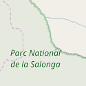
| boundary | national_park | Теґ для позначення меж національних парків, заповідників, резервацій. Дивіться також boundary=protected_area. | ||||
| boundary | place | boundary=place is commonly used to map the boundaries of a place=*, when these boundaries can be defined but these are not administrative boundaries. | ||||
| boundary | political | Межі виборчих округів. | ||||
| boundary | postal_code | Межа дії поштового індексу (території, яку обслуговує окремий поштове відділення). | ||||
| boundary | protected_area | Заповідні території — національні заповідники, місця культурної спадщини, незайманої природи, ендемічних середовищ. | ||||
| boundary | religious_administration | A religious administration boundary, eg. of a catholic diocese or parish. Use religion=* and denomination=* to specify the church to which the boundary applies. Some mappers use religious_level=* instead of admin_level=* to specify level in the church hierarchy. | ||||
| boundary | special_economic_zone | Спеціальні економічні зони, там де урядом декларуються особливі умови ведення бізнесу та ділової активності. | ||||
| boundary | statistical | An official boundary recognised by government for statistical purposes. | ||||
| boundary | disputed | Кордони, що до яких існують певні територіальні суперечки, коли дві чи більше країн заявляють свої права на певну територію (будьте обачними). Дивіться також Disputed territories. | ||||
| boundary | timezone | Boundaries of time zone | ||||
| boundary | Визначається користувачем | Значення, що широко використовуються відповідно до Taginfo | ||||
Додаткові теґи | ||||||
| admin_level | Число | Теґ, який використовується для зазначення місця в ієрархії адміністративно поділу, використовується тільки разом з boundary=administrative. Значення теґу знаходяться в діапазоні від 1 до 10, де 1 – найвищий щабель, 10 – найнижчий, окрім Болівії, Німеччини, Мозамбіку, Нідерландів, Філіппін, Польщі, Туркменістану, Венесуели у яких найнижче значення – 11. | ||||
| health_level | (number) | Used by some mappers instead of admin_level=* in conjunction with boundary=health and is usually in the range 1 to 10. | ||||
| postal_code_level | (number) | Used by some mappers instead of admin_level=* in conjunction with boundary=postal_code and is usually in the range 1 to 10. | ||||
| religious_level | (number) | Used by some mappers instead of admin_level=* in conjunction with boundary=religious_administration and is usually in the range 1 to 10. | ||||
| border_type | * | Теґ використовується у випадках, коли застосування admin_level=* є недостатнім для розмежування одного типу меж від інших. Використовується кількома різними способами, наприклад в позначенні типів морських меж. | ||||
| start_date | (date) | Вказує початок дії, може бути корисним, якщо зміни відбулись не так давно (або наберуть чинності найближчим часом). | ||||
This table is a wiki template with a default description in English. Editable here.


