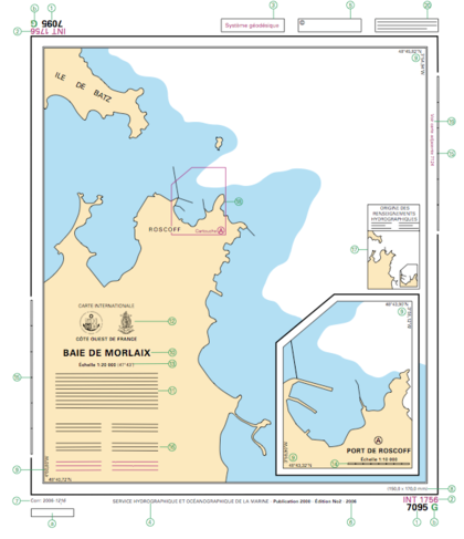
Template:Table:INT-1:A
See here for complete list. List of chapters: A - B - C - D - E - F - G - H - I - J - K - L - M - N - O - P - Q - R - S - T - U
| INT 1 # |
Symbol | Description | OSM Tags | OSM Proposals |
|---|---|---|---|---|
A: Chart Number, Title, Marginal Notes | ||||
|
1: Chart number in National Chart Series 2: Chart number in international chart series (INT if any) 3: Cautionary note (if any) on WGS84 datum 4: Publication Note (imprint) 5: Copyright note 6: Edition note. 7: Small correction note 8: Dimensions of inner borders 9: Corner co-ordinates 10: Chart title 11: Explanatory notes on chart construction. To be read before using chart 12: Seals of issuer (national chart agency) and International Hydrographic Organization (IHO) to show that chart is an international one. Purely national charts mighthave only national seal. Reprints of charts from other national series must also hold seal of origin (third seal) 13: Scale of chart at stated latitude. The scale is precisely as stated only at the latitude quoted 14: Linear scale on large-scale charts 15: Linear border scale on large scale coastal charts. On smaller scales use latitude borders for sea miles. 16: Cautionary notes (if any). Information on particular features. to be read before using chart 17: Source Diagram (if any). The source diagram should be studied before using the chart in order to assess the reliability of the sources. Navigators should be cautious where surveys are inadequate. 18: Reference to a larger scale chart 19: References to an adjoining chart of similar scale 20: Instruction to refer to complimentary nautical publications Note: a and b are references used only in some national series. In the example (french) a refers to the French Notices to Mariners weekly, and b to identificator of a latticed chart. | ||||
