Tr:Haritalama projeleri
(Redirected from Tr:Mapping projects)
Jump to navigation
Jump to search

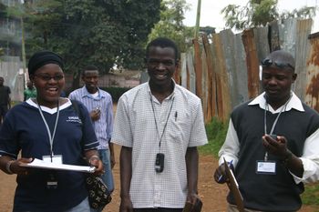
The mapkibera project (mapkibera.org) is training local people of Kibera, Nairobi, to create and own their map with OpenStreetMap.
Haritalama Projeleri özel bir ilgi alanındaki haritalamayı iyileştirmek ya da belli bir bölgeyi haritalamak gibi ortak ilgiye sahip kişilerin ortak çabalarıdır. Dünyadaki çoğu ülkeyle ilgili ve özel ilgi alanıyla ilgili projeler var; aynı zamanda OpenStreetMap projesini mümkün kılan yazılım ve hizmetlerin geliştirilmesi ve yürütülmesiyle ilgili projeler de var.
Bölge tabanlı projelerin listesi
Hemen hemen bütün ülkeler için haritalama bilgisi için Bölge tabanlı projelerin listesi'ne bakın. Bölge ve şehir gibi daha yerel haritalama için bağlantıları izleyin.
Özel ilgi alanları
- Features kategorisine de bakın
OpenStreetMap içerisinde birçok farklı özelliği haritalamayla ilgilenen gruplar var. Birçok farklı özelliğin haritalanmasının tanıtımı için Features kategorisine bakın. İlgi alanları şunları içeriyor:
- Erişilebilirlik: accessibility (mapping for inclusive accessibility using OpenStreetMap for various groups, including the blind (see OSM for the blind), routing for people in wheelchairs (see wheelchair routing)
- Sınırlar ve Yönetimsel Sınırlar: WikiProject United Nations political boundaries and WikiProject Import WDB are project focused on importing information about political boundaries between countries and territories from UN sources and from the CIA World Database.
- İnsani Yardım: The humanitarian OpenStreetMap team coordinates the creation, production and distribution of free mapping resources to support humanitarian relief efforts in many places around the world. There will be many projects including WikiProject Haiti and 2011 Sendai earthquake and tsunami.
- Geliştirme Ortakları: OpenStreetMap development partners lets international development and humanitarian organizations list point people that are working on OpenStreetMaps for better visibility and coordination.
- Altyapı: At the heart of OSM is information about the road network (see Highways), railways (use Railways for a tagging introduction) and WikiProject Metro systems to find out about the project to map the world's metro systems. And then there is WikiProject Power networks which focuses on mapping the electric and gas distribution and generation systems.
- Denizcilik ve Ulaştırma: The OpenSeaMap project collects and adds information needed for navigation at sea including locations of lighthouses and details of harbours, and display it together with bathymetric data, weather charts and other dynamic data fo all water sport enthusiasts like sailors, divers, canoeists.
- Doğa, koruma ve çerve: People in the environmental OSM project are active in adding information relevant to conservation of natural resources and habitats as well as important cultural heritage (see Conservation). Also waterways and WikiProject Corine Land Cover (which is about importing land cover/use information for Europe).
- İbadet yerleri: WikiProject Latter-day Saints (mapping places of worship)
- Eğlenme: There are many groups mapping information relevant to different outdoor activities, including hiking, winter sports, WikiProject Whitewater maps, and IOF mapping (which is about creating orienteering sport maps).
- İşbirlikleri: Wikipedia (interoperation with Wikipedia includes more than 1.7 MiB of data linking to Wikipedia-articles displayed in the map).
- Tercüme: There are several aspects of Translation in OpenStreetMap, including place names in the map itself. This is mostly coordinated under List of territory based projects but we also have WikiProject Esperanto and WikiProject Catalan
- Özel nüfuslar: These include ethnic groups or geographical areas with unique characteristics, such as Native American reservations in the United States. Though Native American reservations, which tend to be highly rural, are included in TIGER data in the United States, typically the data is incomplete or inaccurate. Lately, tribes have taken matters into their own hands and have created their own data. This also is true in other parts of the world.
Teknik Projeler
- WikiProject Cleanup (managing and improving this wiki)
- WikiProject Pictograms (creating and improving icons used on maps, particularly icons for point features)
- WikiProject Semantics (improving terms, classifications and ontologies used within OpenStreetMap)
- Routing (tagging to support routing by many transport modes)
- Indoor Mapping (mapping the interiors of buildings and structures)
Bakınız
- Local contacts (contact people in various countries)
- Local chapters (branches of the OpenStreetMap Foundation in different territories)
- Research (research into the OpenStreetMap project and use of OpenStreetMap in education)