VGPS
Jump to navigation
Jump to search
| VGPS | ||||||||||||||||||||||||||||||||||||||||||||||||||||||||||||||||||||||||||||||||||||||||||||||||||||||||
|---|---|---|---|---|---|---|---|---|---|---|---|---|---|---|---|---|---|---|---|---|---|---|---|---|---|---|---|---|---|---|---|---|---|---|---|---|---|---|---|---|---|---|---|---|---|---|---|---|---|---|---|---|---|---|---|---|---|---|---|---|---|---|---|---|---|---|---|---|---|---|---|---|---|---|---|---|---|---|---|---|---|---|---|---|---|---|---|---|---|---|---|---|---|---|---|---|---|---|---|---|---|---|---|---|
| Author: | Digital Mobile Map | |||||||||||||||||||||||||||||||||||||||||||||||||||||||||||||||||||||||||||||||||||||||||||||||||||||||
| License: | Proprietary (5$) | |||||||||||||||||||||||||||||||||||||||||||||||||||||||||||||||||||||||||||||||||||||||||||||||||||||||
| Platforms: | Android and Java ME | |||||||||||||||||||||||||||||||||||||||||||||||||||||||||||||||||||||||||||||||||||||||||||||||||||||||
| Status: | Broken | |||||||||||||||||||||||||||||||||||||||||||||||||||||||||||||||||||||||||||||||||||||||||||||||||||||||
| Version: | 8.2 (2013-07-21) | |||||||||||||||||||||||||||||||||||||||||||||||||||||||||||||||||||||||||||||||||||||||||||||||||||||||
| Language: | English
| |||||||||||||||||||||||||||||||||||||||||||||||||||||||||||||||||||||||||||||||||||||||||||||||||||||||
| Install: | ||||||||||||||||||||||||||||||||||||||||||||||||||||||||||||||||||||||||||||||||||||||||||||||||||||||||
| Programming language: | Java | |||||||||||||||||||||||||||||||||||||||||||||||||||||||||||||||||||||||||||||||||||||||||||||||||||||||
|
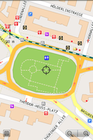
OSM and Garmin offline map with routing turn-by-turn navigation for Android and J2ME mobile phones |
||||||||||||||||||||||||||||||||||||||||||||||||||||||||||||||||||||||||||||||||||||||||||||||||||||||||
| ||||||||||||||||||||||||||||||||||||||||||||||||||||||||||||||||||||||||||||||||||||||||||||||||||||||||
VGPS is an offline turn-by-turn navigation app for Android and J2ME mobile devices. It is developed by Digital Mobile Map with map data from Garmin and OpenStreetMap.
VGPS Website
Features
- Offline map
- Store and load map data from memory card
- Vector Map data from Custom Garmin map and OpenStreetMap (Official Garmin map in NT format is not supported)
- ZoomIn/ZoomOut/Pan, Pinch to zoom
- Long press to open context menu
- Search street by name and/or intersection with other streets
- Search point by name,type,distance or type+name, type+distance
- Search GPS location by latitude and longitude in decimal format
- Partial name search
- Can touch any object on map (point, street, building, park, river...) to view its name
- Text to Speech point/street names
- GPS real-time tracking with built-in compass
- Routing point to point
- Rotate map
- Voice guidance
- Supports all android phones and tablets screen sizes and densities (android version 1.5 to android version 3.2+).
Features under development
- Porting VGPS from android to iphone platform
