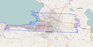
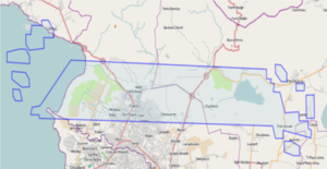
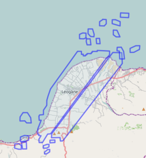
WikiProject Haiti/Imagery and data sources/Old
- WikiProject revisions: Revisions to front page of WikiProject completed = everything consolidated into a single table or moved to different pages. --Ceyockey 16:34, 30 October 2011 (UTC)
- WikiProject revisions: Revisions are underway (slowly) to revise the WikiProject from crisis-response to mapping-as-usual mode. --Ceyockey 16:34, 30 October 2011 (UTC)
- On-the-ground: Fourth deploy write-up - 2010-09-08
- On-the-ground: HOT Mission 3 complete [1] - 2010-06-28
- Hot website launched with blog category 'Haiti' - 2010-05-??
This is a page of imagery sources used immediately after the 2010 Earthquake.
NOAA
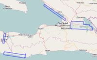
Aerial flights via NOAA, sourced from http://edcftp.cr.usgs.gov/pub/data/disaster/201001_Earthquake_Haiti/data/NOAA_AERIAL_NATIVE/ . This data is believed to be 2010-01-18. Data is in the Public Domain as a work of the US Government.
| Image set | Boundary | Use in JOSM | Use in Potlatch | |
|---|---|---|---|---|
| NOAA
Date: 2010-01-18 Use the tag: source=NOAA, 2010-01-18 |
Browse Relation — show in OSM map |
Use the following WMS URL in JOSM (how to configure):
http://hypercube.telascience.org/cgi-bin/mapserv?map=/geo/haiti/mapfiles/4326.map&layers=noaa-01-18-4326&request=GetMap&version=1.0.0&styles=&format=image/jpeg&service=WMS& |
In Potlatch paste the following URL into the 'custom' setting (how to configure):
http://hypercube.telascience.org/tiles/1.0.0/noaa-20100118-900913/!/!/!.jpg (or launch directly) |
|
| NOAA
Date: 2010-01-20 Use the tag: source=NOAA, 2010-01-20 |
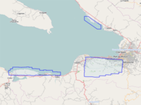
show in OSM map - OSM file |
Use the following WMS URL in JOSM (how to configure):
http://hypercube.telascience.org/cgi-bin/mapserv?map=/geo/haiti/mapfiles/4326.map&layers=noaa-01-20-4326&request=GetMap&version=1.0.0&styles=&format=image/jpeg&service=WMS& |
In Potlatch paste the following URL into the 'custom' setting (how to configure):
http://hypercube.telascience.org/tiles/1.0.0/noaa-20100120-900913/!/!/!.jpg (or launch directly) |
|
| NOAA
Date: 2010-01-22 Use the tag: source=NOAA, 2010-01-22 |
show in OSM map - OSM file |
Use the following WMS URL in JOSM (how to configure):
http://hypercube.telascience.org/cgi-bin/mapserv?map=/geo/haiti/mapfiles/4326.map&layers=noaa-01-22-4326&request=GetMap&version=1.0.0&styles=&format=image/jpeg&service=WMS& |
In Potlatch paste the following URL into the 'custom' setting (how to configure):
http://hypercube.telascience.org/tiles/1.0.0/noaa-20100122-900913/!/!/!.jpg (or launch directly) |
|
| NOAA
Date: 2010-01-23 Use the tag: source=NOAA, 2010-01-18 |
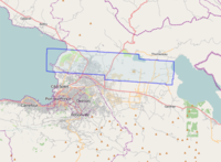
show in OSM map - OSM file |
Use the following WMS URL in JOSM (how to configure):
http://hypercube.telascience.org/cgi-bin/mapserv?map=/geo/haiti/mapfiles/4326.map&layers=noaa-01-23-4326&request=GetMap&version=1.0.0&styles=&format=image/jpeg&service=WMS& |
In Potlatch paste the following URL into the 'custom' setting (how to configure):
http://hypercube.telascience.org/tiles/1.0.0/noaa-20100123-900913/!/!/!.jpg (or launch directly) |
|
| NOAA
Date: 2010-01-24 Use the tag: source=NOAA, 2010-01-24 |
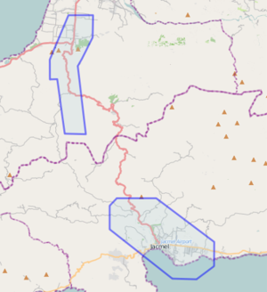
show in OSM map |
Use the following WMS URL in JOSM (how to configure):
http://hypercube.telascience.org/cgi-bin/mapserv?map=/geo/haiti/mapfiles/4326.map&layers=noaa-01-24-4326&request=GetMap&version=1.0.0&styles=&format=image/jpeg&service=WMS& |
In Potlatch paste the following URL into the 'custom' setting (how to configure):
http://hypercube.telascience.org/tiles/1.0.0/noaa-20100124-900913/!/!/!.jpg (or launch directly) - Jacmel
|
GeoEye
GeoEye is a satellite imagery provider who're collecting and releasing imagery of Haiti.
OSM has permission to use the GeoEye image providing we acknowledge the source.
| Image set | Boundary | Use in JOSM | Use in Potlatch |
|---|---|---|---|
| Ikonos
Date: 2010-01-17 Use the tag: source=Ikonos, GeoEye, 2010-01-17 |
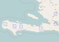 See image boundary here |
Use the following WMS URL in JOSM (how to configure) :
http://hypercube.telascience.org/cgi-bin/mapserv?map=/geo/haiti/mapfiles/4326.map&layers=ikonos-01-17-4326&request=GetMap&version=1.0.0&styles=&format=image/jpeg&service=WMS& Comment: much clouds in this image.--Jan Tappenbeck 22:34, 19 January 2010 (UTC) |
In Potlatch paste the following URL into the 'custom' setting (how to configure):
http://hypercube.telascience.org/tiles/1.0.0/geoeye-ikonos-20100117-900913/!/!/!.jpg (or launch directly) |
| GeoEye1
Date: 2010-01-16 Use the tag: source=GeoEye1, GeoEye, date (yyyy-mm-dd) |
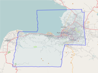 See image boundary here |
Use the following WMS URL in JOSM (how to configure):
http://hypercube.telascience.org/cgi-bin/mapserv?map=/geo/haiti/mapfiles/4326.map&layers=geoeye-01-16-4326&request=GetMap&version=1.0.0&styles=&format=image/jpeg&service=WMS& |
In Potlatch paste the following URL into the 'custom' setting (how to configure):
http://hypercube.telascience.org/tiles/1.0.0/geoeye-geoeye-20100116-900913/!/!/!.jpg (or launch directly) |
| Ikonos
Date: 2010-01-14 / 2010-01-15 Use the tag: source=Ikonos, GeoEye, date (yyyy-mm-dd) |
 See image boundary here |
Use the following WMS URL in JOSM (how to configure):
http://hypercube.telascience.org/cgi-bin/mapserv?map=/geo/haiti/mapfiles/4326.map&layers=ikonos-01-14-4326&request=GetMap&version=1.0.0&styles=&format=image/jpeg&service=WMS& |
In Potlatch paste the following URL into the 'custom' setting (how to configure):
http://hypercube.telascience.org/tiles/1.0.0/geoeye-ikonos-20100115-900913/!/!/!.jpg (or launch directly) |
| GeoEye1
Date: 2010-01-13 Use the tag: source=GeoEye1, GeoEye, 2010-01-13 |
 See image boundary here |
Use the following WMS URL in JOSM (how to configure):
http://maps.nypl.org/mapserv?map=/var/lib/maps/src/relief/haiti.map&layers=geoeye&SERVICE=WMS&VERSION=1.1.1&REQUEST=GetMap&LAYERS=geoeye&STYLES=&EXCEPTIONS=application%2Fvnd.ogc.se_inimage&FORMAT=image/jpeg&SRS=EPSG:4326&
|
In Potlatch paste the following URL into the 'custom' setting (how to configure): |
| GeoEye1
Date: 2010-01-13 Use the tag: source=GeoEye1, GeoEye, 2010-01-13 |
 See image boundary here |
Use the following WMS URL in JOSM (how to configure):
http://maps.geography.uc.edu/cgi-bin/mapserv?map=/home/cgn/public_html/maps/mapfiles/haiti.map&SERVICE=WMS&VERSION=1.1.1&Request=GetMap&LAYERS=GeoEye_Jan_13_2010&SRS=EPSG:4326&STYLES=Default&FORMAT=image/png%3B%20mode%3D24bit&TRANSPARENT=FALSE& |
In Potlatch paste the following URL into the 'custom' setting (how to configure): |
Pre-earthquake Imagery
| Image set | Boundary | Use in JOSM | Use in Potlatch |
|---|---|---|---|
| GeoEye1
Date: 2008-09-28 Use the tag: source=GeoEye1, GeoEye, 2008-09-28 |
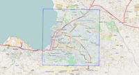 See image boundary here |
Use the following WMS URL in JOSM (how to configure):
http://maps.geography.uc.edu/cgi-bin/mapserv?map=/home/cgn/public_html/maps/mapfiles/haiti.map&SERVICE=WMS&VERSION=1.1.1&Request=GetMap&LAYERS=GeoEye_Sept_28_2008&SRS=EPSG:4326&STYLES=Default&FORMAT=image/png%3B%20mode%3D24bit&TRANSPARENT=FALSE& |
In Potlatch paste the following URL into the 'custom' setting (how to configure): |
DigitalGlobe
The DigitalGlobe imagery is of higher resolution than GeoEye, and has coverage over all of Haiti. However, some of the imagery is obscured by (dust?) clouds, so GeoEye may be a better bet in certain locations.
PDF showing all imagery from DG on a map in an overview: [2]
OSM has permission to use imagery from Digital Globe [3] [4]. DigitalGlobe also provides a WMS Server for DigitalGlobe Crisis Event Service ( see CrisisMappers thread (login required)).
| Image set | Boundary | WMS (JOSM & Merkaartor) | Use in Potlatch |
|---|---|---|---|
| WorldView-2
Date: 2010-01-18 Use the tag: source=WorldView-2, DigitalGlobe, 2010-01-21 |
 See image boundary here |
Use the following WMS URL in JOSM (how to configure) :
http://hypercube.telascience.org/cgi-bin/mapserv?map=/geo/haiti/mapfiles/4326.map&layers=worldview-01-18-4326&request=GetMap&version=1.0.0&styles=&format=image/jpeg&service=WMS& |
In Potlatch paste the following URL into the 'custom' setting (how to configure):
http://hypercube.telascience.org/tiles/1.0.0/worldview-20100118-900913/!/!/!.jpg (or launch directly) |
| DigitalGlobe (cache)
Date: ? Use the tag: source=DigitalGlobe, 2010 |
 See DigitalGlobe's Post-Earthquake Image Boundary here (WMS layer covers all of Haïti, and a big western half of Dominican Republic) |
Use the following WMS URL in JOSM (how to configure) :
|
In Potlatch paste the following URL into the 'custom' setting: http://maps.nypl.org/tilecache/1/dg_crisis/!/!/!.jpg (or launch directly) |
| DigitalGlobe (more direct)
Date: ? Use the tag: source=DigitalGlobe, 2010 |
Use the following WMS URL in JOSM (how to configure):
http://maps.geography.uc.edu/cgi-bin/mapserv?map=/home/cgn/public_html/maps/mapfiles/haiti.map&version=1.1.0&SERVICE=WMS&REQUEST=GetMap&FORMAT=image/png&LAYERS=DG_crisis_event_service& Use the following WMS URL in Merkaartor: http://maps.geography.uc.edu/cgi-bin/mapserv?map=/home/cgn/public_html/maps/mapfiles/haiti.map&SERVICE=WMS&Request=GetCapabilities Click Get Capabilities and choose the DG_crisis_event_service or dg_crisis layers. |
Not available for Potlatch (use above) | |
| QuickBird
Date: 2010-01-15 Use the tag: source=QuickBird, DigitalGlobe, 2010-01-15 |
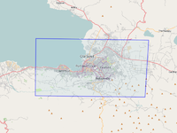 See image boundary here |
Use the following WMS URL in JOSM (how to configure):
http://hypercube.telascience.org/cgi-bin/mapserv?map=/geo/haiti/mapfiles/4326.map&layers=quickbird-01-15-4326&request=GetMap&version=1.0.0&styles=&format=image/jpeg&service=WMS& |
In Potlatch paste the following URL into the 'custom' setting (how to configure):
http://hypercube.telascience.org/tiles/1.0.0/quickbird-20100115-900913/!/!/!.jpg (or launch directly) |
| WorldView-2
Date: 2010-01-20 Use the tag: source=WorldView-2, DigitalGlobe, 2010-01-20 |
 See image boundary here |
Use the following WMS URL in JOSM (how to configure):
http://hypercube.telascience.org/cgi-bin/mapserv?map=/geo/haiti/mapfiles/4326.map&layers=worldview-01-20-4326&request=GetMap&version=1.0.0&styles=&format=image/jpeg&service=WMS& |
In Potlatch paste the following URL into the 'custom' setting (how to configure):
not available |
ErosB
We got access to imagery from ImageSat' Eros-B satellite taken for ScanEx.
| Image set | Boundary | Use in JOSM | Use in Potlatch |
|---|---|---|---|
| ErosB
Date: 2010-01-17 Use the tag: source=ErosB, ScanEx, 2010-01-17 |
 See image boundary here |
Use the following WMS URL in JOSM (how to configure):
http://irs.gis-lab.info/?layers=eros& |
In Potlatch paste the following URL into the 'custom' setting (how to configure):
http://retile.latlon.org/eros/!/!/!.jpg (or launch directly) |
CNES / Spot Image
CNES (Centre National d'Etudes Spatiales - French Space Agency) and Spot Image have also been collecting and releasing imagery of Haiti. It can be found directly on SpotImage website in KML SuperOverlay format.
The two images are also available in WMS format at these URLs :
http://spotgis.spotimage.com/ArcGIS/rest/services/2010_01_14_Haiti/MapServer
http://spotgis.spotimage.com/ArcGIS/rest/services/2010_01_15_Haiti/MapServer
| Image set | Boundary | Use in JOSM | Use in Potlatch |
|---|---|---|---|
| Spot 5
Date: 2010-01-15 Use the tag: source=Cnes/SpotImage, 2010-01-15 |
 See image boundary here |
Use the following WMS URL in JOSM (how to configure):
http://spotgis.spotimage.com/arcgis/services/2010_01_15_Haiti/MapServer/WMSServer?layers=0&request=GetMap&version=1.0.0&styles=&format=image/jpeg&service=WMS& |
In Potlatch paste the following URL into the 'custom' setting (how to configure): |
| Spot 5
Date: 2010/01/14 Use the tag: source=Cnes/SpotImage, 2010-01-14 |
 See image boundary here |
Use the following WMS URL in JOSM (how to configure):
http://spotgis.spotimage.com/arcgis/services/2010_01_14_Haiti/MapServer/WMSServer?layers=0&request=GetMap&version=1.0.0&styles=&format=image/jpeg&service=WMS& |
In Potlatch paste the following URL into the 'custom' setting (how to configure): |
JAXA/ALOS satellite Imagery
By NIED(National Research Institute for Earth Science and Disaster Prevention, Japanese national institute for disaster), a satellite image of Haiti after the earthquake from JAXA(Japan Aerospace Exploration Agency) is permitted to be traced. See also WMS information
| Image set | Boundary | Use in JOSM | Use in Potlatch |
|---|---|---|---|
| ALOS/Pan-Sharpened
Date: 2010-01-23 Use the tag: source=JAXA/ALOS/pan-sharpened, 2010-01-23 |
Use the following WMS URL in JOSM (how to configure):
http://hazardmap.service-section.com/cgi-bin/mapserv?map=/map/UserRaster/alos_pansharpen_haiti_20100123.map&SERVICE=WMS&VERSION=1.1.1&REQUEST=GetMap&LAYERS=alos_pansharpen_haiti_20100123&STYLES=&EXCEPTIONS=application%2Fvnd.ogc.se_inimage&FORMAT=image/png&SRS=EPSG:4326& |
In Potlatch paste the following URL into the 'custom' setting:
Not available
| |
| ALOS/PRISM
Date: 2010-01-23 Use the tag: source=JAXA/ALOS/PRISM, 2010-01-23 |
 see image boundary here |
Use the following WMS URL in JOSM (how to configure):
http://hazardmap.service-section.com/cgi-bin/mapserv?map=/map/UserRaster/alos_prism_haiti_20100123.map&SERVICE=WMS&VERSION=1.1.1&REQUEST=GetMap&LAYERS=alos_prism_haiti_20100123&STYLES=&EXCEPTIONS=application%2Fvnd.ogc.se_inimage&FORMAT=image/png&SRS=EPSG:4326& |
In Potlatch paste the following URL into the 'custom' setting:
Not available |
| ALOS/AVNIR-2
Date: 2010-01-23
|
 see image boundary here |
Use the following WMS URL in JOSM (how to configure):
http://hazardmap.service-section.com/cgi-bin/mapserv?map=/map/UserRaster/alos_avnir2_haiti_20100123.map&SERVICE=WMS&VERSION=1.1.1&REQUEST=GetMap&LAYERS=alos_avnir2_haiti_20100123&STYLES=&EXCEPTIONS=application%2Fvnd.ogc.se_inimage&FORMAT=image/png&SRS=EPSG:4326& |
In Potlatch paste the following URL into the 'custom' setting:
Not available |
| ALOS/PALSAR
Date: 2010-01-16 Use the tag: source=JAXA/ALOS/PALSAR, 2010-01-16 |
 see image boundary here |
Use the following WMS URL in JOSM (how to configure):
http://hazardmap.service-section.com/cgi-bin/mapserv?map=/map/UserRaster/alos_palsar_haiti_20100116.map&SERVICE=WMS&VERSION=1.1.1&REQUEST=GetMap&LAYERS=alos_palsar_haiti_20100116&STYLES=&EXCEPTIONS=application%2Fvnd.ogc.se_inimage&FORMAT=image/png&SRS=EPSG:4326& |
In Potlatch paste the following URL into the 'custom' setting:
Not available |
| ALOS/AVNIR-2
Date: 2010-01-13 Use the tag: source=JAXA/ALOS/AVNIR-2, 2010-01-13 |
 See image boundary here |
Use the following WMS URL in JOSM (how to configure):
http://hazardmap.service-section.com/cgi-bin/mapserv?map=/map/UserRaster/alav2a.map&SERVICE=WMS&VERSION=1.1.1&REQUEST=GetMap&LAYERS=alav2a&STYLES=&EXCEPTIONS=application%2Fvnd.ogc.se_inimage&FORMAT=image/png&SRS=EPSG:4326& |
In Potlatch paste the following URL into the 'custom' setting:
Not available |
Google Imagery
Google provides hi-res imagery from Haiti, see [5].
OSM is allowed to trace over this images [6],[7].
| Image set | Boundary | Use in JOSM | Use in Potlatch | |
|---|---|---|---|---|
| Google
Date: 2010-01-17 Copyright: (c) Google Use the tag: source=Google, 2010-01-17 |
 See image boundary here Boundary also available as gpx file |
Use the following WMS URL in JOSM (how to configure):
http://hypercube.telascience.org/cgi-bin/mapserv?map=/geo/haiti/mapfiles/4326.map&layers=google-01-17-4326&request=GetMap&version=1.0.0&styles=&format=image/jpeg&service=WMS& |
In Potlatch paste the following URL into the 'custom' setting (how to configure):
http://hypercube.telascience.org/tiles/1.0.0/goog-20100117-900913/!/!/!.jpg (or launch directly) |
|
| Google
Date: 2010-01-21 Copyright: (c) Google Use the tag: source=Google, 2010-01-21 |
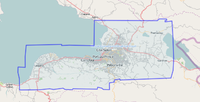 See image boundary here Boundary also available as gpx file |
Use the following WMS URL in JOSM (how to configure):
http://hypercube.telascience.org/cgi-bin/mapserv?map=/geo/haiti/mapfiles/4326.map&layers=google-21-sub10k-4326,google-21-above10k-4326&request=GetMap&version=1.0.0&styles=&format=image/jpeg&service=WMS& |
In Potlatch paste the following URL into the 'custom' setting (how to configure):
http://hypercube.telascience.org/tiles/1.0.0/goog-20100121-900913/!/!/!.jpg (or launch directly) |
WorldBank Imagery
WorldBank has been acquiring hi-res aerial imagery.[1] The imagery is in the public domain and OSM is therefore allowed to trace over it.
Use the tag: source=WorldBank, 2010-01-22
| Image set | Boundary | Use in JOSM | Use in Potlatch | |
|---|---|---|---|---|
| WorldBank
Date: 2010-01-21 - 2010-01-22 Copyright: (c) WorldBank 2010 (Collected by RIT, Public Domain) Use the tag: source=WorldBank, 2010-01-22 |
available as gpx file |
Use the following WMS URL in JOSM (how to configure):
http://hypercube.telascience.org/cgi-bin/mapserv?map=/geo/haiti/mapfiles/4326.map&layers=worldbank-21-4326&request=GetMap&version=1.0.0&styles=&format=image/jpeg&service=WMS&
|
In Potlatch paste the following URL into the 'custom' setting (how to configure):
http://hypercube.telascience.org/tiles/1.0.0/worldbank-21-900913/!/!/!.jpg http://maps.geography.uc.edu/~cgn/RIT-WASP-23rd.jpg
| |
| WorldBank
Date: 2010-01-23 Copyright: (c) WorldBank 2010 (Collected by RIT, Public Domain) Use the tag: source=WorldBank, 2010-01-23 |
show in OSM map |
Use the following WMS URL in JOSM (how to configure):
http://hypercube.telascience.org/cgi-bin/mapserv?map=/geo/haiti/mapfiles/4326.map&layers=worldbank-23-4326&request=GetMap&version=1.0.0&styles=&format=image/jpeg&service=WMS& |
In Potlatch paste the following URL into the 'custom' setting (how to configure):
http://hypercube.telascience.org/tiles/1.0.0/worldbank-23-900913/!/!/!.jpg |
|
| WorldBank
Date: 2010-01-24 Copyright: (c) WorldBank 2010 (Collected by RIT, Public Domain) Use the tag: source=WorldBank, 2010-01-24 |
show in OSM map |
Use the following WMS URL in JOSM (how to configure):
http://hypercube.telascience.org/cgi-bin/mapserv?map=/geo/haiti/mapfiles/4326.map&layers=worldbank-24-4326&request=GetMap&version=1.0.0&styles=&format=image/jpeg&service=WMS& |
In Potlatch paste the following URL into the 'custom' setting (how to configure):
http://hypercube.telascience.org/tiles/1.0.0/worldbank-24-900913/!/!/!.jpg |
Imagery commentary
Timeline overview
For the number of datasets available for a given day, see this bar chart.
For an accounting of imagery provider vs. date, see this table.
- Both last updated 30 January 2010 and based on information in tables below only.
One image set is from before the earthquake; see #Pre-earthquake Imagery, below.
Two image sets are updated every day; see #GeoEye, below, where one Ikonos and one GeoEye1 satellite source provides daily updates.
Imagery coverage
Image:Haiti High Resolution Imagery as of 2010-01-19.png (shown at top of this page) is an aggregate view of most imagery boundaries depicted in the "Boundaries" columns in the tables above.
For Department-level imagery coverage in tabular form, see "Haiti Imagery Coverage by Department".[2]
Geotagged photos
MapPIN'on OSM started to provide makers of geotagged photos uploaded in Flickr, because Flickr uses OSM for Haiti.
- JOSM: You can use them though the mappinonosm plugin.
- Potlatch: set http://mappin.hp2.jp/kml.php to the photo KML. See also Potlatch/Photo-mapping
Quality
see discussion page for proposal
How to use in Editors
Editing in JOSM
- Make sure the WMS Plugin is installed (Edit -> Preferences -> Plugins -> wmsplugin)
- Check that the Projection method is set to WGS84 Geographic (EPSG:4326) if you had previously changed it (Edit -> Preferences -> Map Settings)
- Go to Preferences->WMS
- Click Add
- In the column Menu name enter the name to be displayed in the WMS menu, i.e. Haiti - GeoEye - Ikonos
- In the column WMS URL enter the WMS URL from the table above
- Save the preferences
- Load data from Haiti
- Select the menu item WMS->Haiti - GeoEye - Ikonos (or whatever name you've chosen). This creates a a background layer with the GeoEye imagery
You may want to use the JOSM presets for the Haiti Earthquake Response.
Editing in Potlatch
- In Potlach click on Set Options
- Enter the URL from the table above
Editing in Merkaator
To trace in Merkaartor you need version 0.15. Use the same URL as for Potlatch.
Best Practices
- Add a tag source=* to every object traced from one of the images above. The value should give credit to the image provider and it should include the date of the imagery used. Use ISO 8601 as date format (YYYY-MM-DD, i.e. 2010-01-20).
| Image provider | Source Tag |
|---|---|
| NOAA | source=NOAA, 2010-01-18 |
| GeoEye | source=satellite, GeoEye, date, i.e. |
| DigitalGlobe | source=satellite, DigitalGlobe, date, i.e. |
| ErosB | source=ErosB, ScanEx, date |
| Spot Image | source=Cnes/SpotImage, date |
| JAXA | source=JAXA/ALOS, date |
| source=Google, 2010-01-17
source=Google, 2010-01-21 |
- Add a tag source:name=* if you enter names for streets, locations, or POIs. Example: source:name=MINUSTAH GIS and UN Cartographic Section
For imagery hosted and processed by Christopher Schmidt, see Overview; see also Twitter account for information about current data processing.
- ↑ Susan Gawlowicz. "RIT Captures Haiti Disaster with High-tech Imaging System". 22 January 2010. RITNEWS. Rochester Institute of Technology.
- ↑ Last update on 1 Feb 2010 and does not reflect all imagery coverage


