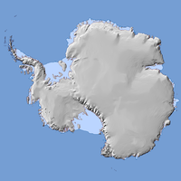
Antarctica
| North America | South America | Europe | Africa | Asia | Oceania | Antarctica |
| V・T・E |
| latitude: -75, longitude: 0 |
| Browse map of Antarctica 75°00′00.00″ S, 0°00′00.00″ E |
| Edit map |

|
|
External links:
|
| Use this template for your locality |
Antarctica is a continent on Earth at latitude 75°00′00.00″ South, longitude 0°00′00.00″ East.
Antarctica is the southernmost continent on the planet. By definition of the Antarctic Treaty, it includes all land south of -60 degrees latitude. This does not include various subantarctic islands which can be considered belonging to Antarctica geographically.
Antarctica poses many problems for OpenStreetMap due to its uniqueness (mostly covered in ice for instance), geographical position around the South Pole (which leads to many problems in usual map projections) and emptiness (not many mappers around).
Tagging territorial claims
|
Do not use landuse=military or boundary=administrative within Antarctica. Article I of the Antarctic Treaty prohibits military activity, while military personnel or equipment may only be used for peaceful purposes such as scientific research. Article IV stipulates that, while the treaty is in force, no act or activity that takes place constitutes a basis for supporting a territorial claim. Signatories cannot enforce territorial laws (Article VIII). All claimants are signatories. Therefore, there is no verifiable current basis for these tags. |
Antarctic bases are mapped as settlements using a place=* node, as their contours are not well defined. Instead of boundary=administrative, claimed areas can be tagged as non-administrative regions with boundary=region.[1]
Data import and tagging
New data for the Antarctic coastline has been imported replacing the previous data which has been quite bad. See Antarctica/Import_2013 for details on this import and Antarctica/Tagging for the Antarctica specific tagging established with this import. Also, Antarctic Digital Database Data has been imported offering additional and more detailed information.
Mapping tasks
After the MOA and ADD imports, there are a lot of islands and ice shelves not yet named. Wikipedia has information on both Islands and Ice shelves.
Creating an Antarctica map
Due to its position around the South Pole and intersection with the 180th meridian, the usual map projections show Antarctica rather distorted. On the typical tiled web maps the area below about 85° South (and above 85° North) is not shown at all. See Creating a map for some tips how to create specialized Antarctica maps.
Note that a fake coastline limit at 85°03'S have been tagged in the database as natural=coastline + coastline=bogus for rendering in Mercator projection due to the projection's inherent restriction, however whenever possible software shouldn't rely on such pseudo-limit.
