ES:Comparativa de editores
Jump to navigation
Jump to search

Este artículo es una traducción incompleta de Comparison of editors: puede tener carencias, errores no corregidos o partes que todavía no han sido traducidas.
Si comprendes el artículo original en inglés, por favor, ayuda a completar esta traducción al español. Lee las instrucciones sobre cómo traducir este wiki.
Parece que nadie está trabajando en la traducción en este momento. Anímate y colabora en la tarea de traducción.
Si comprendes el artículo original en inglés, por favor, ayuda a completar esta traducción al español. Lee las instrucciones sobre cómo traducir este wiki.
Parece que nadie está trabajando en la traducción en este momento. Anímate y colabora en la tarea de traducción.
Tabla de comparación
| Nombre | Para usuarios novatos | Plataforma | Lenguaje de programación | Tipo de editor | El desarrollo está activo | Windows | Linux | Mac OS X | Android | iOS | Gratis | Ventajas | Desventajas |
|---|---|---|---|---|---|---|---|---|---|---|---|---|---|
| iD | sí | basado en web | JavaScript | totalmente funcional | sí | se ejecuta en el navegador web | sí | Funciona casi en todas partes, bajo nivel de entrada | pobre soporte para pantallas pequeñas como smartphones, abstrae el etiquetado con resultados a veces confusos | ||||
| JOSM | sí | escritorio | Java | totalmente funcional | sí | sí | sí | sí | no | no | sí | Extremadamente potente y complejo, altamente configurable y extensible a través de complementos. Soporte para revertir conjuntos de cambios | Extremadamente potente y complejo, requiere la instalación de JRE, requiere aprendizaje |
| Potlatch 3 | sí | escritorio | ActionScript | totalmente funcional | sí | sí | solo con WINE | sí | no | no | sí | Requiere el entorno de ejecución de Adobe AIR | |
| Merkaartor | no | escritorio | C++ con Qt | totalmente funcional | sí | sí | sí | sí | no | no | sí | A veces puede dañar las relaciones | |
| Vespucci | no | móvil | Java | totalmente funcional | sí | no | no | no | sí | no | sí | Permite hacer todas las ediciones mientras se realiza el relevamiento, sin crear notas | Básicamente "JOSM móvil" con todas las desventajas y ventajas que implica. Disponible solo para Android. |
| Go Map!! | no | móvil | Objective-C, Cocoa y Swift | totalmente funcional | sí | no | no | no | no | sí | sí | Permite hacer todas las ediciones mientras se realiza el relevamiento, sin crear notas | Disponible solo en iOS |
| StreetComplete | sí | móvil | Kotlin y Java | solo solución de cuestionarios y superposiciones | sí | no | no | no | sí | no | sí | El editor más fácil disponible: se requiere un teléfono Android y una cuenta de OSM, no se requiere conocimiento ni capacitación en OSM para usar el editor | Disponible solo en Android, limitado a ediciones predefinidas que refinan objetos existentes y agregan nuevos nodos POI predefinidos |
| StreetComplete EE (SCEE) | no | móvil | Kotlin y Java | edición de geometría limitada, no se pueden crear vías/relaciones | sí | no | no | no | sí | no | sí | Al igual que StreetComplete, pero la funcionalidad avanzada como el editor de etiquetas sin procesar y las superposiciones personalizadas requiere conocimiento de OSM | Al igual que StreetComplete, y también la funcionalidad "experta" adicional lo hace significativamente más propenso a errores |
| OsmAnd | no | móvil | Java y C++ | visor de mapas con edición de POI | sí | no | no | no | sí | sí | limitado | Se integra con JOSM | Se usa principalmente para navegación en lugar de edición |
| Maps.Me | sí | móvil | C++ | visor de mapas con edición de POI | sí | no | no | no | sí | sí | sí | Interfaz pobre, tipos limitados de objetos que se pueden agregar, además de una política de privacidad horrible | |
| Organic Maps | sí | móvil | C++, Java, Objective C, Swift | visor de mapas con edición de POI | sí | se compila pero necesita IU | se compila pero necesita IU | sí, pero necesita un Mac con ARM | sí | sí | sí | Código abierto, enfocado en la privacidad, en desarrollo activo | Tipos limitados de POI que se pueden agregar, la experiencia de usuario del editor aún no se ha mejorado |
| Locus | no | móvil | desconocido | visor de mapas con edición de POI | sí | no | no | no | sí | no | no | ||
| Level0 | no | basado en web | PHP | edición de objetos a nivel de texto | estable, el editor está completado | se ejecuta en el navegador web | sí | acceso a datos sin procesar en una interfaz de texto simplificada | acceso a datos sin procesar en una interfaz de texto simplificada | ||||
| ArcGIS | no | complemento SIG | desconocido | totalmente funcional | sí | sí | sí | sí | no | no | no | Software propietario, muy costoso | |
| Every Door | sí | móvil | Dart(Flutter) | visor de mapas con edición de POI | sí | no | no | no | sí | sí | sí | Optimizado para la adición rápida de POI |
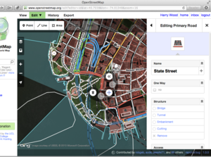
iD

Captura de pantalla de iD
- Resumen
- Editor en línea.
- Ventajas
-
- Actualmente es el editor predeterminado para la pestaña 'Editar' de www.openstreetmap.org y se ejecuta en tu navegador web
- Tiene una función de 'recorrido guiado' y ha sido diseñado para ser una introducción fácil para los nuevos colaboradores de OSM
- Se ha puesto un gran esfuerzo en el desarrollo, con una atención significativa a la experiencia del usuario
- Se puede mostrar ayuda wiki directamente en el editor al editar etiquetas
- Puedes usar imágenes aéreas personalizadas
- Fotos a nivel de calle disponibles directamente en el editor
- Desventajas
-
- No está diseñado para usuarios avanzados (que ya están excelentemente atendidos por JOSM) o aquellos que quieren la velocidad de un cliente de escritorio
- Consume la mayor parte de la potencia de procesamiento (en comparación con JOSM), por lo que si la CPU/navegador es lento, pueden ocurrir retrasos
- Acercar y alejar el mapa provoca una carga del mapa (no tan fluido)
- La interfaz se aparta de la terminología normal de OpenStreetMap ("punto", "línea" y "área" en lugar de "nodo", "vía" y "relación"), lo que puede causar confusión y accidentes de edición
- No es posible trabajar sin conexión
RapiD

Captura de pantalla de Rapid
- Resumen
- Rapid es un editor web moderno para OpenStreetMap. Rapid integra herramientas de mapeo avanzadas, datos geoespaciales abiertos y autorizados, y tecnología de vanguardia para empoderar a los mapeadores de todos los niveles a comenzar rápidamente, haciendo ediciones precisas y actualizadas a los mapas.
- Ventajas
-
- Se ejecuta en cualquier navegador web, con la mayor velocidad y capacidad de respuesta del editor del navegador gracias al renderizado basado en PixiJS
- Cuenta con una introducción de incorporación para nuevos usuarios
- Está integrado con el software Tasking Manager de HOTOSM y otros para proyectos colaborativos
- Está respaldado por un equipo profesional que incluye varios desarrolladores web, investigadores de UX y varios colaboradores habituales de OSM con experiencia en datos y comunidad
- El equipo de desarrollo está más disponible y receptivo a las solicitudes de funciones y a la evolución del editor para futuros casos de uso
- Tiene todas las funciones del editor iD a partir de abril de 2023, además de funciones adicionales y un mayor rendimiento
- Permite editar cuando se hace zoom a escala de ciudad
- Proporciona fuentes de datos adicionales para que los usuarios validen una por una, incluidos edificios y carreteras generados por IA y datos GIS abiertos y autorizados
- Fotos de Mapillary disponibles directamente en el editor con una colaboración especial con el equipo de desarrollo de Mapillary para futuras compatibilidades
- Desventajas
-
- No está muy especializado con funciones para usuarios avanzados que se verían en JOSM
- Requiere conexión web y no funciona sin conexión
- Puede correr el riesgo de que los usuarios trabajen demasiado rápido y no se tomen el tiempo de validar individualmente los objetos de fuentes externas, a pesar de que la experiencia de usuario está diseñada para la validación uno por uno
- Aún no es visible en OpenStreetMap.org
- Carece de datos en algunos países
- No es compatible con dispositivos móviles
(PENDIENTE DE TRADUCCIÓN DESDE AQUÍ)
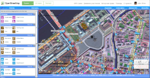
Potlatch 2

Potlatch 2 screenshot. Showing OSM data and background imagery
- Summary
- Flash online editor.
- Pros
-
- Available via the 'Edit' tab's drop-down arrow
- As the precursor to iD (above) Potlatch was also designed for beginners and is great for quick easy immediate editing
- Displaying of GPS traces in a separate layer
- Some advanced features including vector backgrounds and a merging/conflation functionality for specialists
- Several aerial imagery backgrounds preconfigured and option for custom TMS imagery (please check the permissions)
- Cons
-
- Requires a flash plugin in the browser (in Microsoft's Edge browser enable Flash in settings)
- As with iD, it's not intended for power users
- not as fast and fluid as a desktop client
- does not work offline
Desktop↙ and offline↙
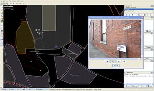
JOSM
- Summary
- JOSM offers a large set of features and useful tools for a wide range of editing styles: It will either read in GPX tracks from your hard disk, or download them from OSM. Aerial imagery can easily be downloaded as a background for tracing. JOSM also supports photo mapping and audio mapping. Once you have completed your edits, you can upload them to OSM.
- Pros
-
- Fast fluid panning and zooming. Near-infinite zooming for super-precise mapping.
- Highly configurable and extendible via plugins, Map Styles, Presets or Validator Rules .
- Advanced editing functionality e.g. changeset reverting.
- A big selection of aerial imagery and third-party GPS traces immediately available as backgrounds for tracing. Custom TMS, WMS and WMTS aerial imagery can be added too (please check the permissions).
- Built in validator, which checks for common mapping errors before data upload
- Can work offline using downloaded data files, and can work with local photo and GPX files
- Tags are shown to user directly. Many tags are recognized by the "presets" which then show description, a translated/localized form and links to the OSM wiki page about a tag for more info.
- Very active development. Bugs are often fixed fast and a new stable version with new features appears usually every month.
- Cons
-
- The finer points of the interface take a while to learn.
- You have to download the software to run it, unlike the following online options (although there is a "Java Web Start" option)
- It requires Java 8 to work (not a big problem for most people).
- No help text when editing tags
Merkaartor
- Summary
- Merkaartor is a fully featured editor for OpenStreetMap available under the GNU General Public License and developed using the Qt toolkit.
- Pros
-
- Has some unique features like transparent display of map features like roads and true curved roads.
- Intuitive user interface
- Binaries for Windows, Mac OS X and some Linux platforms are available. Source for the rest.
- Easy to set up satellite imagery from Bing or any other WMS/TMS source.
- Tag styles can be customized
- Save rendered maps as SVG or bitmap graphic
- Cons
-
- Merkaartor development is a bit slow, which makes bugfixes and new features available only by grabbing the source.
- Small userbase. Developer community is tiny.
- Slow on large number of loaded gps points.
Mobile
Vespucci
- Summary
- Vespucci is the only full OpenStreetMap editor for Android. It is also the first one, having been available and developed since 2009.
- Pros
- mobility
- a full editor for OpenStreetMap that works both on small (phones) and large (tablet) screen Android devices
- supports editing with keyboard and mouse if available
- create/edit nodes, ways, tags, and relations, with all the usual geometry related operations
- built-in support for Imagery Offset Database
- all editing can be done on the ground - no need to rely on memory
- helpful lead developer who is considerate of users' input
- useful display of all the changes you have made, down to a tag- and relation-level diff
- support for offline editing with pre-downloaded dataset in progress
- Cons
- UI can sometimes be a little dated-looking, and clumsy/cryptic to use
- Not currently ideal for editing of large relations (e.g. routes)
- No built-in object history at the moment (opens osm.org history in browser)
- Bad mobile data coverage will bring your mobile survey-edit session to a halt (unless you downloaded the area in advance; see also Pro #9)
Go Map!!
- Summary
- Go Map!! is an iOS app that lets you create and edit information in OpenStreetMap. Go Map!! supports editing nodes and ways and arbitrary tagging.
- Pros
-
- Mobile
- Clean but powerful UI
- Filterable objects to improve load speeds
- Utilizes the preset library from iD
- User friendly Turn Restriction editing GUI
- Ability to clear caches for imagery, OSM data, GPX Traces and more
- Continuous OSM data download
- Cons
-
- Can be resource intensive when cache gets large
- Clunky workflow to edit most relation types
StreetComplete
- Summary
- StreetComplete is a specialized editor of OpenStreetMap data. It allows to easily add some specific information.
- Pros
-
- Mobility.
- Very easy to add predefined data - user is asked simple questions, easy to verify for somebody near object, app handles entirety of tagging and making edit
- allows to create notes
- Ability to edit without Internet connection - quests and map may be cached
- Cons
-
- Is not intended as a general purpose editor, only adding of predefined data and answering notes is available
OsmAnd
- Summary
- Navigation app that allows you to add, delete or change POIs.
- Pros
-
- Fully offline
- Relatively simple user interface
- Also supports Notes
- Cons
-
- Node and closed way edits only (and only for common tag combinations)
- Offline means time lag: downloaded map might be old, might take some time for user to upload changes
- Editing on a mapview, not a dataview. So you might add things that are there but not rendered.
- Usually no sat pic background, so POIs might be some distance from real location.
GIS
ArcGIS Editor for OSM
- Summary
- ESRI has released a plugin for editing OSM data.
- Pros
-
- Industry standard GIS Program
- Very comprehensive GIS capabilities
- Cons
-
- Proprietary
- "ArcGIS for Home Use" will cost you 100$/year
- Works only with ArcGIS 10
- Editing relations are not supported
See also
- Editors — list of different editors (many others not described here)
- Software — list of other software categories including mobile apps (some of which have editing functionality)
- Comparison of discontinued editors — old sections moved off this page
- Change rollback — lists some special editors/methods for reverting / undeletion
- Component overview — Technical overview of OpenStreetMap showing how editors fit in
- Editor usage stats - how often various editors are used
