NoniGPSPlot Android
| NoniGPSPlot for Android | ||||||||||||||||||||||||||||||||||||||||||||||||||||||||||||||||||||||||||||||||||||||||||||||||||||||||||||||||||||||||||||||||||||||||||||||||
|---|---|---|---|---|---|---|---|---|---|---|---|---|---|---|---|---|---|---|---|---|---|---|---|---|---|---|---|---|---|---|---|---|---|---|---|---|---|---|---|---|---|---|---|---|---|---|---|---|---|---|---|---|---|---|---|---|---|---|---|---|---|---|---|---|---|---|---|---|---|---|---|---|---|---|---|---|---|---|---|---|---|---|---|---|---|---|---|---|---|---|---|---|---|---|---|---|---|---|---|---|---|---|---|---|---|---|---|---|---|---|---|---|---|---|---|---|---|---|---|---|---|---|---|---|---|---|---|---|---|---|---|---|---|---|---|---|---|---|---|---|---|---|---|---|
| Author: | Anthony Eguerre | |||||||||||||||||||||||||||||||||||||||||||||||||||||||||||||||||||||||||||||||||||||||||||||||||||||||||||||||||||||||||||||||||||||||||||||||
| License: | (Donate 10€ to Pro) | |||||||||||||||||||||||||||||||||||||||||||||||||||||||||||||||||||||||||||||||||||||||||||||||||||||||||||||||||||||||||||||||||||||||||||||||
| Platform: | Android | |||||||||||||||||||||||||||||||||||||||||||||||||||||||||||||||||||||||||||||||||||||||||||||||||||||||||||||||||||||||||||||||||||||||||||||||
| Status: | Unmaintained | |||||||||||||||||||||||||||||||||||||||||||||||||||||||||||||||||||||||||||||||||||||||||||||||||||||||||||||||||||||||||||||||||||||||||||||||
| Version: | 1.1.11 (2014-09-29) | |||||||||||||||||||||||||||||||||||||||||||||||||||||||||||||||||||||||||||||||||||||||||||||||||||||||||||||||||||||||||||||||||||||||||||||||
| Languages: | German, English, Polish, and French
| |||||||||||||||||||||||||||||||||||||||||||||||||||||||||||||||||||||||||||||||||||||||||||||||||||||||||||||||||||||||||||||||||||||||||||||||
| Website: | http://aeguerre.free.fr/Public/Android/NoniGPSPlot/index.php?ln=EN | |||||||||||||||||||||||||||||||||||||||||||||||||||||||||||||||||||||||||||||||||||||||||||||||||||||||||||||||||||||||||||||||||||||||||||||||
| Source code: | http:// | |||||||||||||||||||||||||||||||||||||||||||||||||||||||||||||||||||||||||||||||||||||||||||||||||||||||||||||||||||||||||||||||||||||||||||||||
| Programming languages: | Java and XML | |||||||||||||||||||||||||||||||||||||||||||||||||||||||||||||||||||||||||||||||||||||||||||||||||||||||||||||||||||||||||||||||||||||||||||||||
| ||||||||||||||||||||||||||||||||||||||||||||||||||||||||||||||||||||||||||||||||||||||||||||||||||||||||||||||||||||||||||||||||||||||||||||||||
Short description
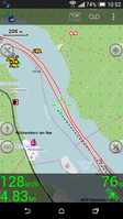
NoniGPSPlot ist ein Tracking Tool zum aufzeichnen von Wander-, Rad-, Boots- oder Autotouren. Das Tool zeichnet detailiert auf wie schnell wann man wo war. NoniGPSPlot ist in der lage als Fartenschreiber genutzt zu werden, die aufzeichnungen haben aber keinen Rechtlichen bestand, also nur als selbstkontrolle. Die Tracks können in verschiedenen Farben aufgezeichnet werden und es können die Farben wärend der Aufzeichnung geändert werden. Es können Punkte/POIs gesetzt und diese mit Alarmsignalen verknüpft werden. Aufgrund das NoniGPSPlot scheinbar rechtliche Probleme hat mit Google Maps (wenn ich es richtig verstanden habe) ist die App nicht mehr im Google Playstore erhältlich. Die App speichert die Maps in Kachel-Form als PNG Dateien, daher hat man zwar relativ viele Details aber auch ein relativ hohen Datenverbrauch. NoniGPSPlot ist in der Lage OpenSeaMap Material anzuzeigen als zusätzliches Layer.
Minimum request
System
minimum Android 2.2
File Versions
- Android 2.2 - 3.2 NoniGPSPlot 1.1.11-13
- Android 4.0 - 4.3 NoniGPSPlot 1.1.11-18
- Android 4.4 or higher NoniGPSPlot 1.1.11-19
Testet on
- Rooted Sony Experia X8 (Android 2.2)
- Xperia Arc S
- HTC ONE XL & M8
- Samsung Galaxy 3 Mini
- Samsung Galaxy Note Tab 2014
- Samsung Galaxy Tab 3
Download
Last Version here: Download NoniGPSPlot Android
Guide
Installation
- Download the right APK for your Android version and select in your configuration "Unbekannten Quellen zulassen".
Overlay
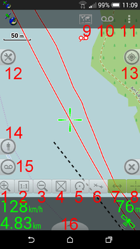
|
|
Configuration
View parameter
Setup
Tracking
- coming soon
FAQ
- coming soon
Pros and Cons
- + High detail Tracks
- + View OpenStreetMap
- + View OpenSeaMap Layer
- + Detail statistics
- + Make Points/POIs
- + Make Points/POIs with alerts
- + Points/POIs import with GPX
- + Tracks import with GPX or KML (planet routes)
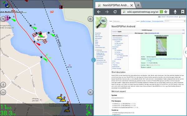
- + support multiwindow
- - Maps in tile format (please take care to not stress the servers too much, i.e. violate the openstreetmap.org tile usage policy or similar ones for other tile services).
- - no Navigation
- - no Offline Maps useable (Garmin)
Planned future features
Anthony Eguerre will insert this features in future:
- Support from other Map formats
- Schedule of routes
Alternatives
- Locus
- OpenSeaMap viewer


