OruxMaps
| OruxMaps | ||||||||||||||||||||||||||||||||||||||||||||||||||||||||||||||||||||||||||||||||||||||||||||||||||||||||||||||||||||||||||||||||
|---|---|---|---|---|---|---|---|---|---|---|---|---|---|---|---|---|---|---|---|---|---|---|---|---|---|---|---|---|---|---|---|---|---|---|---|---|---|---|---|---|---|---|---|---|---|---|---|---|---|---|---|---|---|---|---|---|---|---|---|---|---|---|---|---|---|---|---|---|---|---|---|---|---|---|---|---|---|---|---|---|---|---|---|---|---|---|---|---|---|---|---|---|---|---|---|---|---|---|---|---|---|---|---|---|---|---|---|---|---|---|---|---|---|---|---|---|---|---|---|---|---|---|---|---|---|---|---|---|
| License: | Proprietary ($4.49; free) | |||||||||||||||||||||||||||||||||||||||||||||||||||||||||||||||||||||||||||||||||||||||||||||||||||||||||||||||||||||||||||||||
| Platform: | Android | |||||||||||||||||||||||||||||||||||||||||||||||||||||||||||||||||||||||||||||||||||||||||||||||||||||||||||||||||||||||||||||||
| Version: | 10.5.0 (2024-04-05) | |||||||||||||||||||||||||||||||||||||||||||||||||||||||||||||||||||||||||||||||||||||||||||||||||||||||||||||||||||||||||||||||
| Languages: | English, German, Spanish, and Catalan
| |||||||||||||||||||||||||||||||||||||||||||||||||||||||||||||||||||||||||||||||||||||||||||||||||||||||||||||||||||||||||||||||
| Website: | http://www.oruxmaps.com | |||||||||||||||||||||||||||||||||||||||||||||||||||||||||||||||||||||||||||||||||||||||||||||||||||||||||||||||||||||||||||||||
| Install: | ||||||||||||||||||||||||||||||||||||||||||||||||||||||||||||||||||||||||||||||||||||||||||||||||||||||||||||||||||||||||||||||||
| Programming languages: | C++ and Java | |||||||||||||||||||||||||||||||||||||||||||||||||||||||||||||||||||||||||||||||||||||||||||||||||||||||||||||||||||||||||||||||
|
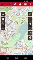
OruxMaps is a map viewer. It can work in two modes: online with Google, Microsoft, Yandex,... maps, and offline, with calibrated maps for OruxMaps, or online maps which have been saved |
||||||||||||||||||||||||||||||||||||||||||||||||||||||||||||||||||||||||||||||||||||||||||||||||||||||||||||||||||||||||||||||||
| ||||||||||||||||||||||||||||||||||||||||||||||||||||||||||||||||||||||||||||||||||||||||||||||||||||||||||||||||||||||||||||||||
OruxMaps is an Android map viewing and navigation app.
It can display OpenStreetMap maps (raster and vector tiles, vector maps from Mapsforge), raster images from OziExplorer and GeoPDF, Shapefiles and KML/KMZ, and has tracking and waypoint recording features making it suitable for gathering and exchanging recorded data as GPX files. It can use offline vector maps or display map tiles online or pre-downloaded from a variety of sources. OruxMaps can also use SRTM elevation data to display 3D views of maps.
On the Mapsforge project page there is plug-in for Osmosis that allows to compile vector maps from OSM data for offline usage. Meanwhile many vector maps are readily available for download and the use of online sources is discouraged.
Recommended as an OpenStreetMap "power-user" Android app
Online charts
To display our maps go to menu -> Maps -> 'Online maps' and select from the available maps e.g. :
- 'OpenStreetMap Mapnik' for the default maps seen on https://openstreetmap.org (the default osm Mapnik style)
- '4UMaps' Outdoor map for hiking, cycling and mountain biking 4UMaps.com
- 'OpenStreetMap Cyclemap' for cycle routes and terrain rendering as seen on OpenCycleMap.org
- 'OpenSeaMap' for a marine/sailing themed rendering (OpenSeaMap)
- 'CloudMade' for CloudMade's default OpenStreetMap rendering
Additionally you can also select 'Microsoft earth' which is the bing imagery which we can use to make maps from.
Offline charts
There are raster- and vector maps available, many of them free of charge.
Vector Maps
Vector maps in Mapsforge format (.map) should be installed on the SD card in the folder /sdcard/oruxmaps/mapfiles. The vector maps now come with additional style files that should be also installed. You can also create subfolders to organize the maps. In the map dialog you can then go to 'Offline maps' and chose you map.
Vector maps designed for hiking and outdoor and CycleMaps purposes are available at openandromaps.org.
Maps of the Mapsforge project itself should be pereferably downloaded from its mirror, the project site has only very limitted bandwidth mapsforge.org.
Here a description how to add contourlines to the maps from OSM from the Oruxmap Forum
Alternatively you can use Mopac to convert the OSM Tiles to use them offline in OruxMaps. This is only useful for small maps.
Garmin vector maps in IMG format also supported, so its possible to use existing Garmin maps and OSM extracts in Garmin format, see: OSM map On Garmin/Download
If you want to create a custom offline vector map from OSM Data you can use the Mapsforge MapWriter Plugin for Osmosis. Its also possible to extract custom region of the latest OSM Data as Garmin and Mapsforge maps using BBBike @ World online extract tool.
Routing
For routing app may use various online services via API. For offline routing its required to install external BRouter, which OruxMaps can communicate with, and download GraphHopper maps for needed area.
Raster Maps
Ready to go topographic maps for outdoor activities are available here 4UMaps Download Simply copy the files into the /oruxmaps/mapfiles folder on the sd card, and select offline map from the main menu.
OpenSeaMap
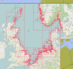
This OpenSeaMap charts are availyble as MBTiles:
| Revier | Download | Grösse | Abdeckung |
|---|---|---|---|
| Adria | Adria | 0,5 GB | 
|
| Biskaya | Biskaya | 0,5 GB | 
|
| Englischer Kanal | Englischer Kanal | 0,5 GB | 
|
| Magellanstrasse | Magellanstrasse | 0,1 GB | 
|
| Mittelmeer Ost | Mittelmeer Ost | 1,2 GB | 
|
| Mittelmeer West | Mittelmeer West | 1,0 GB | 
|
| Nordsee | Nordsee | 1,4 GB | 
|
| Ostsee | Ostsee | 1,2 GB | 
|
Recording tracks
- Tracks are stored in the internal database and can be exported to a .gpx file which can be uploaded to OSM.
- Track Recording sensibility can be set in the menu settings GPS with tree parameters:
- minimum time between GPS measurements. The higher, lower battery consumption.
- minimum distance between measurements.
- maximum precision to record the received position.
- Tracks can be uploaded directly to OpenStreetMap.
Links
- OruxMaps Manuals
- OruxMaps GP - donate version (latest stable)
- OruxMaps - freeware version (old stable)
- OruxMaps Beta - test version (latest preview)
