Papua New Guinea Tagging Guidelines
Papua New Guinea is one of the least well-mapped parts of OpenStreetMap. As no separate tagging guideline exists and a lot of work remains to be done, this document attempts to offer a guide that will help to guide future contributions. Should you have more detailed information do not hesitate to include them. Also remember that this is a guide only and may not reflect local conditions. Part of this guide is based off the East Africa Tagging Guidelines.
Roads in Papua New Guinea
PNG is estimated to have between 20,000 and 25,000 kilometres of road. This is an estimate because although 16,540 kilometres is accounted for in the official databases, around 4,000-8,000 kilometres is thought to remain undocumented. Roads are often poorly maintained and face regular closures and disruptions. Transport access in rural areas is particularly poor.[1]
Roads in PNG can be difficult to categorise as sometimes through roads of major importance can be in very poor condition. At the same time, you may find narrow roads in residential neighbourhoods that are perfectly smooth and freshly tarmaced. As a general guideline, map
- with key highway the importance of a particular road in the country's transport infrastructure. The social and economic importance of a road should outweigh its condition when assessing the appropriate category.
- with key surface the material used for construction of a road
- with key smoothness the state how passable a road is, for example if it can be used by a regular street car or only an offroad vehicle with all-wheel-drive and high clearance.
Road classification
| Description | Tag | Comment | Urban example | Rural Example |
|---|---|---|---|---|
| Motorway | highway=motorway and highway=motorway_link | Motorways do not yet exist in PNG. | ||
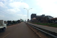
| Trunk roads | highway=trunk and highway=trunk_link | These roads have a motorway-like layout with multiple lanes and usually a central meridian. Their surface is always tarmaced. Trunk roads currently only exist in Port Moresby and Lae. | ||
| National roads | highway=primary | National roads connect the most important cities and larger towns (e.g. Highlands Highway, Madang Highway). These roads will usually be tarmaced and show centre markings. However, primary roads might also be unpaved. | ||
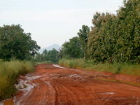
| Regional roads | highway=secondary | They are the second most important roads in transport system. They typically link larger to medium-sized towns. Might be tarmaced in some areas, but many times they are not. | ||
| Local roads | highway=tertiary | These are through roads that link smaller towns and larger villages, as well as government and mission stations, secondary schools, prisons, or other important government infrastructure. More often than not, these roads will be unpaved. As a rule, any through road with a bridge should be tagged as a tertiary road, although most river crossings will be by fords. They are usually wide enough for two cars to pass safely. | ||
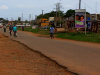
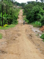
| Other roads | highway=unclassified | Minor collector roads that link small villages or hamlets. These roads are usually unpaved and are only wide enough for one vehicle. This tag is primarily used in rural areas and outside of inhabited places, though unclassified roads can be used to link suburbs in a city or town. | ||
| Residential roads | highway=residential | Road lined with housing. This tag is used only in urban and village areas and only on roads that do not serve a through connection function. | ||
| Service roads | highway=service | This tag is used for driveways, carpark entrance roads, private roads, etc (most often in urban areas, but may exist in rural areas too, such as driveways to petrol stations or service roads in mining sites, industrial compounds, or waste recycling sites). Please remember to add access=* and service=* where applicable. | ||
| Track | highway=track | This tag is usually used for roads providing access to agricultural, plantation, or forestry facilities or isolated individual buildings located away from settlements. If possible, please use also in conjunction with tracktype=*. Never use track to mark an unpaved or unsealed road connecting villages or hamlets or a dirt road in built-up areas. Such roads should be tagged highway=unclassified or highway=residential and complemented by surface=*. | ||
| Path | highway=path | Paths are usually impassable for motorised vehicles. In order to mark a path as appropriate for cycling, add bicycle=yes. Never use path to mark an unpaved or unsealed road in built-up residential areas: Such roads should be tagged according to the local conventions (usually highway=residential if passable by vehicles and pedestrians, or highway=footway for pedestrian only where they can sometimes be separated from another parallel highway for vehicles) and complemented by surface=*. | ||
| Private roads | highway=* access=private | For roads with no public access choose the appropriate category and add access=private. Most private roads are service roads (notably driveways to residences or farms, or carriage ways in mining sites, or service ways in closed industrial or military sites) that may exist in both rural or urban areas (private roads in urban residential areas are usually much shorter than those in industrial sites). |
Road names
Where roads have an officially assigned name, this should of course be tagged using name=*. Many roads, however, are only known by a popular inofficial name. These commonly used names have the problem that the way they are used may change from one person to another or from one village to the next.
Therefore, it is considered good custom to name the major overland routes by their starting / end point; in this case Port Moresby - Haima Road. In doing so, the road name will allow for navigation in both directions.
Having said that, mappers should also make sure that a road does not change its names in very short intervals. Try, therefore, to identify the biggest and most important places a road links together and use only those for naming.
When using the name=* tag make sure you always type the full name. You should never use an abbreviation on names (i.e. Jinja Road, not Jinja Rd).
Road numbers
The ref=* tag should only be used on roads which are signposted with an official number. Please make sure you never use name=* for official road numbers.
Road surfaces
As has been said earlier, a road's surface condition does not necessarily reveal its importance in the country's transport system. Therefore, in addition to choosing the appropriate category, it is recommended to use surface=* to indicate the physical condition of the road.
Generically, a sealed surface is indicated by surface=paved while unsealed roads can be tagged with surface=unpaved.
Where this information is available, it is, however, advisable to be more specific on the material of the road surface (i.e. surface=asphalt and surface=concrete on paved or surface=ground and surface=dirt on unpaved roads).
In the context of PNG, the surface tag should be used as often as possible. Where potholes represent more than 50% of the surface, the road should be considered as unpaved. highway=track are supposed to be unpaved by default.
References
- ↑ “PNG Road Safety Review”. National Road Safety Council. November 2011.
