Tag:man_made=wildlife_opening
Jump to navigation
Jump to search
| Description |
|---|
| Man made clearing for wildlife. |
| Group: man made |
| Used on these elements |
| Useful combination |
| Status: proposed |
| Tools for this tag |
|
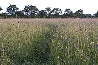
Use to tag a meadow created and maintained in a forest (natural=wood) for wildlife.
The forest service in the United States uses this terminology for artificially created forest openings for wildlife.
How to map
Draw a way around the area of the opening, and tag man_made=wildlife_opening and landuse=meadow
Sometimes these will have a role of "inner" in a forest or wood multipolygon relation.
Tags in combination
These meadows would quickly revert to forest if let alone.
If the opening has a name, add name="name of meadow".
If the opening has access for handicapped, find the right tag for that.
Similar tags
- landuse=meadow - An area of land primarily vegetated by grass plus other non-woody plants.
- landuse=farm - An area of farmland used for tillage and pasture.
- landuse=grass - An unspecified area were grass grows. E.g. a lawn in a park, the middle of a roundabout, part of a golf course, the side of the road, etc.
- natural=scrub - A plant community characterized by vegetation dominated by shrubs (bush) More woody plants than a meadow.
- natural=heath - A dwarf-shrub habitat, characterized by open, low growing woody vegetation, often dominated by plants of the Ericaceae. More woody plants than a meadow.
See also
- Vegetation - summary of tags related to areas of vegetation of different types
- Land use and areas of natural land - about landuse mapping in general
