Tag:tower:type=clock
| Description |
|---|
| Clock tower in |
| Group: man made |
| Used on these elements |
| Requires |
| Useful combination |
| Status: de facto |
| Tools for this tag |
|
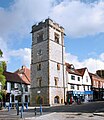
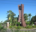
![]() Clock tower. Clock towers are a specific type of structure. They are usually built as very high towers, located on places that are visible from its surroundings, usually in central parts of town and squares, and are capable to house a turret clock and have one or more clock faces on the upper exterior walls, most often four. Many clock towers are freestanding structures but they can also adjoin or be located on top of another building.
Clock tower. Clock towers are a specific type of structure. They are usually built as very high towers, located on places that are visible from its surroundings, usually in central parts of town and squares, and are capable to house a turret clock and have one or more clock faces on the upper exterior walls, most often four. Many clock towers are freestanding structures but they can also adjoin or be located on top of another building.
How to map
Set a node ![]() or draw as an area
or draw as an area ![]() along the outline and tag it with
along the outline and tag it with
Tag to use in combination
- building=tower - if tower is a building
- historic=yes - the tower is of historic value
- heritage=* - the tower is protected by a heritage organization
- height=12 - it is 12 meters high
State
You can use the tag building:condition=State to indicated the state of medieval towers.
And/or, if applicable, you can use the tag ruins=yes.
Rendering suggestions
 suggested by User:Santasa
Examples of freestanding clock towers
Examples of clock towers adjoined to another building or located on top of it
Examples of ancient clock towers
tower:type=clock + historic:civilization=* + building:condition=*
Examples of medieval clock towers
tower:type=clock + historic=tower.+ historic:civilization=* + building:condition=*
Examples of modern clock towers
Examples of Ottoman clock towers
tower:type=clock + historic:period=ottoman + building:architecture=ottoman + building:condition=*
Examples of European
tower:type=clock + historic:period=* + building:architecture=*
Examples in Asia
tower:type=clock + historic:period=* + building:architecture=*


