Talk:Key:trail visibility
Please see the proposals discussion page for the history of this key.
Examples
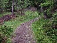
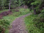
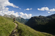
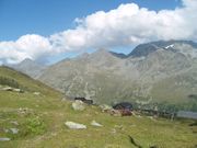
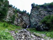
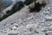
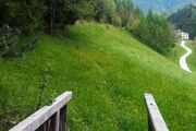
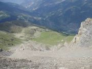
I have added some examples. The big problem is, that pictures are really not telling how it looks in reality. Sometimes moving back/forward for the picture changes the whole situation, while on the trail the eye has no problem at all identifying the trail.--Extremecarver 18:07, 21 November 2010 (UTC)
Why not apply it to highway=track as well?
Since some tracks are seldom used, they are not easily visible--especially tracks whose tracktype=grade5 (i.e. unpaved track; lack of hardcore, and uncompacted, subtle on the landscape, made from only grass, sand and/or soil).
Wouldn't it be useful to tag tracks with trail_visibility? OK, probably tracktype already gives a hint about the track visibility, but with trail_visibility I think it would be much more explicit.--solitone, 2012.01.19
something between excellent and good?
often most wooded trails have pretty good visibility but sometimes the visibility breaks down with leaf cover etc not quite sure how to handle those situations I have been for the most part just tagging them as good or excellent based on sections that have better visibility then other sections it can vary a lot over the coarse of a trail though. --Kc0nlh 2014.05.12
controversy about verifiability
I've added a section about the controversy about this tag (Mainly because it is listed at because verifiability this tag. Those who want to propose solution that problem are welcome to talk about it here. sletuffe (talk) 18:05, 19 February 2015 (UTC)
recommended track
What about recommended tracks for best practise ways to get from A to B? In Norway we often have to hike in areas where there is no track. Could I draw in a recommended track (Tag:seamark:type=recommended track), where it is easiest to go, and mark it with trail_visibility=no? Any comments on that? (user:danielscheidegger58)
highly confusing tag
Is this tag about whatever path itself is visible - or it is about whatever hiking route is visible?
> Next marker always visible, but sometimes has to be searched for.
Indicates "about routes".
On the other hand
> Part of a classification scheme for hiking trails, but can be used for any type of paths.
Indicates "first".
And
> key describes attributes regarding trail visibility (not route visibility)
seems to indicate "about route, not about visibility of highway=*" Mateusz Konieczny (talk) 08:37, 8 July 2017 (UTC)
https://taginfo.openstreetmap.org/keys/trail_visibility#combinations indicates that it is used to mark whatever highway=* is visible - maybe description of values should be amended to remove claims that it is used to describe visibility of hiking routes? Mateusz Konieczny (talk) 08:43, 8 July 2017 (UTC)
- I would concur with removing the hiking reference, if the values in the description of this key were not so tightly coupled to the SAC hiking scale (where visibility "good" can mean, that there is not path visible on the ground, but, as explained in the article here, "if you advance 20m, you will see the continuation".) So this repeats the sac_scale dilemma - in that most paths anywhere apart from high mountain areas are sac_scale=hiking and trail_visibility=excellent.
- PS: In Austria, a "route" is not a "way", because of liability issues: A "way" always has to have a maintainer, that has to keep it up to the advertised standard and can be prosecuted for failing that, while a "route" can be unmaintained, after all it is just a kind of dead reckoning described in some (printed) guide. I think that squares quite nicely with Mateusz' understanding of the term, but I am not sure, what it says about the value of this tag. --Hungerburg (talk) 23:44, 9 July 2020 (UTC)
- Came here to point on the exact same thing, the current wiki is conflicting on weather it's talking about route visibility vs highway=path/footway visibility. One is about are there signposts pointing you which direction to go, especially at intersections (ie. if you don't have a map or GPS or a sense of navigation, can you get buy just by reading the guideposts). The other is about is it easy to follow the path/footway without getting lost (loosing the path) even if there are no intersections, which comes down to how well trodden the path is, how built vs natural it is, how overgrown it typically is, and how much it blends in with the surrounding landscape. The current description muddles these two concepts, so I generally end up mapping based on path visibility, and route visibility can be determined to some extent by checking if every intersection has a nearby mapped information=guidepost or information=route_marker --Aharvey (talk) 00:38, 13 September 2021 (UTC)
- I agree that trail visibility and quality of route marking are two different things: most well-marked trails are well maintained and highly used so clearly visible, but I have been on very visible trails that are not marked at all, and also on well-marked trails that were not popular and thus not visible at all. The wiki is clear that the visibility should be evaluated for this tag, but the descriptions of the key values still mention markers. I propose that we re-write the value descriptions to remove references to markers (and optionally develop a scale for quality of marking). However, the article mentions that this scheme is based on a SAC scale, but the link to it is dead and I haven't found anything on the SAC website that describes such a visibility scale. Are the present descriptions really based on SAC work? Rhhsmits (talk) 09:49, 11 March 2023 (UTC)
- Here to the SAC document, recently published in English https://www.sac-cas.ch/fileadmin/Ausbildung_und_Wissen/Sicher_unterwegs/Sicher_unterwegs_Wandern/2020_Berg_Alpinwanderskala_EN.pdf - This version differs from the one, that both the sac_scale and the trail_visibility tags were derived from, but you will get the idea why trail_visibility is confusing. --Hungerburg (talk) 12:45, 11 March 2023 (UTC)
- Thanks! SAC seems to have removed remarks about marking visibility, so why don't we, too? I.e.
- trail_visibility=excellent Unambiguous well-constructed path everywhere
- trail_visibility=good Continuous established footpath, always visible (I removed "but sometimes has to be searched for" because it seems to be in conflict with "always visible")
- trail_visibility=intermediate Path mostly but not always obvious/visible
- The remaining tag descriptions can stay. A new difference between excellent and good is introduced: excellent paths are "constructed", good paths not necessarily. I think the changes in interpretation are minimal, and already tagged paths will not need to be resurveyed. Rhhsmits (talk) 13:29, 11 March 2023 (UTC)
- Yes I think that sounds better. I or We should never have included the remark about route signs. I would phrase it differently however
- trail_visibility=excellent Unambiguous well-constructed path everywhere. No problem to find the way even at night with a torch/light or in bad weather/fog/clouds.
- trail_visibility=good Continuous established footpath, always visible but in bad visibility conditions may need some searching.
- trail_visibility=intermediate Path mostly but not always obvious/visible. If outside forest very hard and in bad weather/will then need GPS device for following it.
- This way we create a clear separation from excellent and good. Also we should extend it to higwhay=track and highway=bridleway because an overgrown track may still be a track and not a path. I think if it previously had been say a unclassified or tertiary road but overgrown by the forest highway=track and abandoned:highway=unclassified is the best solution so this really should not apply to roads.
- --Extremecarver (talk) 12:38, 16 March 2023 (UTC)
- I chose the descriptions to stay close to the SAC description to remove arguments against this Key by the verifiability gurus ("If the Swiss can classify this in a verifiable way, then everybody can"). We can add a bit more guidance like you propose, but the text should stay brief. The bit on "need GPS device for following it" should be moved to the "Requirements" column (and we should think about mentioning GPS in the other categories). Nothing is stopping anyone from applying this to other ways than paths. --Rhhsmits (talk) 08:56, 17 March 2023 (UTC)
- I'm glad to see some work towards making this about trail not route visibility. I have a few suggestions.
- Sometimes the visibility (I think we are really talking about navigability/followability?) is about other physical features than the path on the ground, which could be a line of cairns, close succession of path markers, fencing either side. Perhaps the best thing to do here would be to consistently use the word 'trail' rather than 'path/footpath' (at least be consistent about this) in the definitions and then mention after the table that these features can make the trail always visible, etc.
- I do think it makes sense to clarify the conditions under which 'mostly but not always visible' are supposed to apply (is that in bright sunlight or dense fog at night?).
- I don't think you should talk about GPS unless as an alternative to excellent navigation skills for example. A compass, paper map, ability to read it, knowledge of how many strides you take per 100m are all good substitutes for a GPS. Some clarity, perhaps later in the page, about what might be considered advanced / excellent orientation skills would help reduce ambiguity.
- --TrekClimbing (talk) 12:14, 18 March 2023 (UTC)
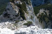
- If you are in deep forest GPS is the only way to find a way that is overgrown - but even then maybe it's hard. Map really doesn't help in deep forest/jungle, nor das a compass add much. And navigation skills help a lot above the treeline / or during bad weather / on more open places (broken branches in the forest could also be caused by animals but still are the main best thing to look for). Yes in Europe dense forest doesn't really exist. It's a completely different situation in tropical countries - especially a forst track can disappear completely within 5-6 years - still following the way on your GPS at least gets you through safely (if it's steep mountaineous jungle). And I also think SAC considered cones or other markers for the trail, not route signs/route markers with their original description but that was pretty hard to differentiate. Excellent should mean you can find the way 364 days a year (safe that one day with a blizzard when you will not be outside anyhow). But even then with a GPS device if the way is not exposed/high sac_scale it should be possible to use it. Good on the other hand means in good visibility it's easily findable/followable. That way there would be a pretty clear differentiation. As this applies to other use cases too - I would still rate it good if you can mountainbike and don't need to reduce speed often to follow the trail. On a visibiity intermediate however very fast running/mountainbike use likely is not possible even in good visibility because the trail is not obvious enough anymore (without previous knowledge where the trail goes). Oh and it would be great if we could add some more pictures to clarify the differences. I uploaded the original pictures but I really think they could be replaced by better ones and also several situations like above treeline and forest/jungle.! --Extremecarver (talk) 19:16, 18 March 2023 (UTC)
- I'm glad to see some work towards making this about trail not route visibility. I have a few suggestions.
- I chose the descriptions to stay close to the SAC description to remove arguments against this Key by the verifiability gurus ("If the Swiss can classify this in a verifiable way, then everybody can"). We can add a bit more guidance like you propose, but the text should stay brief. The bit on "need GPS device for following it" should be moved to the "Requirements" column (and we should think about mentioning GPS in the other categories). Nothing is stopping anyone from applying this to other ways than paths. --Rhhsmits (talk) 08:56, 17 March 2023 (UTC)
I notified the forum here https://community.openstreetmap.org/t/trail-visibility-description-improvement-proposed/97865/1 that a discussion is going on here, but apparently the community prefers to discuss it there. So please join --rhhs (talk) 12:18, 10 April 2023 (UTC)
Using this tag to hide footways on the Mapnik renderer?
In my city (Brussels) I spotted many occurrences of people using trail_visibility=no to map for the renderer (normally not a good idea) and create invisible ways.
Typically, there will be a large pedestrian area on a square, and users will then draw a spider web of footways across it. This will help routing engines to present more natural trajectories *across* the square. And those footways will not clutter the standard map rendering, because one will only see one big area. (example)
I wonder whether this practice should be encouraged, or whether other tags will suit better. Bxl-forever (talk) 10:55, 5 February 2018 (UTC)
- This is tagging that is not even working! Openstreetmap carto is completely ignoring trail_visibility tag, invisibility of this ways is caused by fact that highway=pedestrian in pedestrian area is not visible. And it seems that this tagging is incorrect. I opened https://www.openstreetmap.org/note/1290977 Mateusz Konieczny (talk) 07:34, 6 February 2018 (UTC)
New text proposal
Based on the discussion here and at the community forum, I propose the following updated text based on what I think is the consensus reached.
| Description |
|---|
| Classification scheme for hiking trails which describes trail visibility and orientation skill required. |
| Group: properties |
| Used on these elements |
| See also |
| Status: approved |
| Tools for this tag |
|
The key trail_visibility=* is used as part of a classification scheme for hiking trails and paths. The key describes how easy it is to follow a mapped way using all available visual aspects of a path. These aspects include the visibility of the path on the ground (differences in the trail surface vs its surroundings, a levelled or hollow path surface, differences in vegetation such as a treeless corridor through a forest, etc.) as well as human-added markers such as trail blazes, poles and cairns.
How to map
Add the key trail_visibility=* to a way that might have visibility issues, such as highway=path, highway=footway, highway=cycleway, etc. For ways that are paved, trail_visibility=* is assumed to be excellent and doesn't need to be tagged.
Values
| Tag | Trail | Requirements | Example |
|---|---|---|---|
| trail_visibility=excellent | Unambiguous well-constructed path everywhere. Easily followable even in low visibility weather. | None, orientation unproblematic, no map required | |
| trail_visibility=good | A continuous path which is always visible, but may occasionally become faint or ambiguous. | Basic sense of direction, map recommended | |
| trail_visibility=intermediate | Path mostly visible. It has short gaps in visibility but a visible section is always within sight. | Good sense of direction, map required | |
| trail_visibility=bad | A path mostly exists, but has sections with no visible signs of a path to follow. | Basic skills in orientation | |
| trail_visibility=horrible | Often or mostly pathless, signs of a path exist but are often rare or hard to locate. | Advanced orientational skills | |
| trail_visibility=no | Pathless | Excellent orientational skills |
Note
To add a path with trail_visibility=no to the map, it should be Verifiable, for instance because there is evidence on the ground that there is a path but it is useless and doesn't help trail visibility, or that the path position has been published by an official authority. One can also use it to tag small pathless sections of a longer path with generally better visibility.
Controversy
Based on the guidelines of verifiability some people find this tag lacking of verifiability. As always on OSM, use your best judgement to follow common sense and consensus. Please, have a look at the discussion page at Talk:Proposed features/Hiking. You can use the talk page for suggesting improvement.
See also
- Approved features/Hiking
- Hiking Maps to see how this tag is rendered by OSM hiking maps
- sac_scale=* for classification of hiking difficulty (how physically difficult it is to hike the path)
- trailblazed:visibility=* for quality (visibility) of trail markers (how easy it is to choose the right path at a junction)
- information=guidepost
Alternative Pictures
Proposed change to the "Values" Table
| Tag | Trail | Requirements | Example |
|---|---|---|---|
| trail_visibility=excellent | Well cleared path throughout | None, no map required | |
| trail_visibility=good | Well trodden path throughout | Basic sense of direction | |
| trail_visibility=intermediate | Trodden path with short gaps | Good sense of direction, map recommended | |
| trail_visibility=bad | Path sometimes invisible | Basic skills in orientation | |
| trail_visibility=horrible | Path often invisible | Advanced orientational skills, map required | |
| trail_visibility=no | No path most of the time | Excellent orientational skills |
TODO: another picture for "bad" in T5 terrain
