Tag:highway=cycleway
 |
| Description |
|---|
| For designated cycleways. |
| Rendering in OSM Carto |

|
| Group: cycleways |
| Used on these elements |
| Implies |
| Useful combination |
|
| Status: de facto |
| Tools for this tag |
|
The highway=cycleway tag indicates a separate way for the use of cyclists.
When not to use
Cycling infrastructure that is an inherent part of a road – particularly "cycle lanes" which are a part of the road – should usually not be tagged as a separate cycleway, but by adding the cycleway=* tag to an existing highway=* instead.
The Bicycle page provides more information about how to tag bicycle-related infrastructure in general.
Ways that are not marked as cycleway by traffic signs (and are therefore open to non-bicycle traffic (e.g., moped or horse) should typically be tagged as highway=path instead of highway=cycleway, but see duck tagging as well. However, highway=path without any additional information about surface quality, etc... can be hard to interpret for bicycle routers and other data consumers due to the wide variety of path types ranging from perfectly flat and paved ways that simply lack explicit cycleway signs to mountain hiking routes that are completely impassable for bicycles[1]. Adding additional tags such as surface=* makes it easier for data consumers to properly categorize and make use of ways tagged as highway=path.
How to map
To tag a cycleway just create the way ![]() and tag it with
and tag it with highway=cycleway. If the cycleway has a name then add a name=* tag to it. To indicate that the cycleway is part of a cycle route, see Cycle routes for a full guide.
Tags to use in combination
surface=*smoothness=*oneway=yesif it's onewaylit=*traffic_sign=*width=*name=*- access tags
Foot access on cycleways
Tagging a way with highway=cycleway implies that the route is designated for bicycles.
Different countries have their own rules as to whether foot access is allowed by default on cycleways. See default access restrictions. In countries where foot access is not allowed by default, use the foot=designated or foot=yes tag when foot access is allowed. In this case, you can add the segregated=* tag to indicate whether or not there is a separate pedestrian lane present.
The iD preset "Cycle & Foot Path" uses highway=cycleway along with bicycle=designated and foot=designated. On the other hand, the equivalent JOSM preset tags this as highway=path with bicycle=designated and foot=designated.
In either case adding also segregated=yes or segregated=no is helpful.
Special situations
cycleway=*– If the cycleway is mapped as part of another highway (especially bicycle lanes).oneway=yes– If cyclists are only allowed to ride in one direction on the cycleway.bridge=yes– If the cycleway goes over a street or waterway.tunnel=yes– If the cycleway goes below a street or waterway.
Examples
| Description | Picture | Tags |
|---|---|---|
| Dedicated cycleway | 
|
highway=cycleway + traffic_sign=GB:956
(add access restriction tags like |
| Cycleway with sidewalk | 
|
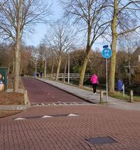
highway=cycleway + sidewalk=right + traffic_sign=NL:G12a
|
| Combined cycle- and footway | 
|
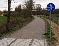
highway=cycleway + foot=designated + segregated=no + traffic_sign=DE:240
or
|
| Dedicated cycleway and footway, segregated from each other but being a single object | 
|
highway=path + bicycle=designated + foot=designated + segregated=yes
or
or
|
| One-way cycleway | 
|
highway=cycleway + oneway=yes + traffic_sign=AT:52.16
|
Rendering
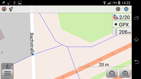
| Old OSM Carto | OSMAnd |
|---|---|
See also
area:highway=cycleway– An area representation of cycleways- Bicycle – Bicycle and cycleway features
cycleway=*– Cycle lanes or tracks provided within the carriageway or next to it- Cycle routes – Route relations for cycle routes
- Category:Bicycles
- OpenCycleMap – OSM data cycle map! (also available as a layer on the OSM main map)
amenity=bicycle_repair_station– A public tool for self-repair of bicycles- Osm cycleways tagging guide – developed by BikeOttawa on Github
- Proposal:Key:is sidepath – To indicate whether a cycle way runs in parallel along a street, making it adjoining or runs separated and thus detached from the road.
References
| ||||||||||||||||||||||||||||||

