Template:Map Features:information
Information
| Key | Value | Element | Comment | Rendering | Photo |
|---|---|---|---|---|---|
| information | office | An office where you can get information about a town or region. | |||
| information | visitor_centre | A place where you can get information about a specific attraction or place of interest. | |||
| information | board | A board with information. To describe it closer, have a look at board_type=*. | |||
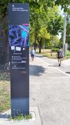
| information | stele | A stele for information. | |||
| information | terminal | A information terminal provides information access via electronic methods. Mostly it is combined with access to the internet. (See internet_access=*.) | |||
| information | audioguide | A place where you can get information using headphones or a mobile phone. | |||
| information | map | A board with a map. To specify the type or shown details, have a look at map_type=* and map_size=* in information=map. To describe the access to the shown routes or the kind of route use the keys e.g hiking=yes, bicycle=yes, mtb=yes, horse=yes or ski=yes. | |||
| information | tactile_map | Tactile maps are maps for the blind, also known as haptic maps. | |||
| information | tactile_model | Tactile models are models for the blind representing buildings and surroundings. | |||
| information | guidepost | Signposts/Guideposts are often found along official hiking/cycling routes to indicate the directions to different destinations. To describe the access to the shown routes or the kind of route use the keys e.g hiking=yes, bicycle=yes, mtb=yes, horse=yes or ski=yes. | |||
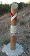
| information | post | A small pole, erected vertically, with information on the top or sides that may be inscribed, or on a small plaque. Somewhat similar to an information=stele, but smaller. | |||
| information |
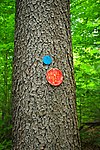
A marker that shows the position of the way of a route. Could be a symbol, a short pole or a painted marking. Note that two partially equivalent tag values are used: a more popular route_marker and less popular trail_blaze, which documents the difference some mapper see between the two. |
||||
| information | user defined | All commonly used values according to Taginfo |
This table is a wiki template with a default description in English. Editable here.
Note to editors: Please don't categorize this template by editing it directly. Instead, place the category in its documentation page, in its "includeonly" section.
Template for the information table in the Map Features page. Use the default English text or use the template arguments for your translations
Usage
All parameters are optional. By default, text is in English. English writers shall write their comments in the template itself (avoiding double edition). Other languages are translated in template arguments, not in the template itself.
== section header ==
|name=        (section header line)
|description= (displayed before and/or after the table; optional)

== One key/value row ==
||head:key=   |head:value=   |head:desc=   | head:render=   | head:photo=
Template for copy/paste...
<noinclude>{{languages}}</noinclude>
{{Map_Features:information
|name=
|description=
|head:key=
|head:value=
|head:element=
|head:desc=
|head:render=
|head:photo=

|information:key=
|office:desc=
|terminal:desc=
|audioguide:desc=
|map:desc=
|tactile_map:desc=
|tactile_model:desc=
|board:desc=
|route_marker:desc=
|}}


