Template:Pl:Map Features:properties
Jump to navigation
Jump to search
Właściwości
Używane do oznaczenia dodatkowej informacji o charakterze ogólnym dotyczącej innego elementu.
| Klucz | Wartości | Element | Opis | Zdjęcie |
|---|---|---|---|---|
| area | yes | Oznacza, że linia tworzy zamknięty obszar. Nie należy dodawać do obiektów domyślnie rysowanych na mapie jako obszary. | ||
| brand | user defined | Brand of the feature. | ||
| bridge | yes / aqueduct / viaduct / cantilever / movable / covered / … | Most. Użyj również layer=*. Wartość bridge=yes jest wartością domyślną. Można również użyć wartości aqueduct, viaduct itd. | ||
| capacity | amount | Used for specifying capacity of a facility. | ||
| charge | amount | Used for specifying how much is charged for use/access to a facility. See toll=* or fee=*. | ||
| clothes | see key's page | Tagged on shops and other features to denote if they sell clothes or not and what type of clothes they sell. | ||
| covered | yes | Określa, czy dany obiekt jest przykryty przez inny lub znajduje się pod ziemią. | ||
| crossing | no / traffic_signals / uncontrolled / island / unmarked | Do oznaczania typu i infrastruktury przejścia dla pieszych - np. świateł, wysepek. | ||
| crossing:island | yes / no | Specifies whether a pedestrian crossing has a refuge island | ||
| cutting | yes / left / right | Przekop przez wzniesienie (lub wkop drogi biegnącej poniżej poziomu terenu) na potrzeby ruchu samochodowego bądź kolejowego. | ||
| disused | yes | Obiekt, który jest przydatny do nawigacji, jednak jest nieużywany lub porzucony. | ||
| drinking_water | yes / no | Describes whether a drinking water is available | ||
| drive_through | yes / no | (przejechać) Określa, czy fast-food, bank, bankomat, apteka, skrzynka pocztowa są dostępne bez wychodzenia z pojazdu. | ||
| drive_in | yes / no | Określa czy kino jest drive-in (wjechać), czy restauracja oferuje usługi drive-in. Drive_in jest inny niż drive_through dla zmotoryzowanych. | ||
| electrified | contact_line / rail | Indicates infrastructure to supply vehicles with electricity on rail tracks | ||
| ele | Number | Wysokość na poziomem morza mierzona w metrach. | ||
| embankment | yes | Nasyp, w celu poprowadzenia na nim ruchu samochodowego bądź kolejowego. | ||
| end_date | Date | Data kiedy obiekt przestał istnieć. | ||
| est_width | Number | Szacunkowa szerokość w metrach. | ||
| fee | yes / no | Used for specifying whether fee is charged for use/access to a facility. See also toll=*. | ||
| fire_object:type | poo / szo | Potentially dangerous and socially significant objects | ||
| fire_operator | Name | Fire station, which serves the object | ||
| fire_rank | 1bis / 2 to 5 | Rank fire, defined for a particular object | ||
| frequency | Number | Frequency in Hz | ||
| hazard | see hazard | Indicates of the hazards. | ||
| hot_water | yes / no | Describes whether a hot water is available | ||
| inscription | User Defined | The full text of inscriptions, which can be found on buildings, memorials and other objects. | ||
| internet_access | yes / wired / wlan / terminal / no | Określa czy obiekt jak budynek, sklep, restauracja, itp. oferuje dostęp do Internetu jako płatną usługę lub bezpłatną. | ||
| layer | -5 to 5 | Nr warstwy, na której znajduje się obiekt. 0: na powierzchni; -1 i mniej: pod powierzchnią; 1 i więcej: nad powierzchnią (nie +1) |
||
| leaf_cycle | evergreen / deciduous / semi_evergreen / semi_deciduous / mixed | Describes the phenology of leaves | ||
| leaf_type | broadleaved / needleleaved / mixed / leafless | Describes the type of leaves | ||
| location | underground / overground / underwater / roof / indoor | Location | ||
| narrow | yes | Zwężenie szerokości jezdni, ścieżki, kanału. | ||
| nudism | yes / obligatory / designated / no / customary / permissive | Indicates if the described object provides the possibility of nudism | ||
| opening_hours | 24/7 or mo md hh:mm-hh:mm. (read described syntax) | Godziny otwarcia. | ||
| opening_hours:drive_through | 24/7 or mo md hh:mm-hh:mm. (read described syntax) | opening_hours describes when something is open for drive-through services. | ||
| operator | User Defined | Wskazuje do jakiej korporacji/firmy należy obiekt. | ||
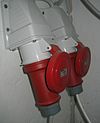
| power_supply | yes / no | Describes whether a power supply is available | ||
| produce | User Defined | Describes a feature's agricultural output produced though a natural process of growing or breeding. | ||
| rental | see key's page | Tagged on shops and other features to denote if they rent something or not and what they rent. | ||
| sauna | yes / no | Describes whether a sauna is available | ||
| service_times | see opening_hours | Times of service of a given feature e.g. church service | ||
| shower | yes / no | Describes whether a shower is available | ||
| sport | soccer / tennis / basketball / baseball / multi / ... | Describes which sports are placed on a facility such as a pitch or stadium. | ||
| start_date | Date | Data kiedy obiekt został utworzony. | ||
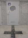
| tactile_paving | yes /no | Wyżłobienia w podłożu, ułatwiające poruszanie się niewidomym. | ||
| tidal | yes | Area is flooded by the tide | ||
| toilets | yes / no | Describes whether a toilets is available | ||
| topless | yes / no | Indicates if the described object provides the possibility of female topless practice | ||
| tunnel | yes | Tunel. Użyj również layer=*. | ||
| toilets:wheelchair | yes / no | States if a location has a wheelchair accessible toilet or not. | ||
| wheelchair | yes / no / limited | Dostępność dla wózków inwalidzkich. | ||
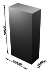
| width | Number | Szerokość drogi w metrach. | ||
| Określa rodzaj drzew w landuse=forest i natural=wood - iglaste / liściaste / mieszane. |
Polskie tłumaczenie może być edytowane tutaj.
This documentation is transcluded from Template:Pl:Map Features:properties/doc. (Edit | history)
Note to editors: Please don't categorize this template by editing it directly. Instead, place the category in its documentation page, in its "includeonly" section.
Note to editors: Please don't categorize this template by editing it directly. Instead, place the category in its documentation page, in its "includeonly" section.
Usage
Wszystkie parametry są opcjonalne. Domyślnie tekst jest w języku angielskim.
Angielscy edytorzy zapisują komentarze w samym szablonie (unikając podwójnej edycji).
Inne języki są tłumaczone w argumentach szablonu, a nie w samym szablonie.
== section header ==
|name=        (section header line)
|description= (displayed before and/or after the table; optional)

== One key/value row ==
|healthcare:key=   |hospital:value=   |hospital:desc=   |hospital:render=   |hospital:photo=


