User:Yurik/sandbox
Cycleway
To describe infrastructure designed mainly for cyclists. See also: Cycle routes.
| Key | Value | Element | Comment | Rendering | Photo |
|---|---|---|---|---|---|
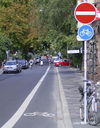
| cycleway | lane | Cycle lanes form an inherent part of the road, separated from traffic by paint or other markings with no physical separation. |

| ||
| cycleway | lane | A lane is a route that lies within the roadway | Cyclist map
|

| |
| cycleway:right | lane | Cycle lane form an inherent part of the road, separated from traffic by paint or other markings with no physical separation. Only on one side of the road. |

| ||
| cycleway:right cycleway:left |
lane | A cycle lane only on one side of the road. Left or right depend on the direction in which the way is drawn in OpenStreetMap. | Cyclist map
|
||
| cycleway | opposite | Using this tag is discouraged, use key:oneway:bicycle and regular key:cycleway tags instead. |

| ||
| cycleway | opposite | Used on ways with oneway=yes where it is permitted to cycle in both directions.
Note - such streets are common in Belgium, the Netherlands and Denmark, for example, but are rare in the UK (although they do exist): often, instead, actually the street is two-way as normal for its whole length except for the very short section past the no-entry sign at the end, where cycles are excepted from the no-entry by means of a short lane separated by an island. This is called a "cycle plug". In some places this has been represented as very short oneway Way at the end with an adjacent cycleway, forming a little triangle with the road they join to, or sometimes with a short oneway Way with cycleway=opposite_lane or opposite_track. |
Cyclist map
|

| |
| cycleway | opposite_lane | Using this tag is discouraged, use key:oneway:bicycle and regular key:cycleway tags instead. |

| ||
| cycleway | opposite_lane | Used on ways with oneway=yes that have a cycling lane going the opposite direction of normal traffic flow (a "contraflow" lane) | Cyclist map
|

| |
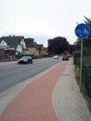
| cycleway | track | Marks that the highway has a cycle track, or cycleway separated by a kerb, on both sides. |

| ||
| cycleway | track | A track is a route that is separate from the road.+oneway=yes if needed. | Cyclist map
|

| |
| left | track | ||||
| cycleway:right cycleway:left |
track | A track only on one side of the road. You can drive in both directions. Left and right depend on the direction in which the way is drawn in OpenStreetMap. | Cyclist map
|
||
| cycleway | opposite_track | Using this tag is discouraged, use key:oneway:bicycle and regular key:cycleway tags instead. |

| ||
| cycleway | opposite_track | Used on ways with oneway=yes that have a cycling track going the opposite direction of normal traffic flow | Cyclist map
|

| |
| cycleway | shared | ||||
| cycleway | shared | Cyclists share space with other traffic on this highway. | |||
| cycleway | share_busway | Bus lane is designated for use by cyclists |

| ||
| cycleway | share_busway | There is a bus lane that cyclists are permitted to use. | 
| ||
| cycleway | shared_lane | Used to identify roads which contain a shared lane marking, or sharrow, to indicate that the travel lane is shared by bicycles and other vehicles. |
|||
| cycleway | shared_lane | Cyclists share a lane with motor vehicles, but there are markings indicating that they should share the lane with motorists. The road markings are usually there to highlight a cycle route or to remind drivers that you can cycle there. Also used for the on-road shared-lane marking called a "sharrow"[1]. | 
| ||
| cycleway | user defined | All commonly used values according to Taginfo |
This table is a wiki template with a default description in English. Editable here.