MENTZ GmbH/Modellierungsvorschläge Indoor
The points below should provide support for indoor modeling in OpenStreetMap. The topics are presenting a collection of information, which was taken from OSM-Wiki. The aim is to reflect the guidelines for modeling real features. We are thankful for any annotations and comments: MENTZ Kontakt
Access to our other topics:
Footways
This abstract describes all details, how pedestrians can reach public transport. For providing pedestrian routing in OSM, it is necessary that footways are connected from the street to the platform. Accessible (barrier-free) routing should be enabled by the consideration of adding elevators, ramps or escalators.
Horizontal pedestrian structures/ Footways 
Footways
Footways inside buildings are tagged with highway=footway, level=* and indoor=yes. If they are illustrated in areas (halls, corridors), the tag indoor=corridor should be used.
| Key | Value | Description | Example |
|---|---|---|---|
| highway | pedestrian | For pedestrian area | 
|
| indoor | corridor | Indicating, that the area should present a corridor (or hall) | |
| area | yes | bei Flächen obligatorisch | |
| level | integer | Indicating, on which level the corridor is located | |
| description | description | More detailed description for the corridor |
Vertical pedestrian structures/ Steps, elevators & ramps 
Vertical structures are divided in chamber-shaped elements (elevators) and in structures, where a predefined slope is given (steps, escalators, ramps). The sloping line is used in OSM for steps, escalators & ramps and shows the footway with the biggest slope.
Steps
Steps are tagged with highway=steps. If they are inside a staircase, the tag levelpart=step_platform + steps + indoor + area=yes should be applied.
| Key | Value | Description | Modeling | Image |
|---|---|---|---|---|
| highway | steps | 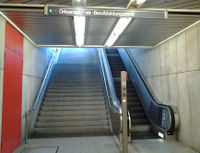
| ||
| incline=* | up/down | Indicating, if steps are going up or down (in drawing direction) | ||
| * % | Accurate allegation of the slope. A negative value means that the steps are going down (in drawing direction) | |||
| level | integer | Indicating, which levels or floors are connected by the steps. The ending points of the steps get level tags. If the steps are connecting level 1 and 2, then the ending points are tagged with level=1 on one hand and with level=2 on the other hand. The step border gets the tag of the lower ending point | ||
| indoor | yes/no | Indicating, if the steps are located inside a building |
The minimum gap for modeling two steps next to each other is 2,00 meters between the two sloping lines.
Escalators 
Escalators get the same tags as steps. Furthermore the tag conveying=* is added.
| Key | Value | Description | Image |
|---|---|---|---|
| highway | steps | rowspan=9 | | 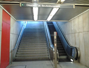
|
| conveying=* | forward | The escalator is carrying the pedestrian into the drawing direction | |
| backward | The escalator is carrying the pedestrian against the drawing direction | ||
| reversible | The direction of the escalator is reversible | ||
| yes | Generalization of the three other values. Can be applied if the direction is unknown | ||
| incline=* | up/down | Indicating, if the steps are going up or down (in drawing direction) | |
| * % | Accurate allegation of the slope. If the steps are going down (in drawing direction) a negative value will be applied | ||
| level | integer | Indicating, which levels or floors are connected by the steps. The ending points of the steps get level tags. If the steps are connecting level 1 and 2, then the ending points are tagged with level=1 on one the end and with level=2 on the other end. The step border gets the tag of the lower ending point | |
| indoor | yes/no | Indicating, if the steps are located inside a building |
The minimum gap for modeling two escalators next to each other is 2,00 meters between the two sloping lines. If escalators are next to steps, the sloping line minimum distance shouldn't be below 1,80 meters.
Elevators 

An elevator consists of a point and a of basic area. The area gets a level-tag, which includes all floors, where elevator-chambers are existing (levels are separated by semicolon, e.g.: 0;1;2;3;4;...). To proceed a well working pedestrian routing, all elevator points should be connected with the footways on every floor where the elevator is moving.
Elevator areas
The elevator areas are containing the following characteristics:
| Key | Value | Description | Image |
|---|---|---|---|
| building:part | elevator | Indicating, that an elevator is part of a building construction | 
|
| area | yes | This tag is needed to identify areas | 
|
| level | integer | Floor of the elevator area | |
| indoor | yes/no | Indicating, if the elevator is located inside a building. |
Elevator points
The elevator points are containing the following characteristics:
| Key | Value | Description | Modeling |
|---|---|---|---|
| highway | elevator | ||
| indoor | yes/no | Indicating, if the elevator is located inside a building | |
| level | integer | All levels with an elevator-chamber are separated by semicolons | |
| wheelchair | yes/no | Indicating, if the elevator is wheelchair accessible | |
| these characteristics can be added | |||
| bicycle | yes/no | Possibility of taking a bicycle into the elevator | |
| operator | Operator | Name of the operator | |
| operator_id | Number | Reference number of the operator | |
| description | Description | More detailed description of the elevator. Name of station & description «from» floor & description «to» floor & number of elevator. Example "Zürich Löwenstrasse, Platform 31/32 after Passage Sihlquai, Lift 122" | |
| ref | Number | Number/description written on the outside and inside of the elevator, which can be used to identify the manufacturer of the elevator, e.g. in an emergency. |
The direction of the entrance and exit is defined by the footway which is leading to the elevator. The footway (highway=footway), which is leading to the elevator points, contains of a level=*-tag and if necessary also a indoor=*-tag.
Incline elevator 


Incline elevators are enabling more mobilities for features in comparison to the usual elevators. They are for example proceeding wheelchair accessible entrances to the stations, closing hillside situations, providing connections to bridge piers or implementing particular architecture.
Inside the two elevator areas, which are located on the beginning and on the end of the elevator route, the elevator points and standard tags are added. The points are connected with a line, containing the tag (highway=elevator).
Ramp 
If a ramp is located next to steps, the tag ramp=yes will be added to the stairs.
For a single ramp, the following tags are used:
| Key | Value | Description | Image |
|---|---|---|---|
| highway | footway | 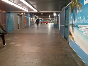
| |
| ramp | yes/no | The footway has an inclination | |
| incline=* | up/down | Indicating, if the ramp direction is going up or down (in drawing direction) | |
| * % | Accurate allegation of the slope. A negative value means that the ramp is going down (in drawing direction) | ||
| level | Integer | Indicating, which levels or floors are connected by the ramp. The ending points of the ramp get level tags | |
| indoor | yes/no | Indicating, if the ramp is located inside a building |
Guideposts for pedestrians inside buildings
The following abstract deals with the creation of tagging-suggestions about the topic "guideposts inside railway stations". The suggested tagging does not present the official course of action. We are thankful for any annotations and comments: MENTZ Kontakt Eifler
The aim of this method is to simplify the indoor routing with the aid of guideposts.
In intermodal routes, often electric information desks are proceeding support. But mostly people are left on their own while navigating throughout complicated railway station constructions. In this case, only simple and comprehensible guideposts could help. To have an idea about which signs to follow, the OSM-Data should proceed the necessary information in future.
Guideposts are captured with relations type=destination_sign. These relations are enabling to describe guideposts at the beginning and at the end of crosses in OSM. Examples, how these relations could be used for indoor paths: destination=* or destination:symbol=* destination:url=*.
It's important to only implement signs, which are crucially needed for finding the destination. Furthermore the data must be complete. The relations are only showing the direction, but not the destination. So if a curve doesn't appear and the passenger is still following the direction of the sign before, the possibility of getting into the wrong way could be the case.
To edit signposts pleasantly, there is a special style in JOSM to get the relation-members shown.
sign.mapcss
 meta
{
title: "destination_sign Relation";
autor: mdv;
   min-josm-version: "2015-09-02";
	  watch-modified: true;
	      description: "Highlight relation rols from, sign and to";
}
relation[type=destination_sign] >[role="to"] node {
   icon-image: https://wiki.openstreetmap.org/w/images/6/65/To_sign.png;
}
relation[type=destination_sign] >[role="from"] node {
    icon-image: https://wiki.openstreetmap.org/w/images/7/7d/From_sign.png;
}
relation[type=destination_sign] >[role="sign"] node {
    icon-image: https://wiki.openstreetmap.org/w/images/5/50/Sign_sign.png;
	text: "destination"
}
Members of relations
Relations are basic elements in OSM. Points can be used as data-elements, which are taken into the relation list. Each data-element gets a role and a description about which function is being taken in the relation. These are the most common roles:
| OSM-Element | Role | Quantity | Description |
|---|---|---|---|
| sign | 1 | The location of the guidepost. It can be connected to a footway, but this is depending on the location itself | |
| from | one or more | Connected to the footway. The location is placed on the position, from where the sign can be seen | |
| to | one or more | Connected to the footway. It is placed, where the passenger gets after passing the sign before |
The edge has to be divided on every point, where a sign is placed. In the relation, a point can only have one role, e.g. the sign cannot present "to" and "from" in the same relation. It is possible to have more "to" and "from" roles in a relation, but only one sign is used.
Attributes
There is a difference between texts and symbols, thereby the relations look different as well. The examples of each attribute (Text/ Symbol) are listed further below. Following tags are used:
| Key | Value | Description |
|---|---|---|
| type | destination_sign | "compulsory" |
| destination | * | "compulsory" Direction of the sign. It is enough to take the direction allegation of the sign |
| bicycle | yes/no | Indicating, if bicycles are allowed |
| foot | yes/no | "compulsory" Indicating, if pedestrians are allowed |
| destination:url |  |
"compulsory at the symbol" Guidepost image link = https://wiki.openstreetmap.org/w/images/thumb/a/a6/Tram-Logo.svg/240px-Tram-Logo.svg.png Please consider the file format (PNG). |
| destination:symbol=* | * | Verbal written pictograms, which are used for the routing. Describes the destination with the help of colors or operator |
| note=* | * | In this tag an act can be added. For example mentioning the tram means, that the relation list will show "tram". These would facilitate the editing in JOSM |
Symbols
The following list of symbols are used for guideposts. There are different versions of symbols. With the destination:url-tag the current symbol-version will be displayed. The links from the wiki file site can be taken into the URL as a value (but only as .png). Every image which was uploaded as svg. can be opened as .png as well.
Text
| Key | Value | JOSM |
|---|---|---|
| type | destination_sign | 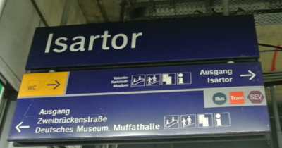
|
| destination | Ausgang Zweibrückenstraße (Exit) | |
| foot | yes |
Symbols
| Key | Value | JOSM |
|---|---|---|
| type | destination_sign | 
|
| destination | Tram | |
| destination:symbol | DBTram | |
| destination:url | https://wiki.openstreetmap.org/w/images/thumb/a/a6/Tram-Logo.svg/240px-Tram-Logo.svg.png | |
| foot | yes |
'Elevator
Beacons
| Key | Value | Description |
|---|---|---|
| beacon:major | integer | Increasing number of stations. |
| beacon:minor | integer | Increasing number of beacons per station. |
| beacon:type | bluetooth | |
| beacon:uuid | * | UUID for the project or mapper. |
| construction | beacon | |
| indoormark | construction | |
| level | * | building level the beacon is installed |
| ref:pt_id | * | Station Global_Id |
Railway station 
"The long version of the following abstract can be opened here: [1] "
The railway station is marked as a point in the middle of the station (not on the track). If it's divided in more independent stations, every single station gets its own point (e.g. Berlin Zoologischer Garten und S Zoologischer Garten). In case of stations which are "internal parts" of other stations the connection will be created with Site (Relation) (e.g. Köln Hansaring is a station part of Köln Hauptbahnhof).
| Key | Value | Description | ||
|---|---|---|---|---|
Note: Disused or abandoned railway stations can be captured with disused: and abandoned:. For example: disused:railway=station.
| ||||
| railway | station | Railway station, an operating station which has at least one switch where trains can start, end, cross, overtake or turn. This tag is added to all stations having access to public transport. These are mostly stations for passengers but also stations which are consisting of goods traffic. | ||
| halt | Stops; are similar to stations, with the difference that there are no switches. There are difficulties to differ stations and stops, if the location is a divergence, crossover or a connection. In Germany these combinations are called "Haltestelle", but the components are captured separately. | |||
| tram_stop | A stop for trams. | |||
| subway | yes | Subway station. | ||
| public_transport | station | Railway station, tagging stations for passengers with public-transport-schema. Stations, where only goods traffic is available are not captured with this tag. | ||
| name | station name | Station name, like it's captured on the signs. (don't do it!) should be considered. | ||
| railway:ref | station abbreviation | Station abbreviation; the code of a railway station. In Germany, Rill 100-abbreviations are used (e.g. KN for Neuss Hbf). If there is an abbreviation of a station from a railway company, an additional tag railway:ref:(Bahngesellschaft)=* can be added.
| ||
| uic_ref | station number | UIC number of the railway station, international reference of stations worldwide. | ||
| uic_name | station name | UIC-Name; a valid international UIC name is given to the stop position. | ||
| railway:station_category | railway station category | Station categories in Germany: see here. | ||
| operator | operator | Operator of the railway station. | ||
| network | network name | Network or passenger transport executive, of which the railway station is a part of. | ||
| operating_times | same syntax as opening_hours=* | Times, when the station is under construction site and not available for public transport. | ||
Railway station building 
Railway station buildings are modeled as an area with the tag building=train_station.
| Key | Value | Description |
|---|---|---|
| building | train_station | |
| building:part | yes | |
| level=* | integer | Number of floors |
| name | Name | Name of the station |
| operator | Name | Operator of the station |
| wheelchair | yes/no | Indicating, if the station is wheelchair accessible |
Platform 


Passengers are waiting for public transport on platforms. These platforms are tagged with public_transport=platform and can be created as points, lines or areas. Areas are recommended, when the platform is identified as an area (light traffic platforms and large bus stations). Generally, there is always a drive-in possibility nearby.
| Key | Value | Comment | Image |
|---|---|---|---|
| public_transport=* | platform | 
| |
| tram | yes/no | Platform for trams | |
| bus | yes/no | Platform for buses | |
| train | yes/no | Platform for trains | |
| subway | yes/no | Platform for subways | |
| level | integer | Level or floor number of the platform | |
| ref | The number of the rail track. If there are more rail tracks on a platform, the semicolon seperation will be needed. For example: ref=1;2 | ||
| shelter=* | yes/no | Indicating, if the platform has a shelter | |
| height=* | Height of the platform edge. Measured from the rail tracks | ||
| area | yes | Indicating an area | |
| name | platform name | If the platform has an own name, it's captured with this tag. Rail track numbers are captured with ref=*. | |
| description | Description of the platform | for example: "Odeonsplatz U3 U6 Bahnsteig" | |
| wheelchair | yes/no/limited | Indicating, if the platform is wheelchair accessible | |
| wheelchair:maxwidth=* | integer | Suggestion. Width of the smallest part of the platform. Important for wheelchair users. The value is indicated in meters. | |
| narrow | yes/no | For capturing the constrictions of the platform (less than 1.50 m) | |
| indoor | yes | Is the platform located in an indoor area or in the underground? | |
| covered=* | Indicating, if the platform is located underground | ||
| tactile_paving=* | Does the platform have supporting patterns for blind persons? |
If a platform is having an edge, for example an access in the middle of the platform, a line for the surrounding outline and another line for the steps will be added. Both lines are part of a relation (type=multipolygon). The outline gets the role "outer" and the line of the steps (inside the outline) gets the role "inner". The tags from the previous table will be applied and added into the relations between the routes and stations, because the relation is now representing a platform.
For example: S-Bahnhof München-Pasing
Characteristics of the platform relation
| Key | Value | Meaning |
|---|---|---|
| type | multipolygon | Indicating, that this relation is a multipolygon. |
| highway | bus_stop | Platform for road traffic (bus) |
| level | Integer | Level or floor number of the platform |
| ref | The number of the rail track. If there are more rail tracks on a platform, the semicolon seperation will be needed. For example: ref=1;2 | |
| shelter=* | yes/no | Indicating, if the platform has a shelter |
| height=* | Height of the platform edge. Measured from the rail tracks | |
| area | yes | Indicating an area |
| train | yes/no | Platform for trains |
| subway | yes/no | Platform for subways |
| tram | yes/no | Platform for trams |
| bus | yes/no | Platform for buses |
| name | platform name | If the platform is having an own name, it's captured with this tag. Rail track numbers are captured with ref=*. |
| wheelchair | yes/no | Indicating, if the platform is wheelchair accessible |
| wheelchair:maxwidth=* | integer | Suggestion. Width of the smallest part of the platform. Important for wheelchair users. The value is indicated in meters. |
| description | Description, for example: Bahnsteig 3/4, Richtung Hauptbahnhof | |
| covered=* | Indicating, if the platform is covered | |
| tactile_paving=* | Does the platform have supporting patterns for blind persons? |
Members of platform-relation
| Path or point | Role | Quantity | Description |
|---|---|---|---|
| outer | 1 | Outline of the platform | |
| inner | 1+ | Access areas, where in the middle (inside the outline) the steps are leading to the platform. |
Shipping pier
| Key | Value | Comment |
|---|---|---|
| amenity | ferry_terminal | Shipping pier |
| name | * | Name |
| operator | * | Operator |
| cargo | * | Freight, load |
Equipment
Equipment

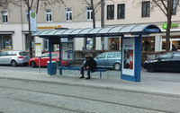
Shelters can be modelled as a point or as an area.
| Key | Value | Comment | Model | Image |
|---|---|---|---|---|
| amenity | shelter | Defines a shelter |  |
|
| shelter_type=* | public_transport | Indicating, if the shelter is intended for public transport | ||
| level=* | integer | Level where the shelter is located |
If a platform does not have a shelter, it can be tagged with shelter=no.
Vending machines for tickets 
| Key | Value | Comment | Image |
|---|---|---|---|
| amenity | vending_machine | Defines a vending machine | 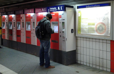
|
| vending=* | public_transport_tickets | Indicating, that public transport tickets can be bought on this vending machine | |
| payment:coins=* | yes/no | Indicating, if it's possible to pay with coins | |
| payment:notes=* | yes/no | Indicating, if it's possible to pay with banknotes | |
| payment:debit_cards=* | yes/no | Indicating, if it's possible to pay with credit cards | |
| payment:electronic_purses=* | yes/no | Money cards | |
| payment:debit_cards=* | yes/no | EC/Maestro-Cards | |
| payment:credit_cards=* | yes/no | EC/Maestro-Cards | |
| payment:ep_geldkarte=* | yes/no | Money cards | |
| payment:maestro=* | yes/no | Maestro | |
| payment:visa=* | yes/no | Visa | |
| payment:mastercards=* | yes/no | Mastercard | |
| payment:american_express=* | yes/no | American Express | |
| payment:contactless=* | yes/no | Contactless payment | |
| payment:account_cards=* | yes/no | Costumer cards | |
| operator | Operator of the vending machine | ||
| level | integer | Level or floor on which the vending machine is located | |
| indoor | yes/no | Indicating, on which level/ floor the object is located | |
| ref | Number | Internal reference number of the vending machine |
Seats 
| Key | Vale | Comment | Image |
|---|---|---|---|
| amenity | bench | Defines a bench | 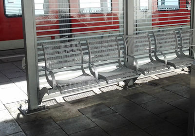
|
| backrest=* | yes/no | Indicating, if the bench has backrest | |
| seats=* | integer | Number of seats | |
| indoor | yes/no | Indicating, if the bench is located inside a building | |
| level | integer | Indicating, on which level/ floor the bench is located |
Emergency facilities 
| Key | Value | Comment | Image |
|---|---|---|---|
| emergency=* | phone | Emergency calls and information | 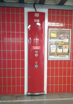
|
| fire_extinguisher | Fire extinguisher | 
| |
| defibrillator | Defibrillator | ||
| operator | Operator of the object | ||
| level | Level/ floor on which the object is located | ||
| indoor | yes/no | Indicating, on which level/ floor the object is located |
Telephone 
| Key | Value | Comment | Image |
|---|---|---|---|
| amenity | telephone | 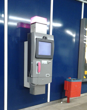
| |
| operator | Operator of the phone | ||
| payment:coins=* | yes/no | Indicating, if the payment can be completed with coins | |
| payment:notes=* | yes/no | Indicating, if the payment can be completed with banknotes | |
| payment:debit_cards=* | yes/no | Indicating, if the payment can be completed with credit cards | |
| payment:electronic_purses=* | yes/no | Money cards | |
| payment:debit_cards=* | yes/no | EC/Maestro-Cards | |
| payment:credit_cards=* | yes/no | EC/Maestro-Cards | |
| payment:ep_geldkarte=* | yes/no | Money cards | |
| payment:maestro=* | yes/no | Maestro | |
| payment:visa=* | yes/no | Visa | |
| payment:mastercards=* | yes/no | Mastercard | |
| payment:american_express=* | yes/no | American Express | |
| payment:contactless=* | yes/no | Contactless payment | |
| payment:account_cards=* | yes/no | Costumer cards | |
| level | integer | Level or floor on which the telephone is located | |
| indoor | yes/no | Indicating, on which level/ floor the object is located | |
| ref | Number | Internal reference number of the telephone |
Platform roof 
| Key | Value | Comment | Image |
|---|---|---|---|
| building | roof | 
| |
| layer=* | integer | The roof is always arranged over the platform. To fulfill this demand, the roof must have a higher value layer=* than the platform below. |
Information centers and shops in railway stations

There are often different shops at stations. They are captured with areas or knots (only if accurate position is unknown). Catering/ gastronomy services and vending machines are tagged with amenity=*, while other shops are captured with shop=*. Office areas should also contain an entrance point entrance=*. Examples for typical shops on stations.
Information centers & ticket selling shops at railway stations
Costumer service center
| Key | Value | Comment |
|---|---|---|
| shop | ticket | For ticket selling |
| ticket:public_transport | yes | For ticket selling |
| public_transport | service_center | For the identification of service center |
| operator | Operator | For the operator identification of service center |
| name | name | Name of service center |
Subscription service center
| Key | Value | Comment |
|---|---|---|
| shop | ticket | For ticket selling |
| ticket:public_transport | yes | For ticket selling |
| ticket:public_transport_subscription | yes | For ticket selling |
| public_transport | service_center | For identification of a service center |
| operator | Betreiber | For the operator identification of service center |
| name | name | Name of service center |
Selling points for tickets
| Key | Value | Comment |
|---|---|---|
| shop | ticket | For ticket selling |
| ticket:public_transport | yes | For ticket selling |
| operator | Betreiber | For the operator identification of the service center |
| ref | Number of reference |
Ticket counter
| Key | Value | Comment |
|---|---|---|
| shop | ticket | For ticket selling |
| ticket | public_transport | For ticket selling |
| operator | Betreiber | For the operator identification of the ticket counter |
| ref | Number of reference |
Ticket vending machine
| Key | Value | Comment |
|---|---|---|
| amenity | vending_machine | Identification of a vending machine |
| vending | public_transport_tickets | For ticket selling |
| operator | Betreiber | For the operator identification of the ticket vending machine |
| ref | Number of reference |
Ticket vending machine
| Key | Value | Comment |
|---|---|---|
| tourism | information | Identification of an enquiry office, which doesn't sell public transport tickets |
| public_transport | service_center | For the operator identification of the ticket counter |
| operator | Betreiber | For the operator identification of the ticket vending machine |
Shops in railway stations
- Bakery: shop=bakery
- Confectionery: shop=confectionery
- Kiosk: shop=kiosk
- Tobacco shop: shop=tobacco
- Hairdresser: shop=hairdresser
- Florist: shop=florist
- Travel agency: shop=travel_agency
- Dry cleaning: shop=dry_cleaning
- Café: amenity=cafe
- Fast food restaurants: amenity=fast_food. Specify with cuisine=*.
- Pharmacy: amenity=pharmacy
- Public toilets: amenity=toilets
Furthermore, the following tags can be used:
| Key | Value | Comment |
|---|---|---|
| shop=* | Shop type | |
| level | integer | Level/ floor, where the shop is located |
| indoor | yes/no | Indicating, if the shop is located inside a building/ train station |
| amenity | Type of amenity (restaurant, fast_food, post_office, see: amenity=*. If the value "fast_food" or "restaurant" is used, the tag cuisine=*) must be added. | |
| name | Name of the shop | |
| description | Description of the shop | |
| operator | Operator of the shop | |
| opening_hours=* | Opening hours | |
| wheelchair | yes/no | Indicating, if the shop is wheelchair accessible |
| phone=* | number | Phone number |
| website=* | Website/ homepage | |
| payment:coins=* | yes/no | Indicating, if the payment can be completed with coins |
| payment:notes=* | yes/no | Indicating, if the payment can be completed with banknotes |
| payment:debit_cards=* | yes/no | Indicating, if the payment can be completed with credit cards |
| payment:electronic_purses=* | yes/no | Money cards |
| payment:debit_cards=* | yes/no | EC/Maestro-cards |
| payment:credit_cards=* | yes/no | EC/Maestro-cards |
| payment:ep_geldkarte=* | yes/no | Money cards |
| payment:maestro=* | yes/no | Maestro |
| payment:visa=* | yes/no | Visa |
| payment:mastercards=* | yes/no | Mastercard |
| payment:american_express=* | yes/no | American Express |
| payment:contactless=* | yes/no | Contactless payment |
| payment:account_cards=* | yes/no | Costumer cards |
Accesses 
Entrance of a train station or an open station area
In case of a station building, a point is being placed at the outline of the buildung (building=train_station) with the tag entrance=*. The point is also connected to the footway network inside the railway station.
| Key | Value | Comment | Image |
|---|---|---|---|
| entrance=* | yes | General definition of an entrance | 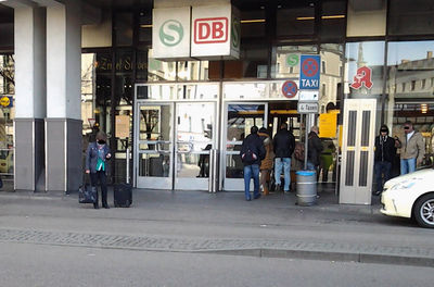
|
| main | Indication of a main entrance of a station | ||
| name | Name of the entrance, if available. NOT the name of the railway station | ||
| access=* | Is this a public access? | ||
| level | integer | Level/ floor, where the entrance is located | |
| ref | Description of the reference (number or letter) | ||
| description | Description. The name of the station can be entered here | ||
| wheelchair | Is this entrance wheelchair accessible? |
For capturing the public transport possibilities on entrances, the following tags are used.
| Key | Value | Comment |
|---|---|---|
| public_transport | entrance | Access to public transport |
| entrance_marker:train | yes | Access to usual railway traffic |
| entrance_marker:s-train | yes | Access to s-train |
| entrance_marker:tram | yes | Access to tram |
| entrance_marker:subway | yes | Access to subway |
| entrance_marker:sev | yes | Access to SEV (rail replacement bus service) |
| level | integer | Indicating, on which level/ floor the entrance is located |
| wheelchair | yes | Indicating, if the entrance is wheelchair accessible |
| width | Number | The width of the entrance |
Other optional tags for entrances are:
- foot = yes
- bicycle = yes (or no)
- wheelchair = yes (or no)
Underground areas 
Intermediate floors on huge railway stations
There are stations, where the platforms can only be reached by intermediate floors. These can be captured as areas. Intermediate floors often consist of shops and benches as well as of ways, which are leading deeper underground.
| Key | Value | Comment |
|---|---|---|
| area | yes | necessary for areas |
| building:part | yes | |
| name | If the floor has an own name | |
| level | integer | Indicating on which level/ floor the intermediate floor is located |
| indoor | yes | Only used for huge intermediate floors, for example Karlsplatz or Isartor |
| tunnel | yes | Indicating, if the intermediate floor is located in the underground |
| description | Description | |
| wheelchair | yes/limited/no | Indicating, if the floor is wheelchair accessible |
Simple underpasses of smaller railway stations
There are stations, which can only be reached by underpasses. These areas mostly don't consist of any shops or benches. Therefore the indoor-tag is not being used.
The footways, which are leading trough tunnels get the tags level + layer + highway=footway.
| Key | Value | Comment |
|---|---|---|
| area | yes | necessary for areas |
| building:part | yes | |
| name | If the floor has an own name | |
| level | integer | Indicating on which level/ floor the underpass is located |
| layer | integer | necessary for the cartographic illustration, if sth. is located above or below sth. |
| tunnel | yes | Indicating, if the underpass is located in the underground |
| description | Description | |
| wheelchair | yes/limited/no | Indicating, if the floor is wheelchair accessible |


