IT:Key:smoothness
Jump to navigation
Jump to search
| Descrizione |
|---|
| Descrive lo stato superficiale di un percorso in relazione alla percorribilità con veicoli. |
| Gruppo: strade |
| Applicabile agli elementi |
| Combinazioni utili |
| Stato: approvato |
| Strumenti |
Sommario
La chiave smoothness=* descrive la superficie dei percorsi per quanto concerne la percorribilità con i veicoli. Il materiale della superficie può essere meglio descritto con surface=*.
Usato per
- highway=*
- Superfici carrozzabili (ad esempio dei posteggi)
Vedi anche
Valori utilizzabili
Scorrevolezza
| Chiave | Valore | Elemento | Utilizzabile con | Descrizione | Foto |
|---|---|---|---|---|---|
| smoothness | excellent | (rotelle) Pattini in linea, skateboard e simili. | As-new asphalt or concrete, smooth paving stones with seamless connections, etc. | 
| |
| smoothness | good | (ruote sottili) Biciclette da corsa e simili. | Asphalt or concrete showing the first signs of wear, such as narrow (<1.5 cm) cracks, wider cracks filled up with tar, shallow dents in which rainwater may collect, etc. that may cause trouble for rollers but not for racing bikes. The best roads paved with bricks, sett, etc. also fall in this category. | 
| |
| smoothness | intermediate | (ruote) Biciclette da città, auto sportive, sedie a rotelle, carrozzine per bambini, scooter e simili. | Asphalt and equivalent that shows signs of maintenance such as patches of repaired pavement, wider cracks (>2 cm), etc. that may cause trouble for racing bikes. The pavement may contain potholes, but these are small, shallow (<3cm deep) and few so they are easily avoided, or the road shows damage due to subsidence (depressions of a scale >50 cm) or heavy traffic (shallow ruts in asphalt caused by trucks in summer). The quality of the surface starts to affect the speed of most passenger cars, so they will slow down to make the ride more comfortable (but still above 50% of the speed they would drive at if the road was smooth). The best unpaved but compacted roads fall in this category. | 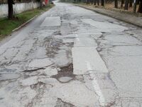
| |
| smoothness | bad | (ruote robuste) Biciclette per cicloturismo, auto normali, risciò e simili. | Heavily damaged paved roads that badly need maintenance: many potholes, some of them quite deep. The average speed of cars is less than 50% of what it would be on a smooth road. However, it isn’t so rough that ground clearance becomes a problem. A ground clearance of a normal passenger car (>14 cm) is sufficient. Good unpaved roads without risk of damage to normal passenger cars are also included here. |  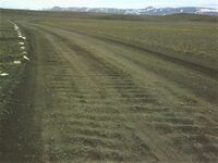
| |
| smoothness | very_bad | (altezza da terra elevata) Auto con altezza da terra elevata, veicoli fuoristrada per uso leggero. | Unpaved roads with potholes and ruts, but still passable with an average SUV with a ground clearance of at least 18 cm.* | 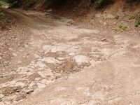
| |
| smoothness | horrible | (ruote per fuoristrada) Veicoli fuoristrada, auto fuoristrada a trazione integrale e simili. | Unpaved tracks with ruts, rocks etc that need a ground clearance of at least 21 cm (Toyota Landcruiser, Landrover, Lada Niva, bukhanka, etc.). Skid plate protection is advisable. | 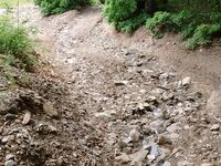
| |
| smoothness | very_horrible | (ruote speciali per fuoristrada) Trattori agricoli, quad-bike, autoblindo, moto da trial, mountain bike e veicoli tuttoterreno. | Tracks with deep ruts and other obstacles that need a ground clearance of at least 24 cm. | 
| |
| smoothness | impassable | Nessun veicolo ruotato | Ways, often highway=path, that are not passable by any vehicles, not even mountain bikes or specialised off-road vehicles, but are recognisable in the landscape and may still be useful for hikers. Consider also lifecycle prefixes disused:*=* or abandoned:*=* if the way used to be a passable road but has deteriorated. | 
|
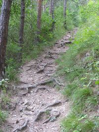
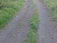
Attenzione: le fotografie sono solamente degli esempi. Il valore da attribuirsi al percorso dipende unicamente dalla possibilità o impossibilità di percorrerlo con una specifica classe di veicoli.
This table is a wiki template with a default description in English. Editable here.
