India/Tags/Highway


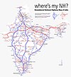
This page details out the tagging scheme of the road network in India. India has over 3 million kilometers of roads making it the worlds third largest road network. The tagging scheme detailed here provides consistent tagging guidelines for all existing levels of the road hierarchy on both a national scale and a local scale.
The scheme is aimed at preserving the traffic hierarchy of Indian roads and for describing the network for much more advanced routing capabilities.
Road classification and tagging scheme for India (proposal)
See Tagging samples for examples of usage.
Highways / Major Road network
The following major roads forms the primary national road network. All sections have a unique identifier which is published on road markers and signages on the route.
- Indian Road Congress - Classification of roads
- Indian Road Congress - Roads and Bridges Hanbook
- Wikipedia - Roads in India
- Basic Road Statistics in India and definitions - Ministry of Road Transport
| Official Class | Id ref=*
|
OSM tag | Description | Tagging guidelines | Photo |
|---|---|---|---|---|---|
| National Expressways | NE | highway=motorway
|
Completely access controlled tolled highways designed for high speed road travel. | Note: use this highway classification for greenfield projects not for upgraded National Highways in India! Ideally only use the tag on roads which use the Vienna convention signage for access controlled roads. If the road is not explicitly marked with controlled access signs, it may be more appropriate to tag it with highway=trunk+motorroad=yes
|
 |
| National Express Highways | NH | highway=trunk
|
Highways which have heavy traffic intensity and connect different State capitals, Major Ports, large industrial areas and tourist centres | See WikiProject_India/National_Highway_Network and https://wiki.openstreetmap.org/wiki/National_Highways_%28new_numbering%29 for route relations. Use the ref-tag for the new numbering scheme (like ref=NH448). Put the old NH-numbers in a ref:old-tag (like „ref:old=NH65A“). Use the name-tag only for real local names. | |
| State Highways | SH | highway=primary
|
Highways which link district headquarters, important towns and the National Highways in the State and neighbouring States. These roads are atleast 1.5 lanes wide (>5.5m) | ||
| Major District Roads | MDR | highway=secondary
|
Highways that connect production and marketing centres and these centres in turn are connected with the National Highways and State Highways. These roads are typically 1.5 lanes wide (3.5-7m) | ||
| Other District Roads | ODR | highway=tertiary
|
Roads serving rural areas of production and providing them with outlet to market centers, taluk headquarters, Block Development headquarters or other main roads. These roads are typically 1.5 lanes wide (3.5-5.5m) | Useful with surface=unpaved for unpaved roads.
|
|
| Village Roads | VR | highway=unclassified
|
Roads that connects villages, but not a ODR. This is the most common type of road in rural India and is usually not more than 1 lane wide (<3.5m). | Useful with surface=unpaved for unpaved roads.
|
Expressways
In India, the term "expressway" can refer to a range of road types. Tagging all of them with highway=motorway would not be appropriate, since they do not restrict access to slow moving vehicles, pedestrians or cycles like the classification implies. They may not also be fully access controlled (i.e. they may have at-grade intersections, or access to driveways). motorroad=yes and expressway=yes can be used as described below to better classify these roads.
| OSM tag | Description | Tagging guidelines | Photo |
|---|---|---|---|
motorroad=yes |
Some National Highways have full access control, and restrict access for slower moving vehicles. However they are not signed as "controlled access highways", and typically will use simple vehicular overpasses / underpasses to interchange with other roads. E.g. NH275 between Bengaluru and Mysuru. | ||
expressway=yes
|
Some National Highways, like the Golden Quadrilateral highways, have better grade separation than typical National Highways (e.g. NH48 between Tumkur and Dharwad). These roads are typically classified by NHAI as Economic Corridors or National Corridors. Such highways may be tagged with expressway=yes. This tag may also be useful for tagging elevated "expressways" that support through traffic over existing highways, like the electronic city expressway in Bengaluru.
|
Frontage roads
Frontage roads run parallel to the main highway that connects local traffic to the highway. These are most commonly found along national highways, especially when there is a settlement along the side. These roads usually carry two-way traffic including human and animal movement. Although they are popularly called 'Service roads', functionally they usually behave as collector roads for local traffic for settlements along the sides of the highway.
As the frontage road is minor then the major road, it must also have a minor highway=* tag than the major road.
| OSM tag | Description | Tagging guidelines | Photo |
|---|---|---|---|
highway=unclassified |
Usually single laned and only connects to other residential or unclassified roads along a highway settlement. | https://www.mapillary.com/app/?lat=12.466927300000009&lng=78.21415619999993&z=17&pKey=zDeIG78qdAjNJxFHZtvNpA&focus=photo | |
highway=tertiary
|
Single or double laned and acts as a main road between settlements along the highway. | https://www.mapillary.com/app/?lat=12.838488055555558&lng=77.67787305555555&z=17&pKey=5wBOnmd3OenrrTtrpZoCtQ&focus=photo |
Highway service roads
| OSM tag | Description | Tagging guidelines | Photo |
|---|---|---|---|
highway=service
|
Use only for single laned roads used to access highway services such as fuel stations | https://www.mapillary.com/app/?lat=12.665936666666667&lng=78.00243833330556&z=17&pKey=jmiRYKyhMrb0TOmO4ySvtQ&focus=photo |
Urban Roads
The following roads forms the road network in urban areas like cities and towns. Sections of these roads carrying very high density are usually oneway (oneway=yes) and intersections are restricted by having a parallel "service" roads to collect local traffic. Major intersections are usually grade seperated or are regulated using highway=traffic_signals. For all practical purpose the roads in an urban area can be considered as those roads that are enclosed within designated ring roads or bypass roads.
| Class | OSM tag | Description | Tagging guidelines | Photo |
|---|---|---|---|---|
| Expressway | highway=motorway
|
High speed signal-free arterial roads which are either completely elevated or has grade separated intersections. | ||
| Arterial Roads | highway=trunk
|
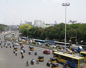
Extensions of National Highways into the city centre. These corridors usually carry the bulk of freight traffic from one end to the other, like ring roads, or roads connecting the ports. | The National Highway ref=NH tag should not be used within cities and should ideally terminate at the ring road/bypass or follow them around the city
|
 |
| Arterials | highway=primary
|
Roads that carry huge volumes of traffic between arterials, or between the city center and its highways. Can be used to differentiate beteween arterials that have sufficient grade separation, vs. those that do not. |  | |
| Sub-arterials/ Major collectors | highway=secondary
|
Roads that carry smaller volumes of traffic, typically between major collectors and arterials. | ||
| Major collectors | highway=tertiary
|
Main roads inside suburbs. Also useful for tagging "service" roads along major urban roads. | ||
| Minor collectors/minor roads | highway=unclassified
|
Minor roads that carry more traffic than residential typical roads, and offer thoroughfare service, but do not offer the level of service that a tertiary road does. It is useful to tag the lowest road inside industrial areas, but also for minor frontage roads, and for minor collectors inside neighbourhoods. Also useful for tagging "service" roads along major urban roads. |
Local Roads
The following roads cater to local traffic movement over short distances and feed traffic into bigger roads. Speed is usually restricted due to narrow widths, high number of intersections or by traffic calming devices like traffic_calming=bump. Access restrictions can be indicated by using the access=* tag.
| Class | OSM tag | Description | Tagging guidelines | Photo |
|---|---|---|---|---|
| Unknown or unverified road | highway=road
|
Roads traced from satellite imagery and who's classification has not been determined. This is a temporary tag indicating further ground survey work is required. | ||
| Residential road | highway=residential
|
General residential roads in a planned locality. Wide enough to carry two-way slow moving residential traffic. Usually has cars parked by the side and footpaths for pedestrians | ||
| Living street | highway=living_street
|
Narrow residential roads in older parts of the city or congested areas. Usually has houses constructed continuously without spacing and no footpaths on the sides. Not wide enough to carry two way car traffic smoothly. | ||
| Pedestrian | highway=pedestrian
|
Roads that are almost exclusively used by pedestrians and are out of bounds of motor vehicles in normal conditions like plazas and internal roads of universities. | ||
| Unpaved motorable tracks | highway=track
+ |
Dirt or gravel tracks or 'kuchha' roads mostly found in rural areas. Usually used by jeeps, tractors or other forms of non motorized transport such as bullock carts and cycles. |
highway=service can be used for tagging roads that provide access to services like petrol bunks, or for roads that act as driveways, alleys, parking isles, etc.
Pedestrian Paths
These roads are meant for pedestrians and cannot be used by motorized transport. Use bicycle=yes and access=* to specify restrictions.
| Class | OSM tag | Description | Tagging guidelines | Photo |
|---|---|---|---|---|
| Footpaths | highway=footway
|
Paved paths designated for pedestrian use like footpaths. Also can be used for narrow 'gullys' which cannot be accesed by vehicles. | Sidewalks can be tagged by drawing ways parallel to the main road, and adding footway=sidewalk.
|
|
| Unofficial paths | highway=path
|
'Kuccha' tracks or dirt paths that are frequently used by pedestrians or cyclists. Also used for mountain trails and trekking paths alongwith sac_scale=*
|
Cycle Paths
Paths where cycles are explicitly allowed. Note that Motor Vehicle Act, which governs road transport, does not mention cyclists (although the draft version of the bill did), so there are virtually zero legal restrictions on cycle transport, as of 2024. Given this, use of bicycle=no should be restricted to ways where there is explicit signage prohibiting the use of bicycles, since that tag implies it is *illegal* to operate a bicycle on a way.
| Class | OSM tag | Description | Tagging guidelines | Photo |
|---|---|---|---|---|
| Protected cycle lanes | highway=cycleway
|
Grade separated cycletracks. If the cycletrack is parallel to the road it must have protection in the form of bollards or kerbs. | ||
| Painted cycle lanes | highway=*+cycleway=*
|
Painted cycle infrastructure along the side of a road. Cycleways which use plastic bollards for protection should also fall into this category. | The tag should be added on the way representing the road. See the wiki for cycleways for a better understanding. | |
| Shared pedestrian and cycle paths | highway=path+bicycle=designated+foot=designated+segregated=*
|
Paths where pedestrians and cyclists are both allowed. These must be protected from motor vehicles via kerbs and bollards. These paths may also be parallel to the road, acting as sidewalks and cycle lanes. |