Relief maps
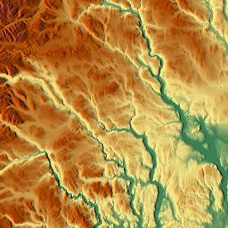
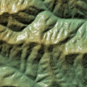
Relief maps are maps with each pixel colour-coded according to the ground height and/or slope at that location. Generally height is shown in a combination of three concepts: contours, colouring and shading.
There is not much height data available from OSM, due to the poor vertical accuracy of GPS units compared to both their horizontal accuracy and the better height data available from other sources. Accurate spot heights, for example mountain summits, are often available from other sources, but wide-scale height data sufficient for making profiles of mountains are simply infeasible to gather by volunteers wandering around! For such data, existing OSM projects normally rely on SRTM data, a near-globally available height dataset from NASA that has been released into the public domain.
Since there are many algorithms to interpret the height data sets (DEMs), and different purposes have different algorithms, data from such sets should NOT be uploaded to OSM (e.g. no ele=* tagging of nodes from SRTM data, or adding contours as ways)!
Colour coding and shading
- colorized by altitude (as seen in example on top right)
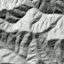
- shaded relief (levels of gray), just to indicate relative slopes, mountain ridges, not absolute height.
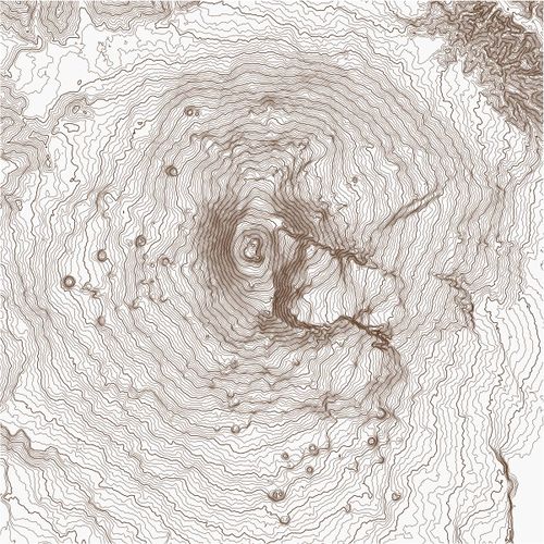
Elevation contour lines
See Srtm2Osm; e.g.:
See also
- wikipedia:Cartographic relief depiction.
- Isohypse Binary File - a description of a new binary format for storing isohypses (contour lines) in files
OSM maps showing relief
- TopOSM, available in the states of Massachusetts and Colorado, shows both contour lines and hill shading.
- The cycle map shows contour lines on slippy map tiles, re-rendered at regular intervals. Technical set-up is described on the Contours page.
- FreeMap ([1]) (of England) shows contour lines together with OSM data on a slippy map. Rendering code is available in SVN.
- FranceTopo Topographic map of France with contour lines and hill shading.
- A Hiking map (german page) (of Europe) shows contour lines and hillshading.
- OpenTopoMap (worldwide). Available as a background layer in iD
- Alpenkarte - Topographic map of the alps
- MapBox terrain maps also available within TileMill
- DirectU app for iOS comes with bundled offline data for large areas e.g. all of Europe, including OSM data and some relief information (contours)
- Relief Maps - Worldwide 3D topographic maps
- Topotresc Hiking map of the Pyrenees and Catalonia with contour lines and hillshading.
- MapTiler Outdoor - Global hiking map with contour lines and hillshading.
Existing software
- Mapnik based maps usually import contours using various tools, see Contours
- Srtm2Osm converts SRTM data to OSM xml, which can be rendered using Osmarender, Tiles@home, Maperitive and Mkgmap
- Maperitive in itself has relief map capabilities (shading, elevation coloring, and contours generation)
- OsmAnd can display relief maps on Android devices via a paid plugin
- Mapbox GL libraries have built-in support for the Mapbox Outdoors style, which combines OSM data with hillshading and contours, and support for custom styles with dynamically lit hillshading
Interesting articles and examples
- http://www.shadedrelief.com/realism/
- https://cosmobird.github.io/content/category/hackwork/try-terrain/try-terrain.html Tutorial to create shaded relief maps using SRTM and QGIS
See also
- Maybe you were looking for Tactile map and OSM for the blind?


