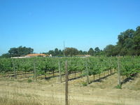
Tag:landuse=vineyard
Jump to navigation
Jump to search
| Description |
|---|
| Used to tag vineyards, a piece of land where grapes are grown. |
| Rendering in OSM Carto |

|
| Group: landuse |
| Used on these elements |
| Implies |
| Useful combination |
|
| See also |
| Status: de facto |
| Tools for this tag |
|
Used to tag vineyards, a piece of land where grapes are grown.
How to map
Create an area and tag it landuse=vineyard.
If you are not sure of its border you can place a single node in the middle and tag it landuse=vineyard but the area is preferable.
Some mappers have added the tag crop=grape as well, but this is redundant: all vineyards consist of grape vines.
Tags used in combination
- grape_variety=*: type of grape (example: Chardonnay, Merlot, Cabernet Franc, etc.) - find a full list of common names in key description page
- vine_row_orientation=*: vine row orientation (in degrees)
- organic=*: to indicate organic crops
- name=*: name of the vineyard (for example, Vignes de Dissignac)
See also
| ||||||||||||||||||||||||||||||||
