Tag:location:transition=yes
 |
| Description |
|---|
| A place where the location of a long linear feature changes. |
| Group: properties |
| Used on these elements |
| Useful combination |
| Status: approved |
| Tools for this tag |
|
Many features can be described with location=* on OSM as for indicating where those features can be seen. The location of long linear infrastructures like power=cables, man_made=pipelines and even highway=motorways can change sometimes.
It is possible to use the location:transition=* on nodes where location changes occur.
Usage
At such places, several OSM features with different locations are connected to each other location:transition=* can enable mappers to indicate the location is changing without describing all features involved (mainly for verifiability/visibility reasons). Currently, location transitions can be gathered by location=* values comparison on two or more connected map features (often ways). Sometimes, underground part can't be mapped due to lack of information (or verifiability principle violation) and the transition isn't complete. This key is intended for such cases.
It is certainly more sustainable than using fixme=continue or other temporarily stuff both regarding data consumers and other mappers.
When it comes to describe lines (power, telecommunications...), this key can be combined with several values of line_management=*. Some other are incompatible, like line_management=termination since the line continues in another location without stopping at the node. line_management=transition is often the most appropriate value.
As you way understand by reading the introduction, this key is mainly designed for industrial networks, power or pipelines. Nevertheless, location:transition=* is a far more global key and should be used in any field of knowledge, depending on opportunities. Feel free to complete this examples section.
Location isn't the only OpenStreetMap property with which transitions occur along the path of linear features. This key is intended with the *:transition=* suffix in mind to be used for any transition to be described. See its page for more information.
Tagging
Tagging is really simple: just add location:transition=yes on the node connecting two or more features with different locations. In case of one side can't be mapped due to its non-verifiable location, just add location:transition=* at the end of features linked to the transition.
yes is currently the only documented value, but a few more can obviously be added for special needs.
- Requests may be mainly interested to check if
location:transition=*exists on features without focusing on any particular value. location=transitionshouldn't be used since transition isn't a proper location for features.
Equivalent values
Here are the keys or values which mean the same as location:transition=yes, on power features only. They can be left on features or replaced depending on mappers needs and views. The proposed key is more global and apply to many more cases than the ones below.
Examples
Power
- A line goes underground
 |
|
 |
Pipelines
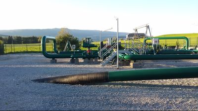
- A pipeline goes underground
 |
Telecom
- Submarine cables cross shores (
location=underground) to reach the sea (location=undersea) and then may be buried under the ocean floor offshore (location=underground).
Those successive parts underground/undersea/underground only exists because ships can't tow burying machines to the ground as shown on the example picture.
