User talk:Fredao
Life Long Learning Mapping Project
Hi Manfred, I hope it`s ok that I moved your pages corresponding to our languages namespaches. Would be good if you add them to your wiki watch list and maybe vou will find time to optimize theem for your readers (shorter headings, real wiki tables, ...) --!i! ![]() 12:44, 10 May 2012 (BST)
12:44, 10 May 2012 (BST)
"Bitte um Hilfe" an User:!i!
Hallo Fredao, ich habe deine Nachricht durch Zufall auch gelesen und mir das mal angesehen: Ich weiss nicht warum es so ist, aber bei Ro:Lanes hab ich's mal korrigiert. Ersetze "{{Languages}}" durch "{{Languages|Lanes}}". --rayquaza 13:55, 19 June 2012 (BST)
- Ich habe es jetzt nicht ausprobiert, ich befürchte fast, dass es an dem Ro: Prefix liegt. Vermute mit RO: würde es funktionieren, da hatte mal jemand an Template:Languages rumgeschraubt. Bei dem jetzigen Workaround könnte es später mal Probleme geben, wenn die Seiten verschoben werden, ab das passt schon ;) --!i!
 09:26, 20 June 2012 (BST)
TrackingVideo
Hi Manfred. Das Video wird mit Party render erzeugt. Wenn man den erst mal zum laufen gekriegt hat (die passenden Bibliotheken zu besorgen war glaube bissel tricky), packt man eigentlich nur die GPX Dateien in den Ordner und lässt ihn drauf los. Schau mal obs klappt :) --!i! ![]() 09:23, 20 June 2012 (BST)
09:23, 20 June 2012 (BST)
Saarburg mapping photo
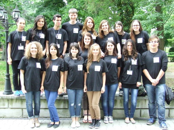
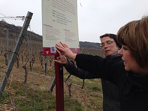
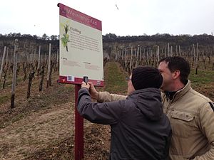
I came across a photo on your life long learning project pages, which is really great! I've put it here: Featured image proposals#Saarburg Life Long Learning mapping party but we need to figure out a suitable caption, telling the story of the photo -- Harry Wood 16:52, 13 November 2012 (UTC)
- It's the featured image on the Main Page this week! I rewrote the caption to be slightly shorter than the one you suggested, but hopefully makes sense -- Harry Wood 14:28, 17 December 2012 (UTC)
Thanks for uploading File:T garmin.jpg. I assume you are OK to release the image for free re-use. Would like to do so as "CC-BY-SA2.0" or just fully free "Public Domain"? -- Harry Wood (talk) 16:28, 5 February 2013 (UTC)
MychOSM
To think about
Maarten Deen <mdeen@xs4all.nl> in talk@openstreetmap.org
" The problem with OSM is that with Google, Google maps is the go-to site to get everything: map, routing, information. With OSM it is not. And while it is perfectly clear that OSM has limited resources and will probably never be able to offer all services from one portal, it is the biggest downside we have at the moment. I go to openstreetmap.org to see the map and/or search for places I go to osrm.at to get car routing I go to fietsrouteplanner-zuid.nl for bicycle routing in my neighborhood I go to maps.cloudmade.com for general bicycle or walking routing I go to opengastromap.de to get proper restaurant information (unfortunately Germany only)
It just is less userfriendly than having it all on one site. " -
Map from Umap
Possibilities for the Wiki_seites
- "Main Page"
- School / City - pages ...
- together like BoostOSM
- or linked directly to the resp. cities.
BoostOSM
WebApp - Gallery
Foto Test
wurde wohl aus offensichtlichen Gründen entfernt
- Projemize destek veren İTÜ, Geomatik Mühendisliği Bölümü'nden Dr. H. Can Ünen, Alternatif Bilişim TV'de projemizden bahsetti. İzlemek için tıklayın.
Ro.template.key - Test
{{Template:Ro:KeyDescription
|key=amenity
|image=Image:Mapping-Features-Parking-Lot.png
|description=Pentru descrierea facilități utile și importante pentru vizitatori și rezidenților.
|group=Amenity
|onNode=yes
|onWay=no
|onArea=yes
|lang=ro
}}
SL P4
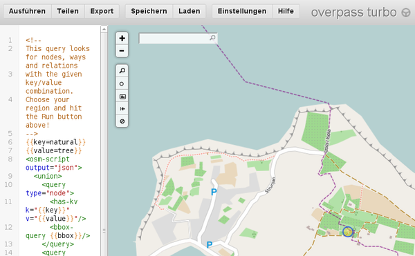
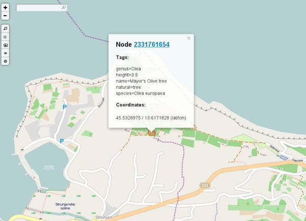
Mayor's Olive Tree
| Screenshot "înainte" | Descriere | Harta: acum |
|---|---|---|
| Lorem ipsum | Kakšna je situacija danes v OpenStreetMap? | |
| Lorem ipsum dolor sit amet, consetetur | http://overpass-turbo.eu/s/pt
Kakšna je situacija danes v Turbo Overpass? Click on the circle to see the additional information |
Who will do the translations?
The main idea is that students do ... read more ...
- Beginners' guide
- FAQ
- www.openrouteservice.org
- http://editor.osmsurround.org
- and the flyer about Walking path, Wine trails, and so on.
Please observe: The center of all efforts is the student. ;-)
The main idea is that students do the translations.

- The teacher gives tasks and guidance.
- Students use the following tools
--- translate.google.com
--- www.leo.org
--- dict.cc
--- other online dictionaries
Why this procedure?
Students learn about OSM
- how to join the community so that you can contribute;
- how to collect data using a GPS unit or by other methods;
- how to upload GPS data (skip this section if you are not using GPS);
- how to edit maps to make changes to OpenStreetMap;
- how to edit data, add tags and upload changes; and
- how to render maps;
and so on ... reading this in a foreign language and
Other aspects:
- Students learn to use online translation tools;
- Students learn to translate into their native language;
- Students learn to evaluate the translations doing the translated tasks in OSM;
- Students learn to formulate so that classmates (and the public) can understand it;
- Students learn to produce helpful content for the community in a real environment; and
- Students learn to use a wiki.
- Summary
- Students learn in a complex real situation about OSM and at the same time produce translations for real life and not as a task for school.
Linktabellen
MUSTER
| Linktabelle zu OSM mit Projektergebnissen | |
|---|---|
| Saarburg | 1
|
| Hermeskeil | 2
|
| Weiskirchen | 3
|
| Jugendherberge Weiskirchen | 4
|
| Wolfgangn Barth | 5
|
| Eichenlaubschule Weiskirchen | 6
|
Linktabelle mit OverPassLinks
Das ist Blödsinn.
| Hermeskeil | Linktabelle zu OSM mit Projektergebnissen |
|---|---|
| Saarburg | 1
|
| Hermeskeil |
|
| Weiskirchen | 3
|
| Jugendherberge Weiskirchen | 4
|
| Wolfgangn Barth | 5
|
| Eichenlaubschule Weiskirchen | 6
|
The project produced the following training papers (English only)
The project produced the following training papers (English only)
| .pdf to print as it is | .odt, .odp adapt the paper to your needs and print your own version |
|---|---|
| Data -> Upload -> Rendering -> Map | |
| Real Life -> Editor -> Key=Value -> Map | |
| Keys and Values cheating paper | |
| Waypoints paper | |
| Quality assurance - how to discover errors | |
| Quality assurance - how to discover errors in housenumbers | |
| How to do a roundabout? | |
| How to force rendering? |
- sieht voll bescheiden aus ;) --Reneman (talk) 18:05, 24 June 2013 (UTC)
- korrekt, aber die erste Zeile freischwebend auch ;-) denn sie gehört zu der Tabelle, ich warte gerne auf ein schöneres Bild ;-) ... Wenn es mir gelungen wäre für die erste Zeile einen leicht veränderten Hintergrund zu erzeugen hätte ich das gemacht. ;-) --Manfred 18:56, 24 June 2013 (UTC)
- class="hintergrundfarbe*" gibt es im OSM-Wiki nicht.
- Ich hatte das aus der Wikipedia Hilfe. :( ;-)
- Ich weiß. Das Problem ist, dass sich dieses spezielle feature nur das DE-Wikipedia ausgedacht hat. Im offiziellen Wikipedia gib es die handlich verpackte Funktion nicht. :( René
- Ich hatte das aus der Wikipedia Hilfe. :( ;-)
- zur Erinnerung: <tr> entspricht |- ;-) Gruß --Reneman (talk) 19:22, 24 June 2013 (UTC)
- OK - got it.
- Ok, danke für diese Erläuterung. Die werden hier stehen bleiben. ;-)
- Ich /wir/ stehen schon noch unter Strom wegen der Inhalte ... und ich kämpfe dann noch mit der Syntax. ;-)
- Über die Farbe ganz oben dürfen jetzt die anderen entscheiden. Ich such noch eine odp Datei. ;-) Danke und schönen Abend ––Manfred 19:48, 24 June 2013 (UTC)
- schau mal:
 Hilfe:Farbverwendung besonders die Einleitung :D --Reneman (talk) 20:17, 24 June 2013 (UTC)
- Und nach dem lesen, versucht ihr bitte euch auf die folgenden Farben zu Konzentrieren:
 Hilfe:Farbverwendung#Hintergrundfarben, verwendet aber nicht die class, sondern die RGB-Werte. :o) Gruß --Reneman (talk) 20:19, 24 June 2013 (UTC)
- Und nach dem lesen, versucht ihr bitte euch auf die folgenden Farben zu Konzentrieren:
- schau mal:
- Über die Farbe ganz oben dürfen jetzt die anderen entscheiden. Ich such noch eine odp Datei. ;-) Danke und schönen Abend ––Manfred 19:48, 24 June 2013 (UTC)
Man weiss ja nicht, wo man es nochmals brauchen wird
Leere Ländertabelle
| Link | |
|---|---|
| Download english version | |
Težave smo imeli ... na otoku Terciera (PT) in ponujena rešitev
| |
Probleme cu linia de coastă din Terceira și rezolvarea lor
| |
Problemas que tinhamos ... Com a linha costeira da ilha Terceira(PT) e a sua solução
| |
Portekiz'deki Terceira adasının kıyı şeridinde yaşadığımız problemler
| |
Probleme mit der Küstenlinie in Terceira und deren Lösung
|
Probleme mit der Küstenlinie in Terceira und deren Lösung ... saubere Wikikonforme Darstellung
(herzlichen Dank an User:Skyper)
- Aufteilen der Küstenlinie in verschiedene Teile
- JOSM -> TOOLS ->Split ways (P)
- lies mehr: way splitting
- Wichtig: nun alle Teile hochladen. (So erhalten die verschiedenen Teile verschiedene IDs auf dem Server!)
- lies mehr: Object IDs
- Verteile die verschiedenen Teile der Küstenlinie auf die Studenten.
- Jeder Student lädt nur eine der Linien herunter ... (ein Objekt)
- Wie lade ich ein einzelnes Objekt herunter? Hier sind 2 Möglichkeiten:
- wähle eine minimale Bbox ... das ist der Bereich, den wir im Downloadfenster von JOSM auswählen ... und nur ein Objekt auszuwählen ist ziemlich schwierig ;-) )
- oder
- viel besser lade es mit der Object-ID herunter.
- Wie lädt man mit einer Object-ID herunter?
- Zuerst braucht man die ID des Objekts für den Download ;-)
- wähle einen Teil deiner aufgesplitteten Küstenlinie mit einem Klick aus (siehe 01.)
- JOSM -> VIEW -> Advanced Info = CTRL+I
- Zuerst braucht man die ID des Objekts für den Download ;-)
- oder
- JOSM -> VIEW -> Advanced Info (web) = CTRL+Shift+I
- und man erhält die ID der Linie ;-) ... nett, nicht wahr?
- Mit der ID kann man dann das Objekt in JOSM folgendermaßen öffnen:
- JOSM -> FILE ->"download object" in dem sich öffnenden Fenster spezifiziert man den Objekttyp: way/node ... und die ID Nummer
- Wie lade ich ein einzelnes Objekt herunter? Hier sind 2 Möglichkeiten:
- Nun korrigiert man die Küstenlinie
- in dem man bestehende Punkte verschiebt und neue Punkte hinzufügt. (wie schon vorher ;-)) aber stelle sicher, dass du nicht jenseits den start/end Punkte der Linie zeichnest und bewege diese zwei Punkte nicht.
- Wenn eine Linie zuviele Knoten hat (>1000) splitte sie.
- Beachte: am besten, aber nicht unbedingt notwendig: Edit mode "Improve Way Accuracy" (nur verfügbar in Expert mode)
- speichere lokal (auf deinem PC)
- JOSM -> FILE -> Save
- nicht notwendig aber viel sicherer sind Punkt 7 und 8:
- aktualisiere die modifizierten Objekte: JOSM -> FILE -> Update modified, um Konflikte gleich feststellen zu können und nicht erst während des Uploads)
- möglicherweise sichere wieder ... und weiter)
- zum Schluss: upload
- done ;-)
Schnipsel von reneman treated for our needs
Alternative
Der "Code" kann von mir in eine Vorlage verschoben werden, sodass ähnlich wie bei Template:Map Comenius nur ein kleiner Baustein in die Seite eingefügt werden muss. --Reneman (talk) 09:49, 17 June 2013 (UTC)
- 1. Ich muss das Aussehen erst abstimmen. ;-)
- 2. Mir ist es lieber so, denn dann kann ich noch ein wenig individuell ändern, wenn nötig ;-) --Manfred 10:00, 17 June 2013 (UTC)
- In einer Vorlage kannst du ebenfalls jederzeit ändern, da steht genau der gleiche Text wie hier. Es hat aber den Vorteil, dass nur eine Vorlage geändert werden muss und über all wo sie verwendet wird, ist alles automatisch alkuell. Des Weiteren macht sie den eigenlichen Seitencode übersichtlicher. --Reneman (talk) 10:10, 17 June 2013 (UTC)
.
- Nicht dass wir uns missverstehen, ich bin fanatischer Verfechter von templates ... und wo immer möglich Trennung von Format und Content ;-) --Manfred 10:17, 17 June 2013 (UTC)
.
- Bitte beachte, es steht nicht die Flage im Vordergrund, sondern der Link/Text. Daher sollten die Bilder nicht zu groß sein. ;) --Reneman (talk) 10:12, 17 June 2013 (UTC)
- Größe - schon klar, ich bin z.Zt. nur am rumspielen, damit ich denen heute Nachmittag was anbieten kann. ;-) Die Größe kommt dann später :) --Manfred 10:15, 17 June 2013 (UTC)
- Bitte beachte, es steht nicht die Flage im Vordergrund, sondern der Link/Text. Daher sollten die Bilder nicht zu groß sein. ;) --Reneman (talk) 10:12, 17 June 2013 (UTC)
LLLMP-Logos
| Welcome - Bem-vindo - Bine ați venit - Hoş geldiniz - Dobrodošli - Willkommen | |||
|---|---|---|---|
|
left, center and right in a table
|
|
Erläuterungen zu oben
Hinweis: Die Tabellen sind width="100%", also immer so breit wie die Seite des Betrachters. Bild 1 hat "left" und klebt somit immer am linken Rand. Bild 2 genauso, jedoch für rechts. Bild 3 und 4 werde im folgenden Fließtext ohne Angabe (wie Text) positioniert und werden dadurch vom Browser an die nächste freie Stelle gerückt. Bildgrößen sind somit "frei" wählbar. Bitte zum Testen das Browserfenster kleiner machen oder den Zoom im Browser erhöhen. gruß --Reneman (talk) 10:27, 17 June 2013 (UTC)
- Edit: Der Seiteninhalt ist dadurch bis auf eine Bildschirmauflösung von nur noch 800px reduzierbar, trotzdem bleibt alles sichtbar. Soweit mir bekannt, ist in Wikis nicht vorgesehen, dass Bilder (wie in html) mit %-Werten angegeben werden. Dann hätte man andere Möglichkeiten :) --Reneman (talk) 10:46, 17 June 2013 (UTC)
Main
| |
|---|
Das ist die Zusammensetzung der Bilder.
vlt. Hilfreich: ![]() ComeniusBoostOsm --Reneman (talk) 12:32, 19 June 2013 (UTC)
ComeniusBoostOsm --Reneman (talk) 12:32, 19 June 2013 (UTC)
Optionale Version für Sl:Life Long Learning Mapping Project
Dobrodošli na slovenski strani EU projekta
Pozdravi iz Izole! Mi bomo OpenStreetMap v Sloveniji še izboljšali. Srednja gostinska in turistična šola, Izola
Naši partnerji v EU Life Long Learning Project: Boost OSMComenius - To boost local and international tourism with OpenStreetMap - BoostOSM
Naši cilji v Izoli (27.3.2012-1.4.2012)Na drugem srečanju EU projekta smo pomladi v Izoli in po Sloveniji nadaljevali naše delo. Skupaj z našimi partnerji smo si ogledali bogato naravno in kulturno dediščino zahodnega dela Slovenije (Škocjanske jame, Predjamski grad) in obiskali prestolnico Ljubljano.Seveda smo vse poti tudi označili s pomočjo GPS-naprav. Naši dijaki so vse udeležence v projektu popeljali po Izoli in jim jo razkazali, nato pa so vsi sodelujoči dijaki kartirali čim več znamenitosti po Izoli in jih kasneje tudi vnesli v karto OpenStreetMap |
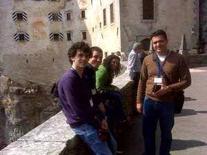 Luis mapping the way to Predajamski Grad, Gerhard Faß, Germany discussing with Necdet (behind Luis) the progress of the project. http://www.openstreetmap.de/karte.html?zoom=14&lat=45.81317&lon=14.14161&layers=B000TT |
THE END --User:Reneman 15:59, 17 June 2013 (UTC)
Various
Cleanup Images
Hallo Manfred, werden die folgenden Bilder weiterhin benötigt?
- File:Dr21.png - nein -

- File:Dr22.png - nein -

- File:D12.png - nein -

- File:Bratianu2.png - ja
- File:Bratianu1.png - ja
- File:Sao mateus.png - JA! hatte ich schon gesucht --- schön, dass es wieder da ist!
- File:Logo lll osm.png Vorschaubild mit niedriger Auflösung
- File:Ocaklar.png Was ist das? :D - muss ich mir noch genauer ansehen
- File:Todo angra.png - ja
- File:Vrangoe-gpx-track.png - ja
Auch sollte die eine oder andere PDF-Datei geprüft werden, nicht alles was darin erläutert wird, ist noch aktuell. ;-)
Hier werdden alle deine hochgeladenen Dateien aufgelistet: Special:ListFiles/Fredao.
Bilder die nicht mehr benötigt werden, können mit der Vorlage {{d|Begründung}} zum löschen markiert werden. Ein Admin kann dies dann zeitnah umsetzen. PS: netter Dateiname: File:5grazien.jpg. Danke :) --Reneman (talk) 14:33, 18 June 2013 (UTC)
--Manfred 21:23, 18 June 2013 (UTC)
Interessantes Thema
Ich bin mal so frei, und verweise mal auf dieses Thema "CheckTheMonuments". Ich könnte mir gut vorstellen, dass diese Art Qualitässicherung für Schüler sehr gut geeignet ist. Da sich hier die Schüler mit den Themen Heimat, Geschichte, Kultur und OSM "beschäftigen" können :). Gruß René --Reneman (talk) 22:20, 18 June 2013 (UTC)
- glaube es oder nicht, unser neues EU Projekt (ich hoffe auf Genehmigung noch in dieser Woche) berührt dieses Thema! :) Allerdings jetzt kommen die großen Ferien aber im September wird das dann starten - incl. Übers. für die Geschichtskarte usw. usw. ;-) Gruß M. --Manfred 06:57, 19 June 2013 (UTC)
Mustertabelle
| Slovenia | Romania | Portugal | Turkey | Germany |
|---|---|---|---|---|
| 1 | 2 | 3 | 4 | 5 |
| 1 | 2 | 3 | 4 | 5 |
| 1 | 2 | 3 | 4 | 5 |
| 1 | 2 | 3 | 4 | 5 |
| 1 | 2 | 3 | 4 | 5 |
File:BoostOSM logo Ro.png
Hallo, kannst du deine Kontakte dafür nutzen, dass zu File:BoostOSM logo Ro.png
- die svg-Datei im Wiki hochgeladen wird
- der Dateiname "anders" sein darf. Damit meine ich, dass das Logo ein OSM-Logo ist, "BoostOSM" paßt hier nicht so gut, oder? (besser z.B. File:Logo Romania.svg o. File:OSM-Logo Romania.svg)

Danke. --Reneman (talk) 21:21, 26 June 2013 (UTC)
- Danach könnte ich das Bild auch hier mit einbinden: WikiProject Romania :) --Reneman (talk) 21:23, 26 June 2013 (UTC)
- hier auch schon drin: Logos :)
- Wichtiger ist die Kategorisierung. Schau mal hier: Category:OpenStreetMap icon --Reneman (talk) 07:33, 27 June 2013 (UTC)
- hier auch schon drin: Logos :)
- Kannte ich auch nicht :( ... wie kommt man denn zu dieser Ehre? oder kann man dort auch selbst eintragen?... Du siehst, wie mühsam sich das Eichhörnchen ernährt. ;-) --Manfred 07:43, 27 June 2013 (UTC)
- Alle Seiten, Bilder, Kategorien, etc. können kategoriesiert werden. Dies ist 100% identisch zu Wikipedia bzw. Wikimedia, daher Wikipedia:Kategorien on Wikipedia. Wenn also zum Bild File:OSM-Logo Romania.svg die Kategorie Category:OpenStreetMap icon ergänzt wird, dann wird das Bild automatisch in dieser Kategorie angezeigt. Bitte schau dir in aller Ruhe die Hilfe an, kategorisieren ist ein wichtiges Thema um allen das Finden von Informationen zu erleichtern. :) --Reneman (talk) 08:13, 27 June 2013 (UTC)
 aus der Category:Animal Trail markings
- Kannte ich auch nicht :( ... wie kommt man denn zu dieser Ehre? oder kann man dort auch selbst eintragen?... Du siehst, wie mühsam sich das Eichhörnchen ernährt. ;-) --Manfred 07:43, 27 June 2013 (UTC)
- BTW 1. von der Sorte liegen bei mir noch 6 Stück auf Lager (ES, SL, TR, UK ...) und 2. das logo wurde zweimal zu viel hochgeladen kannst Du die überzähligen Versionen bitte löschen? --Manfred 06:11, 27 June 2013 (UTC)
- die kommen aber erst, wenn das neue Projekt unter Dach und Fach ist ;-) --Manfred 18:55, 27 June 2013 (UTC)
 siehe WikiProject Romania, nun mit Logo :) --Reneman (talk) 07:33, 27 June 2013 (UTC)
Weinlehrpfad Nittel
Diskussionsbeiträge archivieren
Der folgende Baustein wird auf der Diskussionsseite ganz oben ergänzt. Username muss entspechend angepaßt werden. Speichern. Link wird rot (nicht vorhandene Seite) angezeigt. Drauf klicken, neue Seite speichern. Archivseite ist angelegt. Nun können einzelne Diskussionen aus der Seite User talk:Fredao ausgeschnitten (speichern) und in das Archiv (bearbeiten) eingefügt werden (speichern). Die verschobene Diskussion ist nun archiviert. Damit jeder nachvollziehen kann, warum du eine Diskussion "entfernt" hast, gib immer ein Kommentar beim ausschneiden an (z.B. "archiviert"). Viel Erfolg. --Reneman (talk) 13:59, 1 July 2013 (UTC)
<div style="float:right; width:53px; border: solid 1px rgb(170, 170, 170); margin:2px; background-color: rgb(249, 249, 249); text-align: center;">
[[File:Filing cabinet icon.svg|30px|link=User talk:Fredao/Archiv]] <big>[[User talk:Fredao/Archiv|Archiv]]</big>
</div>
Ergänzung: Im Archiv kann ganz oben noch die Hinweisbox ergänzt werden:
<div id="Vorlage-Archiv-Standard-Baustein">
{| style="border: solid 1px rgb(170, 170, 170); margin:2px; background-color: rgb(249, 249, 249);"
|[[File:Filing cabinet icon.svg|50px|Archiv|link=wikipedia:de:Hilfe:Archivieren]]
|Diese Seite ist ein [[wikipedia:de:Hilfe:Archivieren|Archiv abgeschlossener Diskussionen]]. Ihr Inhalt sollte daher nicht mehr verändert werden. Benutze bitte die [[User talk:Fredao|Diskussionsseite]], auch um eine archivierte Diskussion weiterzuführen.

<div style="font-size:84%;">Um einen Abschnitt dieser Seite zu verlinken, klicke im Inhaltsverzeichnis auf den Abschnitt und kopiere dann Seitenname und Abschnittsüberschrift aus der Adresszeile deines Browsers, beispielsweise <div style="overflow:auto; max-width:100%"><code>{{#tag:nowiki|[[{{FULLPAGENAME}}#Thema 1]]}}</code></div> oder als [[wikipedia:de:Weblink|Weblink]] zur Verlinkung außerhalb der Wikiseiten <div style="overflow:auto; max-width:100%"><code>{{#tag:nowiki|{{canonicalurl:{{FULLPAGENAME}}#{{anchorencode:Thema 1}}}}}}</code></div></div>
|}</div>
--Reneman (talk) 14:02, 1 July 2013 (UTC)
Unificação no prefixo Pt — Você é a favor ou contra?
Olá Fredao!
Você usa português neste wiki e por isso está sendo convocado para a importante discussão sobre a unificação no prefixo Pt.
Alexandre Magno (talk) 00:29, 31 March 2014 (UTC)
Image of the week
Thanks for another image of the week! (Main Page) Sorry it took a while to get featured this time. We've got a bit of a queue of nice images at the moment (which is great!) -- Harry Wood (talk) 13:46, 2 February 2015 (UTC)
schau mal hier: Category:Media license templates
Hi. Ich vermute mal, dass die besser passende Lizenz folgende ist: Template:PD-self
Kopiervorlage: {{PD-self}}
Vorschau:
![]()
In case this is not legally possible, I grant anyone the right to use this work for any purpose, without any conditions, unless such conditions are required by law.
Notice to creator or uploader: Please consider using {{CC0-self}} instead for your work.
"Releasing work to public domain" has some issues, as it is not well defined in some jurisdictions and/or it is not actually possible to "release to public domain". Using CC0 license achieves the intended effect while avoiding such problems and is well suited for media files.
↑ This template should only be used on file pages.
Andere Vorlagen siehe in der Kategorie Category:Media license templates. MfG René aus Mainz :-) --Reneman (talk) 19:39, 18 September 2015 (UTC)
- sehr einverstanden - DANKE! fredao 20:05, 18 September 2015 (UTC)
Liste der WeeklyOSM-Redakteure
Hallo,
ich habe gestern die Seite User:WeeklyOSM Editorial Team nach WeeklyOSM editorial team verschoben, da der Präfix "User:" für die Benutzerseiten der Wiki-Benutzer gedacht ist und gemäß der Wiki-Konventionen die einzelnen Wörter im Englischen nicht großgeschrieben werden. Ich habe jetzt die Seite Microgrants/Microgrants 2020/Proposal/Deepl.com API use for weeklyOSM entsprechend angepasst. Ich hoffe, das stimmt alles. Ich würde dann die neu angelegte Seite wieder löschen oder gibt es einen wichtigen Grund dafür, sie zu behalten?
--Tigerfell ![]() (Let's talk) 21:33, 5 May 2020 (UTC)
(Let's talk) 21:33, 5 May 2020 (UTC)
- hi vielen Dank für die sinnvollen Änderungen und die Hilfe ... bin einfach zu unerfahren ;-=
fredao 08:20, 9 May 2020 (UTC)
MapContrib VS Overpass
Bonjour Fredao, pour répondre à votre question, il semble qu'il existe une section "Overpass" dans l'article MapContrib, pour être précis ici : MapContrib#Adding_an_OverPass_query. J'espère que ça réponds à votre question. Si ce n'est pas le cas, précisez moi exactement votre problème, j'essaierai de vous aider ^^ Bonne journée --Binnette (talk) 20:09, 22 December 2020 (UTC)
- C'est exactement le menu que je cherche, mais je ne le trouve pas dans Mapcontrib. :-( fredao 20:19, 22 December 2020 (UTC)
NaSaarWas
I am going through list of entities illegally using OSM data and found entry that I reported.
"NaSaarWas - App des Ministeriums für Umwelt und Verbraucherschutz" but it appears that both app and developer is gone. I tried to relocate them but failed. Is it solved by disappearance of copyright violation or have they just renamed something? Mateusz Konieczny (talk) 13:18, 29 January 2021 (UTC)
- The app still exists. NaSaarWas - on Android. fredao 13:42, 29 January 2021 (UTC)
- I searched for NaSaarWas in play store, nothing was found. Can you locate it at https://play.google.com/store/ and post link? Mateusz Konieczny (talk) 15:59, 1 February 2021 (UTC)
- I send you a screenshot via email https://play.google.com/store/search?q=NaSaarWas&c=apps ... maybe it doesn't work in your country? Maybe we should continue directly via eamil ;-) fredao 21:16, 1 February 2021 (UTC)
- I will see my email soon - but I get "We couldn't find anything for your search - NaSaarWas" Mateusz Konieczny (talk) 21:25, 1 February 2021 (UTC)
- I have had correspondence with the ministry. I will send it to you at the end of next week. I am very much involved in the preparation of a mapathon of euYouth_OSM with UN mappers at the moment. I will get back to you by the end of next week. OK? fredao 14:06, 17 February 2021 (UTC)
- Definitely OK! Thanks for trying to solve this Mateusz Konieczny (talk) 19:55, 17 February 2021 (UTC)
- Hi Mateusz, could we have a talk so I can explain the email-exchange with the Ministry who offers the app fredao 11:32, 11 March 2021 (UTC)
- I have seen PM already, and I replied to it :) 18:38, 11 March 2021 (UTC)
- Hi Mateusz, could we have a talk so I can explain the email-exchange with the Ministry who offers the app fredao 11:32, 11 March 2021 (UTC)
- Definitely OK! Thanks for trying to solve this Mateusz Konieczny (talk) 19:55, 17 February 2021 (UTC)
- I have had correspondence with the ministry. I will send it to you at the end of next week. I am very much involved in the preparation of a mapathon of euYouth_OSM with UN mappers at the moment. I will get back to you by the end of next week. OK? fredao 14:06, 17 February 2021 (UTC)
- I will see my email soon - but I get "We couldn't find anything for your search - NaSaarWas" Mateusz Konieczny (talk) 21:25, 1 February 2021 (UTC)
- I send you a screenshot via email https://play.google.com/store/search?q=NaSaarWas&c=apps ... maybe it doesn't work in your country? Maybe we should continue directly via eamil ;-) fredao 21:16, 1 February 2021 (UTC)
- I searched for NaSaarWas in play store, nothing was found. Can you locate it at https://play.google.com/store/ and post link? Mateusz Konieczny (talk) 15:59, 1 February 2021 (UTC)
Hi Fredao. I found a missing license attribution here: https://geostadtplan.wuerzburg.de/ (layer "Topographische Karte (BKG)"). It also uses WMS TopPlusOpen but does not link correctly to the "TopPlusOpen-Datenquellen". I would mail them to correct this. My question: According to the BKG instructions, OSM is only mentioned on a separate webpage and not on the map itself (one click away). Is that acceptable or should I point that also out to them? Maybe Mateusz and you have also worked through this during the NaSaarWas case. --Tom yorados (talk) 18:07, 1 May 2022 (UTC)
- https://wiki.osmfoundation.org/wiki/Licence/Attribution_Guidelines - The guidelines are very clear and imho "OSM is only mentioned on a separate webpage and not on the map itself (one click away)" is not enough. Do we want to let everyone define how they implement the guidelines? Fredao (talk) 20:26, 1 May 2022 (UTC)
License information for uploaded images
Hallo! Ich befasse mich zur Zeit mit dem Thema fehlender Lizenzangaben bei Bildern. Bei meiner Recherche bin ich über die Lizenzangaben "gestolpert", die Du zu Uploads vom März diesen Jahres gemacht hast: https://wiki.openstreetmap.org/w/index.php?target=Fredao&namespace=6&tagfilter=&newOnly=1&start=2021-03-23&end=2021-03-24&limit=60&title=Special%3AContributions - Bei den Dateien, die mit "00..." beginnen, hast Du {{GPL}} als Lizenz verwendet. Soweit ich weiß, ist das für Bilder eher unüblich, da eigentlich für Software gedacht. Aber mein Hauptanliegen ist, dass die Lizenz sehr wahrscheinlich nicht auf die Luftbilder zutrifft, die enthalten sind. Ich halte es für erforderlich und fände es gut, wenn Du die Quelle oder Lizenz zu den Hintergrundbildern angeben könntest. Grüße, Chris2map (talk) 22:44, 25 December 2021 (UTC)
- Vielen Dank für den Hinweis! Werde ich umgehend korrigieren. fredao 11:23, 3 January 2022 (UTC)
- Ich tu' mich mit den Dingen so unsäglich schwer. :-( ... Kannst Du bitte einmal nachsehen. Bei den beiden letzten bin ich mir sehr unsicher, was dort angegeben werden muss. Danke auf jeden Fall schon einmal für Deine Hilfe. ;-) fredao 11:52, 3 January 2022 (UTC)
- Danke für's Ergänzen der Quell-/Lizenzangaben! Welche beiden letzten meinst Du? 2021032324.png fehlt noch. Bei Terceira_after_20210322.png würde ich es so belassen. Bei den anderen Bilddateien beginnend mit "00..." ist jetzt bei allen "Bing" angeben. Zumindest für 005_waterway_interact.png scheint das aber nicht zu stimmen. Dort ist bei den Hintergrund-Ebenen in JOSM "Maxar Premium Imagery" eingestellt. Und 006_highway_place.png sieht ziehmlich gleich aus, ich vermute daher ebenfalls "Maxar". Wie ist es beim Rest? Tatsächlich Bing oder auch Maxar? Falls bei denen in JOSM auch Maxar eingestellt war, dann wäre {{Bing image}} durch {{Maxar image}} zu ersetzen. - Kennst Du die vier Tilden
~~~~? --Chris2map (talk) 21:08, 3 January 2022 (UTC) - Bei 004_interesting_tags_n.png könntest Du zusätzlich noch erwähnen, dass Du Ergänzungen gemacht hast und diesen noch eine Lizenz zuweisen. Z.B.
Additions added by Fredao under CC-0 1.0: Tagging description with arrows and text boxes.(Oder andere Lizenz) --Chris2map (talk) 22:27, 3 January 2022 (UTC)
- Danke für's Ergänzen der Quell-/Lizenzangaben! Welche beiden letzten meinst Du? 2021032324.png fehlt noch. Bei Terceira_after_20210322.png würde ich es so belassen. Bei den anderen Bilddateien beginnend mit "00..." ist jetzt bei allen "Bing" angeben. Zumindest für 005_waterway_interact.png scheint das aber nicht zu stimmen. Dort ist bei den Hintergrund-Ebenen in JOSM "Maxar Premium Imagery" eingestellt. Und 006_highway_place.png sieht ziehmlich gleich aus, ich vermute daher ebenfalls "Maxar". Wie ist es beim Rest? Tatsächlich Bing oder auch Maxar? Falls bei denen in JOSM auch Maxar eingestellt war, dann wäre {{Bing image}} durch {{Maxar image}} zu ersetzen. - Kennst Du die vier Tilden
- Guten Morgen, vielen Dank für die Ergänzungen. - Was nicht alles geht, wenn man es kann. :-) - Ich habe entsprechend ergänzt. Diesen Terceira Screenshot haben wir auf http://taches.francophonelibre.org/project/316# gemacht. Dabei bin ich nicht sicher ob das HOT ist oder nicht. Die
~~~~kenne ich und hatte sie auch angewendet. Aber aus irgendeinem mir unbekannten Grund ist das Ergebnis nicht das, was ich erwarte. Irgendwas mache ich dabei falsch. Hast Du eine Idee was ich da ändern muss? Eben schon wieder probiert mit den~~~~und gleiches Ergebnis wie oben, aber nicht mit den Links. Alles probiert mit und ohne Blank vorne und hinten, mit Zeilenschaltung und ohne, aber immer steht dort nur fredao 07:13, 4 January 2022 (UTC) - Ich wäre Dir sehr dankbar, wenn Du mir sagen könntest, was ich dabei falsch mache. fredao 07:26, 4 January 2022 (UTC)
- Guten Morgen, vielen Dank für die Ergänzungen. - Was nicht alles geht, wenn man es kann. :-) - Ich habe entsprechend ergänzt. Diesen Terceira Screenshot haben wir auf http://taches.francophonelibre.org/project/316# gemacht. Dabei bin ich nicht sicher ob das HOT ist oder nicht. Die
- Zu Terceira_after_20210322.png und francophonelibre.org: Das ist der Humanitarian Kartenstil von HOT. Passt also. --Chris2map (talk) 12:03, 4 January 2022 (UTC)
Signatur ~ ~ ~ ~
Hallo, hast du vielleicht in den Benutzer-Einstellungen bei Signatur etwas eingetragen oder das Häckchen darunter gesetzt ("Signatur als Wikitext behandeln")? Bei mir z.B. sind beide Einstellungen leer. --Chris2map (talk) 11:37, 4 January 2022 (UTC)
- In der Tat - so ist es gewesen. Das hätte ich nie selbst gefunden. Fredao (talk) 22:00, 5 January 2022 (UTC)
- Jetzt ist der Link zu (talk) noch kaputt - habe den Fehler dazu nicht gefunden. Nochmal Danke, dass
~~~~jetzt endlich fast richtig funktioniert. Fredao (talk) 22:38, 5 January 2022 (UTC)- Gerne! Der talk-Link sollte auch funktionieren. Ich denke, er lässt sich hier nur nicht anklicken, da wir bereits auf deiner talk-Seite sind. --Chris2map (talk) 08:26, 6 January 2022 (UTC)
- **vor Scham im Boden versink** ;-) an
~~~~bin ich schon mehrfach verzweifelt, niemand hatte eine Erklärung. Ich auch nicht, weil ich das wahrscheinlich bei der Anmeldung schon eingestllt hatte, als ich dann (wohl Jahre später) auf~~~~hingewiesen wurde hat es nicht geklappt und ich war einigermaßen ratlos. Also nochmals DANKE!!! Fredao (talk) 09:14, 6 January 2022 (UTC)
- **vor Scham im Boden versink** ;-) an
- Gerne! Der talk-Link sollte auch funktionieren. Ich denke, er lässt sich hier nur nicht anklicken, da wir bereits auf deiner talk-Seite sind. --Chris2map (talk) 08:26, 6 January 2022 (UTC)
- Jetzt ist der Link zu (talk) noch kaputt - habe den Fehler dazu nicht gefunden. Nochmal Danke, dass
Missing file information
Hello! And thanks for your upload - but some extra info is necessary.
Sorry for bothering you about this, but it is important to know source of the uploaded files.
Are you the author of image File:Auswahl 295.png ?
Or is it copied from some other place (which one?)?
Please, add this info to the file page - something like "I took this photo" or "downloaded from -website link-" or "I took this screeshot of program XYZ".
Doing this would be already very useful.
Licensing - photos
In case that you are the author of the image: Would you agree to open licensing of this image, allowing its use by anyone (similarly to your OSM edits)?
In case where it is a photo you (except relatively rare cases) author can make it available under a specific free license.
Would you be OK with CC0 (it allows use without attribution or any other requirement)?
Or do you prefer to require attribution and some other things using CC-BY-SA-4.0?
If you are the author: Please add {{CC0-self}} to the file page to publish the image under CC0 license.
You can also use {{CC-BY-SA-4.0-self}} to publish under CC-BY-SA-4.0 license.
Once you add missing data - please remove {{Unknown|subcategory=uploader notified March 2022}} from the file page.
Licensing - other images
If it is not a photo situation gets a bit more complicated.
See Drafts/Media file license chart that may help.
note: if you took screenshot of program made by someone else, screenshot of OSM editor with aerial imagery: then licensing of that elements also matter and you are not a sole author.
note: If you downloaded image made by someone else then you are NOT the author.
Note that in cases where photo is a screenshot of some software interface: usually it is needed to handle also copyright of software itself.
Note that in cases where aerial imagery is present: also licensing of an aerial imagery matter.
- Hi - I hope everything is fine now. - Thx for your work and the example. ;-)
Help
Feel free to ask for help if you need it - you can do it for example by asking on Talk:Wiki: new topic.
Please ask there if you are not sure what is the proper next step. Especially when you are uploading files that are not your own work or are derivative work (screenshots, composition of images, using aerial imagery etc).
If you are interested in wider discussion about handling licencing at OSM Wiki, see this thread.
(sorry if I missed something that already states license and source: I am looking through over 20 000 files and fixing obvious cases on my own, in other I ask people who upladed files, but it is possible that I missed something - in such case also please answer)
--Mateusz Konieczny (talk) 21:43, 10 March 2022 (UTC)
--- Hi Mateusz I herewith confirm it that all pictures on Comenius or Erasmus+ sites are my own work. Do you have a possibility to solve the problem all at once. I herewith confirm it.
btw ... I'm derFred in OSM and weeklyOSM - so maybe you believe my words. ;-) Fredao (talk) 14:39, 12 March 2022 (UTC)
- Are you willing to release this image under open license such as {{CC0-self}} allowing unlimited use without attribution? Or {{CC-BY-SA-4.0-self}} that has stricter requirements? Mateusz Konieczny (talk) 19:45, 16 March 2022 (UTC)
- yes, everything what helps, that they stay online. {{CC0-self}} is absolutely OK for me. Thank you for your help Fredao (talk) 19:31, 17 March 2022 (UTC)
- Done! Are you also author of https://wiki.openstreetmap.org/wiki/File:Predjamski_grad.jpg and https://wiki.openstreetmap.org/wiki/File:5grazien.jpg ? Would you be fine with the same license here? Mateusz Konieczny (talk) 10:15, 28 March 2022 (UTC)
- Thx, Predjamski_grad.jpg and 5grazien.jpg that's my work as well and {{T|CC0-self} is OK as well. Fredao (talk) 14:35, 31 March 2022 (UTC)
- BTW - other topic: weeklyOSM will use this picture https://wiki.openstreetmap.org/wiki/File:JOSM_on_the_Steam_Deck.jpg in issue #610 next Sunday. What would be the correct (C) information for it? Fredao (talk) 14:38, 31 March 2022 (UTC)
- WeeklyOSM answered on Discord, CC0-self tagged. For the next one: is https://wiki.openstreetmap.org/wiki/File:Ocaklar.png even needed? Mateusz Konieczny (talk) 13:42, 2 April 2022 (UTC)
- BTW - other topic: weeklyOSM will use this picture https://wiki.openstreetmap.org/wiki/File:JOSM_on_the_Steam_Deck.jpg in issue #610 next Sunday. What would be the correct (C) information for it? Fredao (talk) 14:38, 31 March 2022 (UTC)
- Thx, Predjamski_grad.jpg and 5grazien.jpg that's my work as well and {{T|CC0-self} is OK as well. Fredao (talk) 14:35, 31 March 2022 (UTC)
- Done! Are you also author of https://wiki.openstreetmap.org/wiki/File:Predjamski_grad.jpg and https://wiki.openstreetmap.org/wiki/File:5grazien.jpg ? Would you be fine with the same license here? Mateusz Konieczny (talk) 10:15, 28 March 2022 (UTC)
- yes, everything what helps, that they stay online. {{CC0-self}} is absolutely OK for me. Thank you for your help Fredao (talk) 19:31, 17 March 2022 (UTC)
Also, what about following images? Feel free to edit them directly like https://wiki.openstreetmap.org/w/index.php?title=File:5grazien.jpg&diff=2306316&oldid=2303385 if you are their author and agree with CC0:
First group
- https://wiki.openstreetmap.org/wiki/File:Dublinmeeting2.jpg
- https://wiki.openstreetmap.org/wiki/File:Dublinmeeting1.jpg
- https://wiki.openstreetmap.org/wiki/File:Pmhummapping.jpg
- https://wiki.openstreetmap.org/wiki/File:Stolpersteine%CC%9EP107.JPG
- https://wiki.openstreetmap.org/wiki/File:Dublinmeeting.jpg
- https://wiki.openstreetmap.org/wiki/File:EYE003.jpg
Second group
- https://wiki.openstreetmap.org/wiki/File:UKHull14.jpg
- https://wiki.openstreetmap.org/wiki/File:UKHull12.jpg
- https://wiki.openstreetmap.org/wiki/File:UKHull10.jpg
- https://wiki.openstreetmap.org/wiki/File:UKHull08.jpg
- https://wiki.openstreetmap.org/wiki/File:UKHull07.jpg
Third group
- https://wiki.openstreetmap.org/wiki/File:Stolpersteine%CC%9EP093.JPG
- https://wiki.openstreetmap.org/wiki/File:Stolpersteine%CC%9EP108.JPG
- https://wiki.openstreetmap.org/wiki/File:Stolpersteine%CC%9EP108.JPG
- https://wiki.openstreetmap.org/wiki/File:Stolpersteine%CC%9EP077.JPG
- https://wiki.openstreetmap.org/wiki/File:Stolpersteine%CC%9EP105.JPG
- https://wiki.openstreetmap.org/wiki/File:Stolpersteine%CC%9EP106.JPG
Fourth group
- https://wiki.openstreetmap.org/wiki/File:Stolpersteine%CC%9EP103.JPG
- https://wiki.openstreetmap.org/wiki/File:Stolpersteine%CC%9EP102.JPG
- https://wiki.openstreetmap.org/wiki/File:Stolpersteine%CC%9EP095.JPG
- https://wiki.openstreetmap.org/wiki/File:Stolpersteine%CC%9EP090.JPG
- https://wiki.openstreetmap.org/wiki/File:Stolpersteine%CC%9EP076.JPG
- https://wiki.openstreetmap.org/wiki/File:Stolpersteine%CC%9EP175.JPG
- https://wiki.openstreetmap.org/wiki/File:Stolpersteine%CC%9EP074.JPG
Mateusz Konieczny (talk) 13:42, 2 April 2022 (UTC)
Missing file information
Hello! And thanks for your upload - but some extra info is necessary.
Sorry for bothering you about this, but it is important to know source of the uploaded files.
Are you the creator of image File:EST Star.png ?
Or is it copied from some other place (which one?)?
Please, add this info to the file page - something like "I took this photo" or "downloaded from -website link-" or "I took this screeshot of program XYZ" or "this is map generated from OpenStreetMap data and SRTM data" or "map generated from OSM data and only OSM data" or "This is my work based on file -link-to-page-with-that-file-and-its-licensing-info-" or "used file downloaded from internet to create it, no idea which one".
Doing this would be already very useful.
Licensing - photos
In case that you are the author of the image: Would you agree to open licensing of this image, allowing its use by anyone (similarly to your OSM edits)?
In case where it is a photo you (except relatively rare cases) author can make it available under a specific free license.
Would you be OK with CC0 (it allows use without attribution or any other requirement)?
Or do you prefer to require attribution and some other things using CC-BY-SA-4.0?
If you are the author: Please add {{CC0-self}} to the file page to publish the image under CC0 license.
You can also use {{CC-BY-SA-4.0-self|Fredao}} to publish under CC-BY-SA-4.0 license.
Once you add missing data - please remove {{Unknown|subcategory=uploader notified 2022, June}} from the file page.
Licensing - other images
If it is not a photo situation gets a bit more complicated.
See Drafts/Media file license chart that may help.
note: if you took screenshot of program made by someone else, screenshot of OSM editor with aerial imagery: then licensing of that elements also matter and you are not a sole author.
note: If you downloaded image made by someone else then you are NOT the author.
Note that in cases where photo is a screenshot of some software interface: usually it is needed to handle also copyright of software itself.
Note that in cases where aerial imagery is present: also licensing of an aerial imagery matter.
Help
Feel free to ask for help if you need it - you can do it for example by asking on Talk:Wiki: new topic.
Please ask there if you are not sure what is the proper next step. Especially when you are uploading files that are not your own work or are derivative work (screenshots, composition of images, using aerial imagery etc).
If you are interested in wider discussion about handling licencing at OSM Wiki, see this thread.
(sorry if I missed something that already states license and source: I am looking through over 20 000 files and fixing obvious cases on my own, in other I ask people who upladed files, but it is possible that I missed something - in such case also please answer)
--Mateusz Konieczny (talk) 15:28, 4 June 2022 (UTC)
Missing file information
Hello! And thanks for your upload - but some extra info is necessary.
Sorry for bothering you about this, but it is important to know source of the uploaded files.
Are you the creator of image File:Blantyre.png ?
Or is it copied from some other place (which one?)?
Please, add this info to the file page - something like "I took this photo" or "downloaded from -website link-" or "I took this screeshot of program XYZ" or "this is map generated from OpenStreetMap data and SRTM data" or "map generated from OSM data and only OSM data" or "This is my work based on file -link-to-page-with-that-file-and-its-licensing-info-" or "used file downloaded from internet to create it, no idea which one".
Doing this would be already very useful.
Licensing - photos
In case that you are the author of the image: Would you agree to open licensing of this image, allowing its use by anyone (similarly to your OSM edits)?
In case where it is a photo you have taken then you can make it available under a specific free license (except some cases, like photos of modern sculptures in coutries without freedom of panorama or taking photo of copyrighted artwork).
Would you be OK with CC0 (it allows use without attribution or any other requirement)?
Or do you prefer to require attribution and some other things using CC-BY-SA-4.0?
If you are the author: Please add {{CC0-self}} to the file page to publish the image under CC0 license.
You can also use {{CC-BY-SA-4.0-self|Fredao}} to publish under CC-BY-SA-4.0 license.
Once you add missing data - please remove {{Unknown|subcategory=uploader notified 2022, August}} from the file page.
Licensing - other images
If it is not a photo situation gets a bit more complicated.
See Drafts/Media file license chart that may help.
note: if you took screenshot of program made by someone else, screenshot of OSM editor with aerial imagery: then licensing of that elements also matter and you are not a sole author.
note: If you downloaded image made by someone else then you are NOT the author.
Note that in cases where photo is a screenshot of some software interface: usually it is needed to handle also copyright of software itself.
Note that in cases where aerial imagery is present: also licensing of an aerial imagery matter.
Help
Feel free to ask for help if you need it - you can do it for example by asking on Talk:Wiki: new topic.
Please ask there if you are not sure what is the proper next step. Especially when you are uploading files that are not your own work or are derivative work (screenshots, composition of images, using aerial imagery etc).
If you are interested in wider discussion about handling licencing at OSM Wiki, see this thread.
(sorry if I missed something that already states license and source: I am looking through over 20 000 files and fixing obvious cases on my own, in other I ask people who upladed files, but it is possible that I missed something - in such case also please answer)
--Mateusz Konieczny (talk) 13:38, 5 August 2022 (UTC)
- Hi Mateusz
Thank you very much for the detailed explanations. I did my best to comply with the legal requirements for the 3 projects. All the photos are mine. All materials were created by me.
Then I tried to incorporate your suggestions.
If something is still wrong, please correct it, so that the 3 projects are not suddenly full of holes, as I already told you in a comment to a post in OSMBC (unfortunately I had given the wrong nickname there ;-) ).
If this is not possible, then remove what does not meet your quality standards. Then we have to live with the erasers.
I am working almost full time with weeklyOSM and cannot get involved in the legal issues afterwards.
Thank you for your help and understanding. Fredao (talk) 13:54, 5 August 2022 (UTC)
- Thanks for all the fixes!
- https://wiki.openstreetmap.org/wiki/File:Blantyre.png still needs info about what is the source of aerial imagery. See https://wiki.openstreetmap.org/wiki/Template:JOSM_screenshot_with_imagery for hints it can be fixed (I just fixed some related images where info was obvious). Stolpersteine portrait series seems to be fixed :)
- For https://wiki.openstreetmap.org/wiki/File:Ocaklar.png - is it even needed?Mateusz Konieczny (talk) 12:44, 14 August 2022 (UTC)
- Hi Mateusz
- the Ocaklar.png I took in JOSM - the data are OSM data - in our project we improved the data in Erdek significantly ;-)- not sure how to improve the pic :-(
- the Blantyre.png picture I took in JOSM - background was BING aereal imagery - ... thanks again for your kind help ;-)
Fredao (talk) 15:32, 14 August 2022 (UTC)
- Both should be now fixed. For other things: ideally https://wiki.openstreetmap.org/wiki/File:Comenius_HOT_June.odp https://wiki.openstreetmap.org/wiki/File:Comenius_tourism_June.odp would have info about authors and licenses in file descriptions (may be already in files, have not yet reviewed them). Is https://wiki.openstreetmap.org/wiki/File:Blantyre2.png also a Bing imagery? Who has taken https://wiki.openstreetmap.org/wiki/File:Saarburg_nuestra.jpg photos and what is their licenses? (neither of this files is urgent to fix, but cleanup here would be great) Mateusz Konieczny (talk) 16:30, 14 August 2022 (UTC)
Missing file information
Hello! And thanks for your upload - but some extra info is necessary.
Sorry for bothering you about this, but it is important to know source of the uploaded files.
Are you the creator of image File:Saarburg nuestra.jpg ?
Or is it copied from some other place (which one?)?
Please, add this info to the file page - something like "I took this photo" or "downloaded from -website link-" or "I took this screeshot of program XYZ" or "this is map generated from OpenStreetMap data and SRTM data" or "map generated from OSM data and only OSM data" or "This is my work based on file -link-to-page-with-that-file-and-its-licensing-info-" or "used file downloaded from internet to create it, no idea which one".
Doing this would be already very useful.
- I hope it's OK now.
Licensing - photos
In case that you are the author of the image: Would you agree to open licensing of this image, allowing its use by anyone (similarly to your OSM edits)?
In case where it is a photo you have taken then you can make it available under a specific free license (except some cases, like photos of modern sculptures in coutries without freedom of panorama or taking photo of copyrighted artwork).
- Yes, I agree.
Would you be OK with CC0 (it allows use without attribution or any other requirement)?
- Yes.
Or do you prefer to require attribution and some other things using CC-BY-SA-4.0?
If you are the author: Please add {{CC0-self}} to the file page to publish the image under CC0 license.
You can also use {{CC-BY-SA-4.0-self|Fredao}} to publish under CC-BY-SA-4.0 license.
Once you add missing data - please remove {{Unknown|subcategory=uploader notified 2022, September}} from the file page.
Licensing - other images
If it is not a photo situation gets a bit more complicated.
See Drafts/Media file license chart that may help.
note: if you took screenshot of program made by someone else, screenshot of OSM editor with aerial imagery: then licensing of that elements also matter and you are not a sole author.
note: If you downloaded image made by someone else then you are NOT the author.
Note that in cases where photo is a screenshot of some software interface: usually it is needed to handle also copyright of software itself.
Note that in cases where aerial imagery is present: also licensing of an aerial imagery matter.
Help
Feel free to ask for help if you need it - you can do it for example by asking on Talk:Wiki: new topic.
Please ask there if you are not sure what is the proper next step. Especially when you are uploading files that are not your own work or are derivative work (screenshots, composition of images, using aerial imagery etc).
If you are interested in wider discussion about handling licencing at OSM Wiki, see this thread.
(sorry if I missed something that already states license and source: I am looking through over 20 000 files and fixing obvious cases on my own, in other I ask people who upladed files, but it is possible that I missed something - in such case also please answer)
--Mateusz Konieczny (talk) 19:09, 7 September 2022 (UTC)
- Mateusz Konieczny you are doing a great job. I promise, never again uploading anything to our wiki. ;-) Fredao (talk) 13:49, 20 September 2022 (UTC)
Missing file information
Hello! And thanks for your upload - but some extra info is necessary.
Sorry for bothering you about this, but it is important to know source of the uploaded files.
Are you the creator of image File:OSMBC.png ?
Or is it copied from some other place (which one?)?
Please, add this info to the file page - something like "I took this photo" or "downloaded from -website link-" or "I took this screeshot of program XYZ" or "this is map generated from OpenStreetMap data and SRTM data" or "map generated from OSM data and only OSM data" or "This is my work based on file -link-to-page-with-that-file-and-its-licensing-info-" or "used file downloaded from internet to create it, no idea which one".
Doing this would be already very useful.
Licensing - photos
In case that you are the author of the image: Would you agree to open licensing of this image, allowing its use by anyone (similarly to your OSM edits)?
In case where it is a photo you have taken then you can make it available under a specific free license (except some cases, like photos of modern sculptures in coutries without freedom of panorama or taking photo of copyrighted artwork).
Would you be OK with CC0 (it allows use without attribution or any other requirement)?
Or do you prefer to require attribution and some other things using CC-BY-SA-4.0?
If you are the author: Please add {{CC0-self}} to the file page to publish the image under CC0 license.
You can also use {{CC-BY-SA-4.0-self|Fredao}} to publish under CC-BY-SA-4.0 license.
Once you add missing data - please remove {{Unknown|subcategory=uploader notified 2022, November}} from the file page.
Licensing - other images
If it is not a photo situation gets a bit more complicated.
See Drafts/Media file license chart that may help.
note: if you took screenshot of program made by someone else, screenshot of OSM editor with aerial imagery: then licensing of that elements also matter and you are not a sole author.
note: If you downloaded image made by someone else then you are NOT the author.
Note that in cases where photo is a screenshot of some software interface: usually it is needed to handle also copyright of software itself.
Note that in cases where aerial imagery is present: also licensing of an aerial imagery matter.
Help
Feel free to ask for help if you need it - you can do it for example by asking on Talk:Wiki: new topic.
Please ask there if you are not sure what is the proper next step. Especially when you are uploading files that are not your own work or are derivative work (screenshots, composition of images, using aerial imagery etc).
If you are interested in wider discussion about handling licencing at OSM Wiki, see this thread.
(sorry if I missed something that already states license and source: I am looking through over 20 000 files and fixing obvious cases on my own, in other I ask people who upladed files, but it is possible that I missed something - in such case also please answer)
--Mateusz Konieczny (talk) 15:50, 30 November 2022 (UTC)
--- Dear Mateusz - your question is a bit stange: Are you the creator of image File:OSMBC.png? Do you think I have a ghost writer? That is the first page of my presentation in Heidelberg. Do what you must do with my contributions. Delete it or what ever. I have enough to do with OSMBC ;-) Fredao (talk) 19:44, 30 November 2022 (UTC)
FYI all my uploads are my own work. And if not mentioned Copyright always WTFPL. Fredao (talk) 19:48, 30 November 2022 (UTC)
- Sorry for bothering you AGAIN but for example https://wiki.openstreetmap.org/wiki/File:Peacekeeping.png seems to not be your work - do you remember its source? Mateusz Konieczny (talk) 10:23, 22 December 2022 (UTC)
Attribution updated
I updated https://wiki.openstreetmap.org/wiki/File:382.jpg https://wiki.openstreetmap.org/wiki/File:383.jpg https://wiki.openstreetmap.org/wiki/File:384.jpg https://wiki.openstreetmap.org/wiki/File:385.jpg https://wiki.openstreetmap.org/wiki/File:386.jpg https://wiki.openstreetmap.org/wiki/File:387.jpg https://wiki.openstreetmap.org/wiki/File:731.jpg
Let me know if anything is wrong/mistaken. -- Thank you so much. Fredao (talk) 09:31, 17 January 2023 (UTC)
Mateusz Konieczny (talk) 10:33, 22 December 2022 (UTC)
One more annoying question
Is https://wiki.openstreetmap.org/wiki/File:MychOSM_cities.png an osm-based map? Do you remember who made it? Maybe you made it? Mateusz Konieczny (talk) 10:44, 22 December 2022 (UTC) - Dear Mateusz, yes OSM based map. I made it. Unfortunately I don't remember the tool. Cheers Fredao (talk) 09:29, 17 January 2023 (UTC) -- BTW ... I only use OSM based maps. ;-)
File description
https://wiki.openstreetmap.org/wiki/File:Weekly_countries.png - can you add description what is depicted there? Mateusz Konieczny (talk) 07:13, 26 June 2023 (UTC)


