Oslo Standard
Please note: This page describes how internal classes of cycleways in Oslo (Bymiljøetaten) are being translated to OSM tags. The key "Oslostandarden" is not supposed to be used in OSM.
The Norwegian local authority Bymiljøetaten (Agency for Urban Environment) in Oslo is interesting on mapping all bike infrastructure within its municipality to improve route planning for its citizens. This is an organized editing effort by BYM. You can read more about this effort on the BYM's organized editing page. BYM uses a wide range of tags to document the type of cycle ways in its bicycle network in Oslo. The different types of cycle ways are defined by the official document, the Oslo Standard (written in Norwegian). This page explains the correct tags to be used for each Oslo Standard category.
C1 — Cycle Lane Detailed Description
| Category (according to Oslostandarden) | Value | Meaning | Image | Sign |
|---|---|---|---|---|
| C1 — Cycle lane | ||||
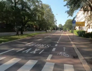
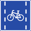
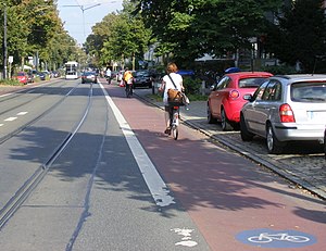
| C1 | Broad Cycle Lane | Bicycle infrastructure that is an inherent part of the road, but set aside for the exclusive use of bicycles, whilst being separated only by paint or other markings, and without a physical separation from vehicles. Can be red- or asphalt-colored.
Cycle lanes in Oslo shall be marked with a dashed lane between the cycle lane and motorway. A solid line is often used around intersections.
|
||
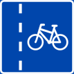
| C1 | Narrow Cycle Lane | Follows Broad Cycle Lane tagging
|
||
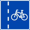
| C1 | Very Narrow Cycle Lane | Follows Broad Cycle Lane tagging
|
||
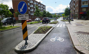
| C1 | Raised Cycle Lane | Cycle lane which is separated from both vehicles and pedestrians with curbs and height difference. Signposted as cycle lane. | ||
| C1 | Protective elements | Physical barriers between cyclists and motor vehicles like traffic calming islands, vegetation, parking or public furniture (like benches). | ||
Tagging for C1 — Broad/ Narrow/ Very Narrow Cycle lane
| Diagram | OSM | Tagging | ||
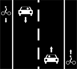
|
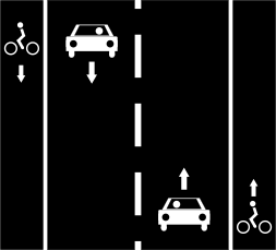
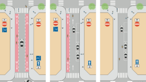
Broad cycle lane on both sides of the road
Way A: highway=* + cycleway=lane or Way A: highway=* + cycleway:both=lane or more detailed Way A: highway=* + cycleway:left=lane + cycleway:right=lane
E.g Broad: cycleway:width=2.0 m or cycleway:<side>:width E.g Narrow: cycleway:width=1.8 m E.g Very Narrow: cycleway:width=1.4 m | |||
| Examples | Additions for compliance with Oslo Standard | |||
 barred_area – road marking indicating a buffer or restricted area. Consider also using cycleway:buffer=* in this case. |
Asphalt Color:
Red: cycleway:surface:colour=red or cycleway:<side>:surface:colour=<colour> (E.g grey) even though it is possible to use hexadecimal colours, it makes querying more difficult.
Based on proposed feature Symbolic_separation: marking cycleway:both:marking=solid_line / double_solid_line / dashed_line / barred_area / pictogram / surface or or
Right side cycle lane marking side of traffic or marking curbside | |||
| Complex example | highway=secondary +
lanes=3 + vehicle:lanes=yes|yes|no|yes|no + turn:lanes=through|through|through|right|right + cycleway:lanes=none|none|lane|none|lane + bicycle:lanes=no|no|designated|no|designated +
cycleway:separation:left:lanes=||dots||no + cycleway:separation:right:lanes=||no||kerb + cycleway:marking:left:lanes=||solid_line||solid_line + cycleway:marking:right:lanes=||solid_line|| | |||
Tagging for C1 — Raised Cycle Lane
| Diagram | OSM | Tagging | ||
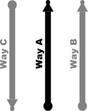
| Way A — For only one line drawn where there is a kerb separating raised cycle lane from both the main road and the sidewalks.
Way A: highway=* + cycleway=track + cycleway:both:separation:both=kerb + cycleway:both:surface:colour=red | ||||
| Way C A B — where a separate line has been drawn for both raised cycle lanes and the main road.
Way C: highway=cycleway + is_sidepath=yes + is_sidepath:of=* "highway value of A" + is_sidepath:of:name="Way A - name" + + separation:both=kerb + oneway:bicycle=yes + foot=no
Way A: highway=* + cycleway:both=separate + bicycle=use_sidepath + sidewalk=both
| ||||
| Additions | ||||
Tagging the width of the kerb (separation) can be done using the cycleway:buffer=* tag or cycleway:<side>:separation:<side>:<type>:width=*.
Way A: cycleway:both:buffer:left=0.15 + cycleway:both:buffer:right=0.3 or cycleway:both:separation:left:kerb:width=0.15 + cycleway:both:separation:right:kerb:width=0.3
Way C and B: buffer:left=0.15 + buffer:right=0.3 or separation:left:kerb:width=0.15 + separation:right:kerb:width=0.3 | ||||
Tagging for C1 — Protective Elements
| Diagram | Elements | Tagging |
| traffic_calming=island |
C2 — Pedestrian and Bicycle Prioritised in Calm Traffic Detailed Description
| Category (according to Oslostandarden) | Value | Meaning | Image | Sign |
|---|---|---|---|---|
| C2 — Pedestrian and bicycle prioritised in calm traffic | ||||
| C2 | Cycling in calm traffic | Streets with low traffic volume (<2000 average daily traffic) and low speeds (<30 Km/h). These streets are usually narrowed and other traffic calming elements are used to encourage low speeds. These streets are effective as connections between different parts of the larger bicycle network. | ||
| C2 | Cycle Street | Street which favors cyclists and pedestrians. Motorised traffic are considered guests. These streets should accommodate moderate cycling speed (15-25 Km/h). Motorised daily average traffic should be below 500 and measured real average speed below 20 Km/h. For motorised traffic these streets are usually one-way.
|
||
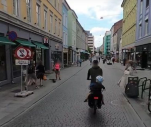
| C2 | Cycling against oneway street | In Norway cycling both directions in a one-way street is usually always allowed. Some one way streets are safer than others depending on what accommodations are in place.
|
||
| C2 | Cycling in bus lane | Cycling along high frequency buss routes should be discourage unless there is dedicated cycling infrastructure. Cyclists should be directed to alternative (parallell) routes. | ||
| C2 | Cycling along tram lines | Cycling along trams lines are legal in Norway, but highly discouraged and dangerous, as cycle tires can get stuck in the tram rail. Cyclists should be directed to alternative (parallell) routes. | ||
Tagging for C2 — Cycling Against Oneway Street
| Diagram | OSM | Tagging | |
C3 — Separate Pedestrian and Bicycle Infrastructure Detailed Description
| Category (according to Oslostandarden) | Value | Meaning | Image | Sign |
|---|---|---|---|---|
| C3 — Separate pedestrian and bicycle infrastructure | ||||
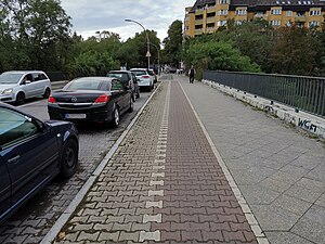
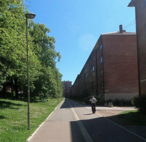
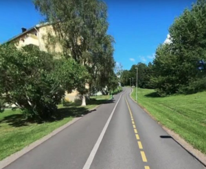
| C3 | Cycleway with sidewalk | To be classified as a dedicated cycleway there should be at least 1.2 meter distance between the motorised way and the cycleway.
|
||
| C3 | Cycle Expressway |
|
||
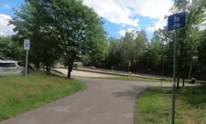
| C3 | Pedestrian and cycleway | Combined pedestrian- and cycleway. Pedestrians and cyclists share the same track, physically separated from vehicles. Only used exception-wise when cycling takes place on pedestrian terms. May cause conflict between cyclists and pedestrians due to speed differences. A lot of these tracks were built until the 2010s, and still remain in use, especially in Oslo's suburbs. | ||
D, E – Other Cycle Related Infrastructure Detailed Description
| Category (according to Oslostandarden) | Value | Meaning | Tags | Image |
|---|---|---|---|---|
| D — Intersections | ||||
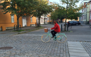
| D1 | Raised Intersection | A raised intersection does not have to be connected to cycle lanes, but is a traffic calming element encouraging all traffic to slow down. Often the road is narrowed in right before the intersection. Other traffic calming elements like trees and vegetation can be combined. | Tags:
+
surface=sett + sett:shape=rectangle + sett:pattern=interleaved |
|
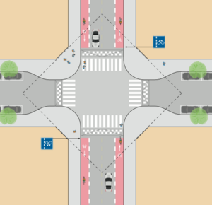
| D1 | Intersection with Advanced Stop Line (Bike Box) | A cycleway |
Use cycleway:surface:colour=red |
|
| D2 | Signal Regulated Intersection with ASL | |||
| D2 | SRI with ASL and Short Bike Lane | |||
| D2 | SRI with Dedicated Area for Cyclists | |||
| D3 | Mini Roundabout | |||
| D3 | Roundabout with Mixed Traffic and Traffic Calming Elements | |||
| D3 | Roundabout with at least one Cycle Way exit point | |||
| D3 | Roundabout with Protected Cycle Lane and Facilitated Crossing Points for Cyclists | |||
| D3 | Roundabout with Protected Cycle Lane where all other Vehicles Have Duty to Give Way to Cyclists | |||
| E - Challenging points for cyclists | ||||
| E1 — Stops | ||||
| E1 | Hourglass Buss-/ Tram Stop | |||
| E1 | Cycle Lane behind Buss-/ Tram Stop Refuge | |||
| E1 | Interrupted Cycle Lane | |||
| E2 — Goods delivery and parking | ||||
| E2 | Cycle Lane in combination with Goods Delivery and Parking | |||
| E3 — Cycle Passage and System Changes | ||||
| E3 | Cycle Passage from One-way Street to Street with Cycle Lane | |||
| E3 | System Change on Distance with Cycle Lanes to Cycle Ways | |||
| E3 | Cycle Passage with Right of Way | |||
| Element | Meaning | Description | ||||||||||||||||||||||
|---|---|---|---|---|---|---|---|---|---|---|---|---|---|---|---|---|---|---|---|---|---|---|---|---|
| Bicycle Parking | ||||||||||||||||||||||||
| Bicycle Garage | ||||||||||||||||||||||||
| Bicycle Hotel | ||||||||||||||||||||||||
| Bicycle Counter | A Bicycle Counter is a device measuring number of passing cyclists. Usually stats are show on the device. A daily, monthly and/or yearly count could be displayed. |
| ||||||||||||||||||||||
| Bicycle Repair Station | service:bicycle:diy=yes was previously frequently used together with amenity=bicycle_repair_station but has been discontinued as a bicycle repair station inherently is "do-it-yourself".
| |||||||||||||||||||||||
| Air Pump |
| |||||||||||||||||||||||
