Using OpenStreetMap offline
Many software tools and services allow you to use OpenStreetMap data offline, without an Internet connection. You may want to use OpenStreetMap offline to:
- Access the map quickly if you live or work in an area with poor Internet service
- Continue to use the map while underground in a basement or subway (metro)
- Minimize metered Internet fees or avoid roaming fees while traveling abroad
- Orient yourself while hiking or cycling in a remote area
- Participate in disaster relief efforts where Internet infrastructure is unreliable
OpenStreetMap itself is open data, so if you have advanced needs not served by existing tools and services, you are also free to download and process the data yourself without making repeated requests to the OpenStreetMap API.
Printing or exporting a map
- Main article: OSM on Paper
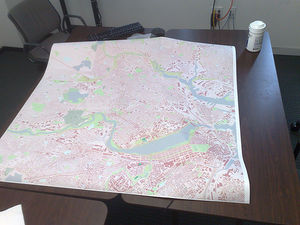
The most basic way to use OpenStreetMap offline is to export an image or PDF of an area and optionally print it out. Besides the rudimentary export options built into openstreetmap.org, third parties have developed print-friendly map styles, as well as ![]() desktop publishing tools for designing pocket maps, atlases, and large-format maps. Popular print map services include MapOSMatic and cycle.travel. Field Papers produces maps suitable for field surveying.
desktop publishing tools for designing pocket maps, atlases, and large-format maps. Popular print map services include MapOSMatic and cycle.travel. Field Papers produces maps suitable for field surveying.
Rendering data yourself
- Main article: Rendering
If you have specific needs not served by existing tools, you can also download an extract of the database, then render it yourself using a tool such as Mapnik, which powers the maps on openstreetmap.org.
Viewing an interactive map
Applications
- Main article: Software/Mobile

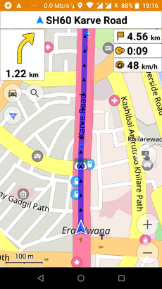
Many applications for Android, iOS, and other mobile devices use offline map data, some for displaying a map, others for routing and search. Look at the "Stores map-data on-board" column in Comparison of Android applications and Comparison of iOS applications. Here are some popular, offline-capable navigation applications:
- OsmAnd (Android, iOS)
- Organic Maps (Android, iOS)
- Cruiser (Android)
- MapFactor Navigator Free (Android, Windows Phone)
- Maps.Me (Android, BlackBerry, iOS)
- Mapy.cz (Android)
You can use OSM-based garmin image files with a Garmin portable GPS device (via BaseCamp) or desktop computer (using the cross-platform QMapShack application).
Frameworks
- Main article: Frameworks#Displaying interactive maps
Software developers can use the following frameworks to provide offline map viewing capabilities in their own applications:
- MapLibre – vector tile rendering library (JavaScript and native)
- Mapsforge – Applications using Mapsforge
- osmdroid
- OsmSharp
- GLMap
- Mapbox
Looking up addresses
Software developers can use the following frameworks to provide offline geocoding in their own applications:
- CartoType (cross-platform)
Getting directions offline
- Main article: Routing/offline routers
The following navigation applications support offline routing:
- Organic Maps (Android, iOS)
- OsmAnd (Android, iOS)
Software developers can use the following frameworks to provide offline routing in their own applications:
- CartoType (cross-platform)
- GraphHopper (cross-platform)
- OsmSharp (cross-platform)
Contributing to OpenStreetMap
The editors JOSM, Merkaartor, Vespucci and StreetComplete support editing OpenStreetMap while offline.
Other aids to contributing to OpenStreetMap while offline:
- Field Papers produces maps suitable for field surveying and provides a workflow for uploading annotated maps.
- Mapillary automatically records your trip in photographs, so that you can add the photographed details to OpenStreetMap when you get back to your computer.
JOSM
JOSM's offline editing workflow involves several steps:
While you have an internet connection...
- Download an area of the map (can be one or several bounding boxes)
- Save the data as a OSM XML file on your local disk.
While you're offline without an internet connection...
- Open the file
- Maybe open GPS traces and overlay them on the data (This can also work fine offline)
- Make changes e.g. add local information you have captured while out surveying
- Save changes back to file. The file includes information about all your changes including moving and deleting data.
When you're back to an internet connection...
- Open the file from your disk into JOSM
- Do "File" menu > "Update Data" to re-download the areas you worked on. Resolve any conflicts (see JOSM/Advanced editing#Resolving conflicts)
- Click upload to save the changes to the OpenStreetMap server.
Multi-user offline editing
One challenge with offline editing is that a downloaded area can become out of date, so that by the time you make your edits and upload them, conflicts arise with intervening edits by other mappers. This problem is exacerbated in scenarios such as disaster relief, where many people need to contribute to the same part of the map in tandem while offline. The Portable OpenStreetMap (POSM) project, with its POSM Replay Tool, aims to address this issue by implementing a version control system for offline edits and proper merging afterwards.
Limitations
Quickly serving huge volumes of raster or vector tile data can incur a significant cost to map providers. Therefore, even free-of-cost services usually limit the number of tiles you can download, the rate at which you can download them, or the geographic area or level of detail that you can download. If you download tiles from the OpenStreetMap website or API, please see our Tile usage policy. Otherwise, please respect the restrictions imposed by the tool or service you choose.
Using the Wiki offline
In case you want to check the Wiki while not having access to any internet connection, you can import the Wiki into a reader application beforehand.
Note: If you are looking for an online mirror instead, they are listed at Cache.
ZIM
Install a ZIM reader application from this list and import a ZIM file from the list below. maxi and nopic mean with / without images. If no version is recent enough, you should ask for an update, by opening a ticket here. Please be aware that the Kiwix mirror is not supplied by OpenStreetMap.
More details on the ZIM format are here on Wikipedia.
Available versions:
- 2023 May
Raw dump
If you host an own MediaWiki instance, you can import a daily raw dump of the wiki's database, as documented here.
