Comparison of iOS applications
Jump to navigation
Jump to search
Apple iOS#OpenStreetMap applications has currently maintained list, list below is unfortunately abandoned and not maintained
This page describes a historic artifact in the history of OpenStreetMap. It does not reflect the current situation, but instead documents the historical concepts, issues, or ideas.
General information
| Name | Download | Screenshot | Display map | Navigate | Make track | Monitor | License | Price | Languages | Release date | Version | Description |
|---|---|---|---|---|---|---|---|---|---|---|---|---|
| 700 City Maps | [1] | 
|
yes | yes | no | no | proprietary | $2.99 for each city's map | EN | 2014-02-23 | 2.0.8 | |
| ape@map | [2] | 
|
yes | no | no | no | proprietary | Free | DE | 2016-05-04 | 2.7.0 | Outdoor GPS navigation |
| ArcGIS for iPhone | [3] | 
|
yes | no | no | no | proprietary | Free | EN | 2013-08-06 | 10.1.2 | Shows just different maps |
| aSmartHUD NAVI MAP+ | [4] | 
|
yes | yes | yes | ?
|
proprietary | $1.99 | 20 | 2015-04-02 | 6.6 | vehicle digital dashboard, unified with in-car navigation system |
| be-on-road | [5] | 
|
yes | yes | yes | ?
|
proprietary | Free | DE; EN; CS; NL; FR; EL; HU; IT; PL; PT; RO; RU; SK; ES; TR; UK | 2015-01-31 | 3.10 | Offline multi-language voice navigation app with lane-guidance assistant. Data from OSM and propietary maps. |
| Bike Citizens | [6] | 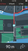
|
yes | yes | yes | no | proprietary | €5 per city | EN, DE, FR | 2016-05-26 | 5.1.2 | Designed for cyclists in urban areas incl. Insider tours. |
| Bikey | [7] | 
|
yes | no | no | no | proprietary | Free | EN | 2016-06-05 | 1.2.2 | Bike share station locator |
| BucketMan | [8] | 
|
yes | no | no | no | proprietary | Free | DE, EN, PT | 2016-02-23 | 1.0.3 | A game similar to Pac-Man but in the streets of the world |
| Cartograph | [9] | 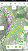
|
yes | no | yes | no | proprietary | $4.99 | EN | 2016-06-23 | 1.01 | 3D map viewing and track recording |
| City Maps 2Go | [10] | 
|
yes | no | no | no | proprietary | $2.99 €2.69 |
EN, DE, FR, IT, ES | 2016-06-19 | 10.2 | City Maps 2Go |
| Cycle Hire | [11] | 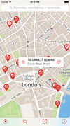
|
yes | no | no | no | ?
|
Free | DE; EN; ... | 2016-01-22 | 7.1 | Find Cycle Hire locations in London |
| CycleStreets | [12] | 
|
yes | yes | no | no | GPLv3 | Free | EN | 2016-06-24 | 3.2.1 | Cycle journey planning and navigation |
| Embark | [13] | 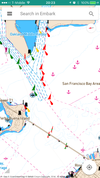
|
yes | no | yes | no | proprietary | Free | EN | 2016-06-17 | 1.2.2 | Interactive nautical charts and track logging |
| ForeverMap | [14] | 
|
yes | yes | no | no | proprietary | €1.59 | EN; DE; FR; SP; IT; RU | 2015-04-20 | 4.0 | ForeverMap is an offline navigation app, providing address/POI search and route calculation |
| Gaia GPS | [15] | 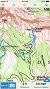
|
yes | yes | yes | yes | proprietary | trial on iOS, $19.99 on Android | EN | 2016-05-22 | 1.0 | Backcountry maps, navigation, and tracking. |
| Galileo Offline Maps | [16] | yes | no | yes | yes | proprietary | freemium | EN, NL, DE, IT, JP, RU, ES, ZH | 2016-06-30 | 3.4.2 | Fast and easy-to-use vector maps with offline search based on OpenStreetMap data. | |
| geoMapTool | [17] | 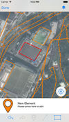
|
yes | no | no | no | proprietary | Free | EN | 2016-06-10 | 1.0.1 | An editor that lets you draw and tag map features |
| Go Map!! | [18] | 
|
yes | yes | yes | no | ISC | Free | EN, DE, DK, ES, IT, FR, NL, JP, RU, ZH | 2020-04-20 | 1.7.1 | Easy to use iPhone/iPad editor for OSM with support for adding POIs, editing ways, offline support, undo-redo, copy-paste tags, make ways straight, circular or rectangular and more. |
| GPS Kit | [19] | 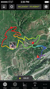
|
yes | yes | yes | yes | proprietary | $9.99 | EN | 2014-01-15 | 7.0.1 | |
| GPS Tuner | [20] [21] | 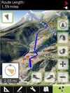
|
yes | yes | yes | yes | proprietary | $6.99 / free | EN | 2012-05-31 | 1.0.10 | Google Earth like 3D Navi with DEM |
| GPS-Tracks | [22] | 
|
yes | yes | yes | yes | proprietary | Free | EN; DE; FR; IT | 2016-04-06 | 2.26 | |
| GPSies | [23] | 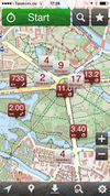
|
no | no | yes | yes | proprietary | Free | 7 | 2015-07-10 | 2.5.1 | |
| iLOS | [24] | 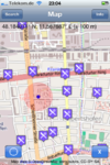
|
yes | no | no | no | proprietary | $1.99 | EN | 2011-10-24 | 2.4 | OSM Map and POI finder |
| INRIX Traffic | [25] | 
|
yes | yes | no | ?
|
proprietary | free, InApp purchase | EN; | 2016-06-06 | 6.1.2 | Turn-by-turn navigation, real-time traffic alert, pre-drive alert with calendar integration |
| Karta GPS | [26] | 
|
yes | yes | no | no | proprietary | Free | CS, DA, EN, ES, FI, FR, DE, EL, ID, IT, MS, NB, NL, PL, PT, RU, SK, SV, TH, TR, ZH | 2016-03-18 | 1.8.08 | Offline turn-by-turn GPS navigation |
| kMaps | [27] | 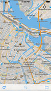
|
yes | no | no | no | proprietary | Free | EN | 2014-12-17 | 1.2.6 | Free offline maps, covering the entire world |
| komoot iPhone App | [28] | 
|
yes | yes | yes | yes | freemium | ?
|
DE; EN | 2016-06-18 | 8.1 | free usage in a small region, larger/different regions can be bought |
| Leisure | [29] | 
|
yes | yes | no | no | proprietary | $0.99 | DE; EN; FR | 2010-12-15 | 2.3 | |
| Locations Tagger | [30] | 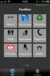
|
no | no | yes | no | proprietary | Free | EN | 2012-03-01 | 1.2 | |
| Looking4Cache | [31] | 
|
yes | no | no | no | proprietary | free $8.99 |
DE; EN | 2016-06-08 | 2.3.6 | Geocaching App with a lot of functions. Including vector maps for complete offline caching. |
| Magic Earth | [32] | 
|
yes | yes | no | no | proprietary | Free | EN; DA; NL; FR; DE; IT; KO; PT; RO; RU; ES: SV; TH; TR; ZH | 2015-12-02 | 1.0.4 | Free maps and navigation app based on OpenStreetMap data and featuring free turn-by-turn navigation, free downloadable maps and free speed cameras. |
| MapOut | [33] | 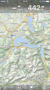
|
yes | no | yes | yes | proprietary | €4.49 | EN; DE | 2015-06-30 | 2.4.3 | Offline map covering the whole world, OpenGL vector rendering |
| mAPP | [34] | 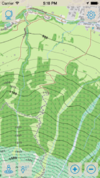
|
yes | no | yes | yes | proprietary | InApp Purchases | DE; EN | 2014-01-29 | 1.1 | Offline topo vector maps for iPhone and iPad |
| Maps 3D PRO | [35] | 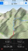
|
yes | no | yes | yes | proprietary | $2.99 | EN; DE | 2016-04-27 | 4.1.2 | 3D Worldwide Maps and Tracks, Allows to download maps for offline use (topo and street) |
| MAPS.ME | [36] | 
|
yes | yes | no | no | Apache 2.0 | Free | EN; RU; CS; DE; ES; FR; IT; JA; KO; NL; UK; ZH-HANT; PL; PT; HU; TH; ZH-HANS; AR; DA; TR | 2016-06-07 | 6.1.9 | Offline maps of all countries, fast renderer, offline search, whole planet fits to 27Gb |
| MapSwipe | [37] | 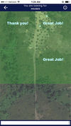
|
no | no | no | no | Proprietary | Free | EN | 2016-07-16 | 1.0.1 | Super-simple contribution to humanitarian mapping (indirectly) by helping find features in imagery |
| MapTap | [38] | 
|
?
|
?
|
?
|
?
|
proprietary | €5 | EN | 2010-04-19 | 1.5 | |
| MotionX-GPS | [39] [40] | 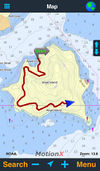
|
yes | yes | yes | yes | proprietary | $1.99 €1.79 |
EN | 2015-11-24 | 24.1 | |
| MyTracks | [41] | 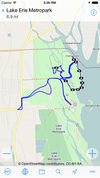
|
yes | no | yes | no | ?
|
Free | ?
|
2016-03-11 | 3.2.2 | myTracks turns your iPhone into a fully functional GPS logger |
| Navmii | [42] [43] [44] [45] [46] [47] [48] [49] [50] [51] [52] [53] [54] [55] [56] [57] [58] [59] [60] [61] [62] [63] [64] [65] [66] [67] [68] [69] [70] [71] [72] [73] | 
|
yes | yes | no | no | proprietary | first country is free, then €2.69 | EN; ES; DA; DE; FR; SW; IT and others | 2016-06-07 | 3.5.3 | Free satnav app. Maps available: Andorra, Argentina, Australia, Austria, Benelux (Belgium, Netherlands, Luxembourg), Brazil, Canada, Croatia, Czech Republic, Denmark, Estonia, Finland, France, Germany, Hungary, India, Ireland, Italy, Latvia, Lithuania, Mexico, Monaco, Netherlands, New Zealand, Norway, Poland, Portugal, Slovakia, Slovenia, South Africa, Spain, Sweden, Switzerland, UK. |
| Navigon Urban | [74] | 
|
yes | yes | no | ?
|
proprietary | €4.49 | DE; EN | 2013-06-11 | 1.2.1 | Offline router esp. for pedestrians/cyclists |
| Naviki | [75] | 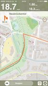
|
yes | no | yes | no | proprietary | Free | DE | 2016-06-10 | 3.43.1 | Only Germany supported |
| Navitel | [76] | 
|
yes | yes | yes | no | proprietary | €17 | EN; RU | 2016-06-13 | 9.6.2519 | Popular in Russia |
| OffMaps 2 | [77] | 
|
yes | no | no | no | proprietary | €1.59 | DE,EN | 2015-07-01 | 2.22 | Offline maps and POIs for selected destinations around the world. Combines OSM map with Wikipedia Articles. |
| OsmAnd Maps & Navigation | [78] | 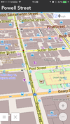
|
yes | no | yes | yes | GNU GPLv3 | Free with in-app purchases | EN, BY, NB, NO, CA, CS, DA, NL, FR, DE, EL, HU, ID, IT, JA, KO, NN, PL, PT, RU, ZH_CN, SL, ES, SV, zh_TW, TR, UK, VI | 2016-04-27 | 4.2.4 | Offline OSM maps of the world, points of interest information, plugins for hiking, winter sports, nautical navigation, parking, etc. Contour lines info. |
| OpenSeaMap | [79] | 
|
yes | no | no | yes | proprietary | ?
|
DE,EN,FR | 2013-11-22 | 2.1.2 | App for searching and offline caching |
| OSMTrack | [80] | 
|
yes | no | yes | yes | proprietary | $0.99 | EN, DE, FR | 2011-12-30 | 3.0.3 | Easy to use tracking app with offline, user-updateable vector map and direct upload to OpenStreetMap |
| Pocket Earth Offline Maps & Travel Guides | [81] | 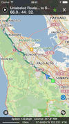
|
yes | yes | yes | no | proprietary | $0.99 | EN, DE, FR, ES, NL, RU, CS | 2016-05-25 | 3.1.2 | OpenGL powered Offline Maps (OSM) and Travel Guides (wikivoyage) with Wikipedia Articles, GPS Track Recording, Online Routing, and other advanced features and customization |
| Private Maps | [82] | 
|
yes | no | no | no | proprietary | $2.99 | EN, DE, RU | 2023-10-29 | 1.1 | Minimalist, private, standard OpenStreetMap style, high-resolution retina tiles |
| Pushpin OSM | [83] | 
|
yes | no | no | no | proprietary | Free | EN | 2012-12-05 | 1.1 | Simple POI editor. |
| QuoVadis Mobile | [84] | 
|
yes | yes | yes | no | proprietary | $4.99 | EN | 2016-04-28 | 3.1 | Turn-by-turn navigation and GPS recording |
| Scenic - GPS Motorcycle Navigation, Ride Planning and Tracking | [85] | File:ScenicScreenshot1 | yes | yes | yes | yes | proprietary | Free | EN; NL; DE | 2017-02-24 | 1.40 | Scenic is a motorcycle app to plan your rides, navigate routes with many via points and track your touring adventures. It has many ways to create and import routes, a high end navigation interface with voice guidance and a ride recorder to record all your rides. |
| Sea Weather Professional | [86] | 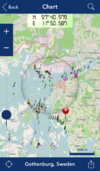
|
yes | no | no | no | proprietary | €5.99 | DE | 2015-11-09 | 5.0 | App for searching and offline caching |
| Skobbler GPS Navigation | [87] | 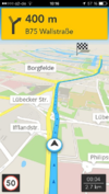
|
yes | yes | no | no | proprietary | Free | EN; DA; NL; FR; DE; HU; IT; PO; RO; RU; ES; SV; TR | 2015-09-16 | 7.2 | Online and offline worldwide turn-by-turn navigation. Includes pedestrian and cyclist route planner, TripAdvisor, Foursquare and speed camera warning integration. |
| Terra Map GPS | [88] | 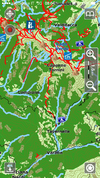
|
yes | yes | yes | yes | proprietary | $2.99 $4.99 |
DE; EN; IT; FR; ES | 2016-04-08 | 6.0 | Amazingly clear map rendering, nice UI, import of KMZ, KML, GPX files. |
| The Map | [89] | 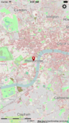
|
yes | no | no | yes | proprietary | £1.99 | EN | 2015-05-02 | 3.5.3 | Offline Viewer for lots of countries. |
| Topo GPS World | [90] | 
|
yes | no | yes | no | ?
|
$3.99 | ?
|
2016-04-20 | 4.2 | Makes from your iPhone/iPad a complete GPS device including a route planner based on the detailed and clear OpenStreetMap. The maps will be saved on the iPhone/iPad, so that Topo GPS can also be used without an internet connection. |
| Trails | [91] | yes | no | yes | yes | proprietary | Free | DE; EN | 2015-06-01 | 1.31 | ||
| TripGo | [92] | 
|
yes | no | no | no | proprietary | ?
|
EN | 2016-06-03 | 4.5.3 | Calendar-aware trip planner with real-time transport suggestions |
| Trip4YouMaps | https://maps.trip4you.net | 
|
yes | yes | yes | yes | proprietary | free | DE; EN; | 2023-11-26 | 2.2.19 | Trip4YouMaps is a PWA for Route planning, Navigation & Tracking; optimised for outdoor activities; different maps; up to 50 waypoints, routes can be saved, shared and exported as gpx-files; pois can be added to routes; show path surfaces on the map; for Desktop, Android & iOS |
| UK TravelOptions | [93] | 
|
yes | no | no | no | proprietary | Free | EN | 2014-10-13 | 1.33 | Vector map viewing with tilting/spinning 3D buildings & transport data of London. |
| Ultimate Rides | [94] | 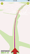
|
yes | yes | no | no | proprietary | Free | EN | 2015-10-30 | 1.1.3 | Motorcycle optimised satnav covering the planet |
| Vectorial Map | [95] | 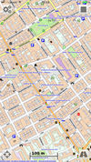
|
yes | no | yes | no | proprietary | $3.99 | EN | 2016-01-29 | 1.58 | Vectorial Map is map viewer and track logger for Mapsforge offline vector maps (*.map) with support for custom XML styles like provided by OpenAndroMaps.org. It is based on a platform independent custom render engine. |
| Wheelmap | [96] | 
|
yes | no | no | no | proprietary | Free | DE, EN, FR, IT, IS, JP, ES | 2016-06-03 | 3.0.2 | Showing/setting which places are suitable for wheelchair users |
| ViewRanger GPS | [97] | 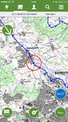
|
yes | ?
|
yes | ?
|
proprietary | free (purchases available) | EN,DE | 2016-06-21 | 6.3.1 | proprietary outdoors-oriented map app for mobile phones, OSM & cycle & piste maps |
| Wisepilot | [98] | 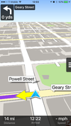
|
yes | yes | no | no | proprietary | €1.79 monthly | EN; DE; ES; FR; SV; and much more | 2016-04-01 | 5.3.3 | online turn-by-turn navigation |
| World Maps Offline | [99] | 
|
yes | no | no | no | proprietary | $0.99 £0.69 €0.79 |
EN | 2013-11-04 | 1.9.3 | World Maps Offline lets you select map areas and save them to your iPhone, iPod Touch or iPad for browsing without an internet connection. |
This page describes a historic artifact in the history of OpenStreetMap. It does not reflect the current situation, but instead documents the historical concepts, issues, or ideas.
This table in the past was generated automatically by a bot. Learn more.
Map display features
| Name | Shows map as vector | Shows map as bitmap | Stores map-data on-board | Stores map-data off-board (downloads from internet) | Rotate map | 3D view |
|---|---|---|---|---|---|---|
| <20MB, <512MB, <2GB Maps | yes | no | yes | no | yes | no |
| 700 City Maps | no | yes | yes | no | yes | no |
| ArcGIS for iPhone | no | yes | no | yes | ?
|
no |
| aSmartHUD NAVI MAP+ | yes | no | yes | no | yes | yes |
| B.iCycle | no | yes | yes (cache) | yes | ?
|
no |
| be-on-road | yes | no | yes | no | yes | yes |
| BikeCityGuide | yes | no | yes | no | yes | no |
| Bluemapia | yes | yes | yes | yes | yes | no |
| CartoType | yes | yes | yes | yes | yes | yes |
| City Maps 2Go | yes | yes | yes | no | no | no |
| Cycle Hire | ?
|
?
|
?
|
?
|
?
|
no |
| directu | ?
|
?
|
?
|
?
|
?
|
?
|
| EasyMaps | no | yes | yes | yes | ?
|
no |
| ForeverMap | yes | no | yes | no | yes | no |
| Gaia GPS | no | yes | yes (cache) | yes | yes | no |
| Galileo Offline Maps | yes | yes | yes | yes | yes | no |
| GeoGuide 3D Worldwide Maps and Tracks | ?
|
?
|
yes (cache) | yes | no | yes |
| Go Map!! | yes | yes | yes | yes | no | no |
| GPS Kit | no | yes | no | yes | ?
|
no |
| GPS Tuner | yes | yes | yes | yes | yes | yes |
| GPS-Tracks | no | yes | yes (cache) | yes | yes | no |
| iLOE | no | yes | yes (cache) | no | no | no |
| iLOS | no | yes | yes (cache) | no | no | no |
| kMaps | yes | no | yes | no | no | no |
| komoot iPhone App | no | yes | yes (cache) | yes | yes | no |
| Layar Reality Browser | yes | no | no | yes | yes | yes |
| Leisure | no | yes | no | yes | no | no |
| Looking4Cache | yes | yes | yes | yes | yes | no |
| Magic Earth | yes | no | yes | yes | yes | yes |
| MapOut | yes | no | yes | no | yes | no |
| mAPP | yes | no | yes | yes | yes | no |
| MapQuest4Mobile | no | yes | no | yes | ?
|
no |
| MAPS.ME | yes | no | yes | no | yes | no |
| MotionX-GPS | no | yes | yes (cache) | yes | yes | no |
| NavFree | yes | no | yes (cache) | no | yes | yes |
| Navigon Urban | yes | no | yes | no | yes | yes |
| Naviki | ?
|
?
|
?
|
?
|
?
|
?
|
| Navit | yes | no | yes | no | yes | yes |
| Navitel | yes | no | yes | no | yes | yes |
| OffMaps 2 | yes | no | yes | no | yes | no |
| OMaps | no | yes | yes (cache) | yes | ?
|
no |
| Open Car InfoTainmenT system | yes | no | yes | no | ?
|
no |
| OpenMaps | no | yes | yes (cache) | yes | ?
|
no |
| OpenSeaMap | no | yes | yes | yes | no | no |
| OsmPad | no | yes | yes | yes | no | no |
| OSMTrack | yes | yes | yes | no | yes | no |
| Path Tracker | no | yes | no | yes | no | no |
| Pocket Earth Offline Maps & Travel Guides | yes | no | yes | no | yes | no |
| POI+ | ?
|
?
|
?
|
?
|
?
|
?
|
| Pushpin OSM | no | yes | no | yes | no | no |
| Roadee | no | yes | yes | yes | ?
|
no |
| RoadMap | yes | no | yes | no | yes | yes |
| Scenic - GPS Motorcycle Navigation, Ride Planning and Tracking | yes | no | yes | yes | yes | yes |
| Sea Weather Professional | no | yes | yes | yes | no | no |
| Skobbler GPS Navigation | yes | no | yes | yes | yes | yes |
| Terra Map GPS | yes | no | yes | no | yes | no |
| The Map | yes | no | yes | no | no | no |
| Track'n Trail | ?
|
?
|
?
|
?
|
?
|
no |
| Trails | no | yes | yes (cache) | yes | ?
|
no |
| TripGo | yes | no | yes (cache) | yes | no | no |
| Trip4YouMaps | no | yes | no | yes | yes | no |
| True Offline Maps 2.0 | no | yes | yes | no | yes | no |
| UK TravelOptions | yes | no | yes (cache) | yes | yes | yes |
| Vectorial Map | yes | yes | yes | yes | no | no |
| VectorMaps GB | yes | no | yes | no | ?
|
no |
| ViewRanger GPS | no | no | no | no | ? | ? |
| VoxTrek Navigation GPS | no | yes | yes | yes | yes | yes |
| Wikimap | no | yes | yes (cache) | yes | ?
|
no |
| Wisepilot | yes | yes | no | yes | yes | yes |
| World Maps Offline | no | yes | yes | yes | no | no |
This page describes a historic artifact in the history of OpenStreetMap. It does not reflect the current situation, but instead documents the historical concepts, issues, or ideas.
This table in the past was generated automatically by a bot. Learn more.
| Name | Navigate to point | Find location | Find nearby POIs | Navigate along predefined route | Create route manually | Calculate route | Calculate route without internet | Car routing | Bike routing | Foot routing | Turn restrictions | Navigation with voice | Keep on road | Works without GPS |
|---|---|---|---|---|---|---|---|---|---|---|---|---|---|---|
| 700 City Maps | yes | yes | no | ?
|
?
|
?
|
?
|
no | no | no | no | ?
|
?
|
?
|
| aSmartHUD NAVI MAP+ | yes | ?
|
no | ?
|
?
|
?
|
?
|
yes | no | no | ?
|
no | no | ?
|
| be-on-road | yes | yes | yes | ?
|
?
|
yes | yes | yes | no | yes | yes | yes | yes;no | yes |
| BikeCityGuide | yes | yes | yes | ?
|
?
|
yes | yes | no | yes | no | ?
|
yes | ?
|
?
|
| CartoType | yes | yes | yes | yes | ?
|
yes | yes | yes | yes | yes | yes | ?
|
yes | yes |
| ForeverMap | yes | yes | yes | no | ?
|
yes | ?
|
yes | yes | yes | ?
|
no | no | no |
| Gaia GPS | yes | yes | ?
|
no | ?
|
no | no | no | no | no | no | ?
|
?
|
?
|
| Go Map!! | ?
|
?
|
?
|
?
|
?
|
?
|
?
|
?
|
?
|
?
|
?
|
?
|
?
|
?
|
| GPS Kit | yes | ?
|
?
|
?
|
?
|
?
|
?
|
no | no | no | no | ?
|
?
|
?
|
| GPS Tuner | ?
|
?
|
?
|
?
|
?
|
?
|
?
|
yes | yes | yes | ?
|
?
|
?
|
?
|
| GPS-Tracks | yes | yes | yes | no | ?
|
no | no | no | no | no | no | ?
|
no | yes |
| Guide Me | ?
|
?
|
?
|
?
|
?
|
?
|
?
|
?
|
?
|
?
|
?
|
yes | ?
|
?
|
| komoot iPhone App | yes | yes | yes | ?
|
?
|
?
|
?
|
no | yes | yes | no | yes | yes | yes |
| Leisure | yes | yes | yes | ?
|
?
|
?
|
?
|
no | no | no | no | no | no | no |
| Magic Earth | yes | yes | yes | yes | yes | yes | yes | yes | yes | yes | yes | yes | yes | yes |
| MotionX-GPS | yes | no | no | ?
|
?
|
?
|
?
|
no | no | no | no | ?
|
yes;no | no |
| NavFree | ?
|
?
|
?
|
?
|
?
|
?
|
?
|
?
|
?
|
?
|
?
|
?
|
?
|
?
|
| Navigon Urban | yes | yes | yes | ?
|
?
|
?
|
?
|
no | yes | yes | no | yes | no | ?
|
| Navit | yes | yes | yes | no | ?
|
yes | yes | yes | no | yes | yes | yes | yes | no |
| Navitel | yes | yes | yes | no | ?
|
yes | yes | yes | yes | yes | yes | yes | yes | yes |
| OpenMaps | yes | yes | yes | ?
|
?
|
?
|
?
|
yes | yes | yes | yes | ?
|
?
|
?
|
| Pocket Earth Offline Maps & Travel Guides | yes | yes | yes | ?
|
?
|
yes | no | ?
|
?
|
?
|
no | no | no | yes |
| RoadMap | yes | yes | no | ?
|
?
|
?
|
?
|
?
|
?
|
?
|
no | no | ?
|
yes |
| Scenic - GPS Motorcycle Navigation, Ride Planning and Tracking | yes | yes | yes | yes | yes | yes | yes | yes | yes | yes | yes | yes | yes | yes |
| Skobbler GPS Navigation | yes | yes | yes | ?
|
?
|
yes | yes | yes | yes | yes | yes | yes | yes | no |
| Terra Map GPS | yes | no | no | yes | ?
|
no | no | no | yes | yes | no | no | no | yes |
| Trip4YouMaps | yes | yes | yes | ?
|
no | yes | no | yes | yes | yes | no | no | yes | yes |
| VoxTrek Navigation GPS | yes | ?
|
?
|
?
|
?
|
?
|
?
|
yes | no | no | ?
|
yes | ?
|
?
|
| Wisepilot | yes | yes | yes | ?
|
?
|
?
|
?
|
yes | no | yes | yes | yes | ?
|
no |
This page describes a historic artifact in the history of OpenStreetMap. It does not reflect the current situation, but instead documents the historical concepts, issues, or ideas.
This table in the past was generated automatically by a bot. Learn more.
Track making features
| Name | Customizable log interval | GPX format | KML format | NMEA format | All formats | Geo-tagged notes | Geo-tagged photos | Geo-tagged audio | Fast POI buttons |
|---|---|---|---|---|---|---|---|---|---|
| aSmartHUD NAVI MAP+ | ?
|
?
|
?
|
?
|
?
|
?
|
?
|
?
|
?
|
| B.iCycle | no | yes | yes | no | gpx;kml | ?
|
?
|
?
|
no |
| be-on-road | ?
|
?
|
?
|
?
|
?
|
?
|
?
|
?
|
?
|
| BikeCityGuide | ?
|
?
|
?
|
?
|
?
|
?
|
?
|
?
|
?
|
| Gaia GPS | ?
|
?
|
?
|
?
|
?
|
?
|
?
|
?
|
?
|
| Galileo Offline Maps | yes | yes | yes | no | gpx, kml, csv | no | no | no | ?
|
| GeoGuide 3D Worldwide Maps and Tracks | yes | yes | no | no | gpx | ?
|
?
|
?
|
?
|
| GPS Kit | ?
|
yes | yes | no | gpx;kml | no | yes | no | ?
|
| GPS Tuner | ?
|
?
|
?
|
?
|
?
|
?
|
?
|
?
|
?
|
| GPS-Tracks | no | yes | no | no | gpx | no | yes | no | yes |
| GPSies | ?
|
yes | no | no | gpx | ?
|
?
|
?
|
?
|
| komoot iPhone App | ;no | yes | no | no | gpx | yes | yes | no | yes |
| Locations Tagger | ?
|
yes | no | no | gpx | yes | no | no | yes |
| MapOut | no | yes | no | no | gpx | no | no | no | no |
| mAPP | yes | yes | no | no | gpx | yes | no | no | yes |
| MotionX-GPS | ?
|
yes | yes | no | gpx;kml | ?
|
?
|
?
|
?
|
| Naviki | ?
|
?
|
?
|
?
|
?
|
?
|
?
|
?
|
?
|
| Navit | ?
|
yes | no | yes | bin, garmin, gpx, nmea | ?
|
?
|
?
|
?
|
| Navitel | yes | yes | no | no | gpx | ?
|
?
|
?
|
?
|
| Open Car InfoTainmenT system | ?
|
?
|
?
|
?
|
?
|
?
|
?
|
?
|
?
|
| OSMTrack | ?
|
yes | no | no | gpx | ?
|
?
|
?
|
no |
| Path Tracker | ?
|
?
|
?
|
?
|
?
|
?
|
?
|
?
|
?
|
| Pocket Earth Offline Maps & Travel Guides | ?
|
?
|
?
|
?
|
?
|
?
|
?
|
?
|
?
|
| RoadMap | ?
|
?
|
?
|
?
|
?
|
?
|
?
|
?
|
?
|
| Scenic - GPS Motorcycle Navigation, Ride Planning and Tracking | no | yes | no | no | gpx, google maps link, furkot link, routeYou link | no | yes | no | no |
| Terra Map GPS | no | no | no | no | png | yes | yes | no | yes |
| Track'n Trail | yes | yes | no | no | gpx | yes | no | no | yes |
| Trails | yes;no | yes | no | no | gpx | no | no | no | ?
|
| Trip4YouMaps | no | yes | no | no | gpx | no | no | no | yes |
| True Offline Maps 2.0 | ?
|
?
|
?
|
?
|
?
|
?
|
?
|
?
|
yes |
| Vectorial Map | yes | yes | yes | no | jpg;png;gpx;kml;kmz | yes | no | no | yes |
| ViewRanger GPS | ? | no | no | no | ? | no | no | no | ? |
This page describes a historic artifact in the history of OpenStreetMap. It does not reflect the current situation, but instead documents the historical concepts, issues, or ideas.
This table in the past was generated automatically by a bot. Learn more.
Monitoring features
| Name | Show current track | Open existing track | Altitude diagram | Show DOP value | Satellite view | Show live NMEA data | Send current position via SMS | Upload current position |
|---|---|---|---|---|---|---|---|---|
| B.iCycle | yes | yes? | yes | no | no | no | no | yes |
| Gaia GPS | ?
|
?
|
?
|
?
|
?
|
?
|
?
|
?
|
| Galileo Offline Maps | yes | yes | ?
|
?
|
?
|
?
|
?
|
?
|
| GeoGuide 3D Worldwide Maps and Tracks | yes | yes | yes | ?
|
?
|
?
|
?
|
?
|
| GPS Kit | yes | yes | yes | yes | no | no | ?
|
?
|
| GPS Tuner | ?
|
?
|
?
|
?
|
?
|
?
|
?
|
?
|
| GPS-Tracks | yes | yes | no | yes | no | no | no | no |
| GPSies | yes | yes | ?
|
?
|
?
|
no | ?
|
?
|
| komoot iPhone App | yes | yes | yes | no | no | no | yes | yes |
| MapOut | yes | yes | yes | no | no | no | no | no |
| mAPP | yes | yes | no | no | no | no | no | no |
| MotionX-GPS | yes | ?
|
yes | ?
|
?
|
no | ?
|
?
|
| Navit | yes | ?
|
no | yes | no | no | no | no |
| OpenSeaMap | ?
|
no | no | yes | no | no | ?
|
?
|
| OSMTrack | yes | yes | no | yes | no | no | no | no |
| Scenic - GPS Motorcycle Navigation, Ride Planning and Tracking | yes | yes | no | ?
|
no | no | no | no |
| Terra Map GPS | yes | yes | no | yes | no | no | yes | no |
| The Map | no | yes | no | no | no | no | ?
|
?
|
| Trails | yes | yes | yes | ?
|
?
|
no | no | no |
| Trip4YouMaps | yes | ?
|
yes | no | no | no | no | no |
This page describes a historic artifact in the history of OpenStreetMap. It does not reflect the current situation, but instead documents the historical concepts, issues, or ideas.
This table in the past was generated automatically by a bot. Learn more.
OpenStreetMap editing features
| Name | Add POIs | Edit / Delete POIs | Edit arbitrary tags of existing OSM objects | Edit geometries | Support imagery offset DB | Upload to OSM |
|---|---|---|---|---|---|---|
| GeoMapTool | yes | no | no | no | no | yes |
| Go Map!! | yes | yes | yes | yes | ?
|
yes |
| iLOE | yes | yes | yes | no | ?
|
yes |
| Maps.Me | yes | yes | partial | no | ?
|
Automatically |
| OpenMaps | yes | yes | yes | no | ?
|
yes |
| POI+ | yes | yes | yes | no | ?
|
yes |
| Pushpin OSM | yes | yes | yes | no | ?
|
yes |
| Every Door | yes | yes | no | no | no | yes |
This page describes a historic artifact in the history of OpenStreetMap. It does not reflect the current situation, but instead documents the historical concepts, issues, or ideas.
This table in the past was generated automatically by a bot. Learn more.
