He:Using OpenStreetMap
רבים מדפי הוויקי האלה עוסקים בדרכים לתרום ל-OpenStreetMap. דף זה עוסק בדרכים להשתמש בנתונים שכבר נצברו לעשיית דברים מועילים.
אם אתה משתמש בנתונים של OSM בדרכים אחרות, אנא הוסף הערות בדף זה (עדיף ב גירסא האנגלית) והסבר מה עשית, כמה פשוט זה היה וטיפים או בעיות שמצאת.
למידע על מגבלות חוקיות לגבי השימוש בנתונים מ-OSM ראה רישיון OpenStreetMap ו-שאלות משפטיות נפוצות.
צפייה מקוונת במפות של האזור שלך
The online "slippy map" is the standard way to view OSM maps, which is a JavaScript "AJAX" application that can load maps as required when you move around.
The information Freeway has a "slippy map" using tiles@home data. It is possible to update the tile for an area by zooming to level 12 and ctrl-clicking. The tile is then generated and the new tile is available within the hour.
Shortcuts to cities that have already been well-mapped are available at Mapping milestones, and the helpfile is at Browsing.
Freemap is an alternative method to display OSM data, using a similar JavaScript interface.
Yet another approach is Osmabrowser, which provides an interactive online front end to Osmarender, as well as PNG rendering using Freemap. This is not "slippy" but is useful if you want to display a static map of, say, a town. In early stages of development.
MetaCarta Labs have created an add-on for NASA World Wind and online map viewer.
OSM-3D (we need an english tranlation of this wiki page!) is a project of Univesity of Bonn to display OSM data in 3D (powerful computer needed!).
מפות גדולות
To save this big maps on you pc you can use the Firefox plugin FireShot (no Linux version available).
אבטחת איכות
הדף אבטחת איכות מכיל כמה אפשרויות לתיקון נתונים ב-OSM.
הצגת מפה באתר שלך
רוצה OpenStreetMap באתר שלך?
You can embed our existing map into your page, just as you might with Google or Yahoo! maps. This is the easiest step, and you should make sure you can do this first before trying anything else. This can be done:
- Using OpenLayers is the most(?) common way to get your own map.
- Using Mapstraction.
- Using Google Maps.
- Using Zoom_zoom_zoom_map (nice zoom if tiles are in cache)
Your slippy map can use any of the OSM tile servers, although note that this comes with no guarantee as to availability or quality (if you expect particularly heavy demand, please discuss this with the project first).
For ultimate flexibility, OpenStreetMap also gives you the unique ability to generate your own map tiles - styled any way you like - from our data.
There are som other ways too:
תוספים לדפדפן
Making an OpenStreetMap handler for Operator documents the process of creating a new handler for the geo microformat for the Operator extension for Firefox.
OpenStreetMap Finder is a Firefox extension for the Mozilla Firefox web browser.
הצגת מפה על המחשב שלך ללא חיבור אינטרנט
ישנן מבחר תוכנות המסוגלות להציג/להשתמש בנתוני OSM על המחשב המקומי שלך. There are several software that can show/use OSM data on you local computer.
JOSM
JOSM edits OpenStreetMap data and is also capable of working with offline data. (Requires Java 1.5.)
Merkaartor
Another editor, Merkaartor, can do the same.
osmrender.pl
osmrender.pl is a small PERL program that can be customized easily and draws simple maps.
iPhoto '09
Apply the following patch to use OpenStreetMap in iPhoto '09:
macbook:/Applications/iPhoto.app/Contents/Resources$ diff googleMap.html.old googleMap.html
31a32
>   var G_PHYSICAL_MAP
36a38,41
>   copyOSM = new GCopyrightCollection("<a href=\"https://www.openstreetmap.org/\">OpenStreetMap</a>");
>   copyOSM.addCopyright(new GCopyright(1, new GLatLngBounds(new GLatLng(-90,-180), new GLatLng(90,180)), 0, " "));
>   tilesMapnik = new GTileLayer(copyOSM, 1, 17, {tileUrlTemplate: 'https://tile.openstreetmap.org/{Z}/{X}/{Y}.png'});
>   G_PHYSICAL_MAP = new GMapType([tilesMapnik], G_NORMAL_MAP.getProjection(), "OpenStreetMap");
הצגת המיקום הנוכחי שלך על מחשב נישא
- RoadNav will display OSM data, either downloading it from the internet, or from an .OSM file.
- GpsDrive is the standard Linux software for showing your position on a moving map, written in C and using GTK+.
- NavSys is a similar program (in Python) for displaying maps.
- OpenCITT is an in-car entertainment system capable of displaying OSM data
- Mapper
- NaviPOWM: Displays current position on the map. Saves received GPS data to file.
- TangoGPS: easy to use map and GPS application for Linux. Track logging for openstreetmap is possible.
GPS הצגת רחובות על מכשיר
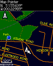
- View maps on your Garmin GPS or in MapSource
- One project is explained at OSM Map On Garmin
Windows הצגת רחובות על מחשבון כף יד
See also: WinPDA
- How to use the data in the OziexplorerCE Oziexplorer
- Run.GPS directly downloads, caches and displays OpenStreetMap in map view and navigation view.
- NaviPOWM: Displays current position on the map. Saves received GPS data to file.
- OSMtracker (GPLv3)
PalmOS הצגת רחובות על מחשבון כף יד
- OSMTile: Download tiles with a windows software transfer it to a sd-card for a palm-handheld. Displays current position on the map. Saves received GPS data to file and shows it on the map.
הצגת רחובות על טלפון נייד
See also: Software for mobilephones
- 8motions A Java2/MIDP app which support also OpenStreetMap and provide an easy display of geo centric data on mobile phone (kml, gpx, etc...). The core engine is available as a free library to create your own application j2memap
- ape@map JavaME-Software for hiking and biking. German only at the moment.
- BikeAtor is free (GPL) Software for the Linux-based Motorola A780 and can be used to navigate with and to collect GPS-Data for the OSM-Project. You can build OSM-maps for BikeAtor with the platform-independent Java-Software BikeAtorDesktop.
- Digitalmobilemap (VGPS) Java app, Provides digital city street map application for phone. The application supports routable maps and use A* algorithm for AutoRouting
- Mobile GMaps is popular downloadable free Java Mobile application which supports OpenStreetMap base maps, among several other sources. There is also commercial SDK available based on this, from Nutiteq
- G'o (view maps and log tracks)
- GpsMid - Java app with routable and rotating offline vector map (GpsMid at SourceForge)
- gpsVP
- Maemo mapper - Symbian, Nokia internet table (770, N800, N810)
- MapNav- Map Mobile Navigator (MapNav). JavaME application displays any OSM map, writes track and sends it to OSM directly from mobile phone. When you are just came home your tracks are already parsed and ready for editing :-)
- MobileMap - View maps in the browser on your GSM phone
- Mobile Trail Explorer - software targeted for recording trails.
- Mom is mobile open map, a viewer and tracklogger for OpenStreetMap issued under a Creative Commons licence.
- tangoGPS - Openmoko (Neo 1973/FreeRunner) tangoGPS is a Linux application ideal for the Neo phone. It defaults to using OSM data and can also save tracks for later editing and addition to OSM database.
- trackmyjourney.co.uk
- We-Travel offers "free navigation, 3D maps and voice guidance, always available on your java enabled mobile phone, without network connection" and claims to be the "world's first and only totally free, offline, country level, Java mobile phone navigation system !"
מציאת מסלול
See also: Routing
- Gosmore can do routing from OSM data
- Roadnav has advanced routing capabilities, and the experimental builds have included support for OSM data, although it is still in alpha. [1]
- Navit has a routing engine, and includes advanced stuff such as spoken instruction. It can use a commercial map or openstreetmap data.
יצירת מפה להדפסה מנתוני OSM
- How to turn OSM-data into a printed map.
- מדריך מדות
- Add a Compass Rose to your map
- To make a large map that you can print out on a normal printer see Maps_for_developing_countries
ייצוא
- ייצוא לפורמטים אחרים.
המרה
- Converting between formats: ראה טבלה המראה מהם הפורמטים שבהם ניתן להשתמש כדי לייבא ולייצא נתונים.
יצירת תמונת מפה
Mapnik is the main rendering program, used for OSM's front-page maps
Osmarender is a program to produce high-quality graphical output from OSM data, suitable for printing, or for displaying on a website.
- A small PERL program to draw simple maps: osmrender.pl
- A program to calculate and draw difference maps. Program: osmdiff. Reports: osmdiff_reports
למתכנתים
The main place to download data in bulk is Planet.osm, an XML file (5GB compressed and steadily growing) containing the weekly release of all nodes, ways and relations.
We also provide a protocol for accessing the data directly, but its use for bulk data extracts of large areas is discouraged due to load on the OSM servers.
ראה גם
- Neat Stuff, interesting ways in which OSM data is being used.
- Map displays, software showing your current location on a map
- OpenTrail, walking(hiking) software
- How to create your own tiles
- Technical information about Slippy Map
- Slippy Map MediaWiki Extension - Embedding OSM slippy maps into this wiki, and other MediaWiki installations.
- Using the map tiles


