Id:Properties
Jump to navigation
Jump to search
Properties
Digunakan untuk memberikan informasi tambahan yang bersifat umum tentang elemen lain.
| Key | Value | Elemen | Deskripsi | Foto |
|---|---|---|---|---|
| area | yes | Berarti sebuah fitur yang biasanya merupakan sebuah area. Anda harus tidak tag ini kedalam fitur yang sudah didefinisikan sebagai sebuah area. | ||
| brand | user defined | Brand of the feature. | ||
| bridge | yes / aqueduct / viaduct / cantilever / movable / covered / … | Jembatan, yang digunakan bersama dengan tag lapisan. Nilai "yes" merupakan nilai umum, atau anda dapat menspesialisasikannya. | ||
| capacity | amount | Used for specifying capacity of a facility. | ||
| charge | amount | Used for specifying how much is charged for use/access to a facility. See toll=* or fee=*. | ||
| clothes | see key's page | Tagged on shops and other features to denote if they sell clothes or not and what type of clothes they sell. | ||
| covered | yes | Digunakan untuk menunjukkan suatu node, jalur atau area yang tertutup oleh entitas lain (atau dalam beberapa kasus di tanah), ketika penggunaan lapisan tidak tepat atau membutuhkan klarifikasi tambahan. | ||
| crossing | no / traffic_signals / uncontrolled / island / unmarked | Further refinement for nodes already tagged with highway=crossing or railway=crossing | ||
| crossing:island | yes / no | Specifies whether a pedestrian crossing has a refuge island | ||
| cutting | yes / left / right | Memotong suatu lahan untuk membangun jalan atau trem. Biasanya di bukit. Source | ||
| disused | yes | Untuk fitur yang berguna untuk navigasi, tapi biasanya tidak digunakan. Lihat abandoned=* jika infrastrukturnya dihilangkan. | ||
| drinking_water | yes / no | Describes whether a drinking water is available | ||
| drive_through | yes / no | Untuk mengindikasikan farmasi, bank, atm, makanan cepat saji, yang menyediakan layanan jasa tanpa harus parkir dan berhenti terlebih dahulu. | ||
| drive_in | yes / no | Digunakan untuk mengindikasikan jika bioskop atau restoran terdapat jasa yang dapat memperbolehkan mobil masuk. drive_in berbeda dengan drive_thru. | ||
| electrified | contact_line / rail | Indicates infrastructure to supply vehicles with electricity on rail tracks | ||
| ele | Number | Ketinggian diatas mean sea level dalam meter, sesuai dengan geoid model EGM 96 yang digunakan WGS 84 (GPS). (lihat juga Altitude) | ||
| embankment | yes | Permukaan tanah yang naik yang digunakan untuk membangun jalan, rel kereta api atau kanal yang melewati dataran rendah atau lahan basah (rawa). Source | ||
| end_date | Date | Data dari fitur yang dihilangkan | ||
| est_width | Number | Perkiraan kasar untuk lebar jalur dalam meter | ||
| fee | yes / no | Used for specifying whether fee is charged for use/access to a facility. See also toll=*. | ||
| fire_object:type | poo / szo | Potentially dangerous and socially significant objects | ||
| fire_operator | Name | Fire station, which serves the object | ||
| fire_rank | 1bis / 2 to 5 | Rank fire, defined for a particular object | ||
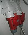
| frequency | Number | Frequency in Hz | ||
| hazard | see hazard | Indicates of the hazards. | ||
| hot_water | yes / no | Describes whether a hot water is available | ||
| inscription | User Defined | The full text of inscriptions, which can be found on buildings, memorials and other objects. | ||
| internet_access | yes / wired / wlan / terminal / no | Label ini digunakan untuk mengidentifikasi entitas seperti bangunan, pertokoan, restoran,dll yang menyediakan akses internet ke publik secara membayar atau gratis. | ||
| layer | -5 to 5 | 0: dasar(default); -1..-5:dibawah lapisan dasar; 1..5 (not +1):diatas lapisan dasar hal ini digunakan untuk memisahkan secara fisik, bukan untuk mempengaruhi proses render. |
||
| leaf_cycle | evergreen / deciduous / semi_evergreen / semi_deciduous / mixed | Describes the phenology of leaves | ||
| leaf_type | broadleaved / needleleaved / mixed / leafless | Describes the type of leaves | ||
| location | underground / overground / underwater / roof / indoor | Location | ||
| narrow | yes | Indikasi relatif pada jalur (sungai, jalan raya, sepeda) yang menyempit. | ||
| nudism | yes / obligatory / designated / no / customary / permissive | Indicates if the described object provides the possibility of nudism | ||
| opening_hours | 24/7 or mo md hh:mm-hh:mm. (read described syntax) | opening_hours menjelaskan kapan (jam berapa) itu terbuka. | ||
| opening_hours:drive_through | 24/7 or mo md hh:mm-hh:mm. (read described syntax) | opening_hours describes when something is open for drive-through services. | ||
| operator | User Defined | Label operator dapat digunakan untuk memberikan nama perusahaan yang bertanggung jawab pada satu objek atau siapa yang mengoperasikannya. | ||
| power_supply | yes / no | Describes whether a power supply is available | ||
| produce | User Defined | Describes a feature's agricultural output produced though a natural process of growing or breeding. | ||
| rental | see key's page | Tagged on shops and other features to denote if they rent something or not and what they rent. | ||
| sauna | yes / no | Describes whether a sauna is available | ||
| service_times | see opening_hours | Times of service of a given feature e.g. church service | ||
| shower | yes / no | Describes whether a shower is available | ||
| sport | soccer / tennis / basketball / baseball / multi / ... | Describes which sports are placed on a facility such as a pitch or stadium. | ||
| start_date | Date | Tanggal dimana data fiturnya dibuat | ||
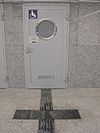
| tactile_paving | yes /no | Indicate if a specific place can be detected or followed with a blindman's stick. | ||
| tidal | yes | Area is flooded by the tide | ||
| toilets | yes / no | Describes whether a toilets is available | ||
| topless | yes / no | Indicates if the described object provides the possibility of female topless practice | ||
| tunnel | yes | Sebuah terowongan, digunakan bersamaan dengan label lapisan (layer tag). | ||
| toilets:wheelchair | yes / no | States if a location has a wheelchair accessible toilet or not. | ||
| wheelchair | yes / no / limited | Mengindikasikan tempat spesial yang bisa menggunakan kursi roda. | ||
| width | Number | Lebar jalur dalam meter | ||
| Diaplikasikan ke landuse=forest dan natural=wood untuk mendetailkan pohon yang ditemukan disetiap penggunaan lahan. Digunakan pada suatu area. |
Tabel ini adalah sebuah template wiki, dengan deskripsi dalam Bahasa Indonesia, edit di sini.


