Ireland/Town projects/Celbridge/Mapping phases
Please note that overlaps between the phases are allowed and necessary.
Orientation Phase
Remote mappers get to know the layout of the town and people working on the project meet in the Telegram group.
Publicity Phase
- press releases and social media. The conversation hashtag is #MapCelbridge4All
- the purpose, or objectives of the exercise will be publicised on the website of OpenStreetMap Ireland
Buildings outline phase (includes validation)
Local and remote mappers can add building outlines using satellite imagery using iD editor and JOSM editor. Co-ordination will take place with a grid using the #osmIRL_buildings task manager
The task manager is used for an efficient and motivating way to finish this job.
Please be aware of the Bing imagery offset!
Building types
| type | osm syntax | additional tags |
|---|---|---|
| House | building=house building=semidetached_house building=apartments building=terrace |
roof:shape=gabled/ hipped/ round etc addr:street=*, addr:city=Celbridge |
| Shed | building=shed | height=* roof:shape=* |
| Garage (for parking cars) | building=garage | |
| Greenhouse | building=greenhouse | |
| School | building=school | name=* and name:ga=* |
| Shops, restaurants, pubs | building=commercial | amenity=pub/ restaurant shop=hairdresser/ bookmaker/ convenience/ supermarket/ shoes etc |
Traffic features
Map highway=crossing, highway=traffic_signals, highway=footway, amenity=parking where you can see them on the satellite view. Further detail can be added using StreetComplete.
Street furniture
Mapillary Phase
Capture as much street level imagery as possible to help remote mappers.
Click here to see progress of Mapillary coverage.
Buildings
Add building:levels=* and addr:street=*.
Traffic features
traffic signs, highway=street_lamp, traffic_calming=bump, highway=traffic_signals
Street furniture
Add public bins (amenity=waste_basket),
power=pole and power=line etc.
Heritage features
historic=monument with subtypes like memorial=plaque
Add original uses for buildings under building=* and their current use under building:use=*.
Natural features
natural=tree, barrier=hedge, natural=tree_row (species etc can be added)
StreetComplete phase
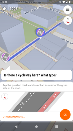
Local mappers can easily add details using the Android app StreetComplete. Choose certain quests to prioritise.
- features for the visually impaired
- street lights
- features for cyclists
FieldPapers phase
For all those who not want to or cannot use apps for mapping, they can use Fieldpapers for surveying natural features. There are several tutorials available on YouTube. The sheets can be scanned and used as a layer in the iD or JOSM editors.
Cleaning Up phase
In this phase, we're going to try to clean up bad geometry, bad tags and insufficiently detailed tagging like building=yes. We will use tools
7. Map competition phase
Make a map using different tools

